Category:Dorfkirche Alt Bork
Jump to navigation
Jump to search
| Object location | | View all coordinates using: OpenStreetMap |
|---|
Building described in Dehio - Handbook of German Art Monuments / Brandenburg  .jpg) | |||||
| Upload media | |||||
| Instance of | |||||
|---|---|---|---|---|---|
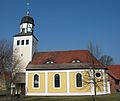
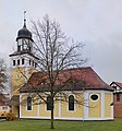
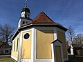
| Location | Linthe, Amt Brück, Potsdam-Mittelmark District, Brandenburg, Germany | ||||
| Heritage designation | |||||
 | |||||
This is the category of the Brandenburger Baudenkmal (cultural heritage monument) with the ID 09190714 (Wikidata)
|
Subcategories
This category has only the following subcategory.
I
- Interior of Dorfkirche Alt Bork (34 F)
Media in category "Dorfkirche Alt Bork"
The following 18 files are in this category, out of 18 total.
-
 Alt Bork church.jpg 2,720 × 2,280; 687 KB
-
 Alt Bork, Dorfkirche (07).jpg 4,364 × 4,681; 3.75 MB
-
 Alt Bork, Dorfkirche (36) (cropped).jpg 3,820 × 4,049; 2.54 MB
-
 Alt Bork, Dorfkirche (36).jpg 5,890 × 4,423; 4.6 MB
-
 Alt Bork, Dorfkirche (37).jpg 6,725 × 4,126; 5.45 MB
-
 Alt Bork, Dorfkirche (38).jpg 5,089 × 5,156; 2.39 MB
-
 Alt Bork, Dorfkirche (39).jpg 8,000 × 4,993; 8.6 MB
-
 Alt Bork, Dorfkirche (40).jpg 8,000 × 4,675; 7.89 MB
-
 Alt Bork, Dorfkirche (41).jpg 2,388 × 4,563; 1.6 MB
-
 Alt Bork, Dorfkirche (42).jpg 4,957 × 5,921; 5.92 MB
-
 Alt-Bork Dorfkirche 01.jpg 427 × 640; 109 KB
-
 Dorfkirche Alt Bork Denkmal Gefallene.jpg 4,032 × 3,024; 5.38 MB
-
 Dorfkirche Alt Bork Nordostansicht.jpg 4,032 × 3,024; 2.01 MB
-
 Dorfkirche Alt Bork Ostansicht.jpg 4,032 × 3,024; 2.6 MB
-
 Dorfkirche Alt Bork Südansicht.jpg 4,032 × 3,024; 3.49 MB
-
 Dorfkirche Alt Bork Westansicht 01.jpg 3,024 × 4,032; 3.73 MB
-
 Dorfkirche Alt Bork Westansicht 02.jpg 3,024 × 4,032; 3 MB
-
 Dorfkirche Alt Bork Westturm Nordansicht.jpg 3,024 × 4,032; 1.85 MB
.jpg)
_(cropped).jpg)
.jpg)
.jpg)
.jpg)
.jpg)
.jpg)
.jpg)
.jpg)


