Category:Dorfkirche Beetz
Jump to navigation
Jump to search
| Object location | | View all coordinates using: OpenStreetMap |
|---|
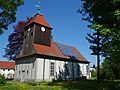
church building in Kremmen, Brandenburg state, Germany  | |||||
| Upload media | |||||
| Instance of | |||||
|---|---|---|---|---|---|
| Location | Beetz, Kremmen, Oberhavel District, Brandenburg, Germany | ||||
| Heritage designation | |||||
 | |||||
This is the category of the Brandenburger Baudenkmal (cultural heritage monument) with the ID 09165014 (Wikidata)
|
Deutsch: Ansichten der Kirche in Beetz, Stadt Kremmen, Landkreis Oberhavel, Land Brandenburg, Deutschland.
English: Pictures of the church in Beetz, Kremmen municipality, Oberhavel district, Brandenburg state, Germany
Français : Photos de l'église à Beetz, ville de Kremmen, arrondissement de Oberhavel, état fédéral de Brandebourg, Allemagne
Media in category "Dorfkirche Beetz"
The following 7 files are in this category, out of 7 total.
-
 Dorfkirche Beetz 2018 NW.jpg 4,864 × 3,648; 8.46 MB
-
 Dorfkirche Beetz 2018 SSE.jpg 6,268 × 4,695; 13.8 MB
-
 Dorfkirche Beetz 2018 SW.jpg 4,864 × 3,648; 5.95 MB
-
 Dorfkirche Beetz 2018 Turm.jpg 3,648 × 4,864; 5.15 MB
-
 Dorfkirche Beetz 2018 Westportal.jpg 3,576 × 4,810; 6.42 MB
-
 Dorfkirche Beetz 2018 WSW.jpg 4,421 × 4,592; 9.23 MB
-
 Kremmen Beetz church.jpg 1,488 × 1,890; 537 KB


