Category:Dorfkirche Dissen
Jump to navigation
Jump to search
| Object location | | View all coordinates using: OpenStreetMap |
|---|
This is the category of the Brandenburger Baudenkmal (cultural heritage monument) with the ID 09125065 (Wikidata)
|
church building in Brandenburg state, Germany  | |||||
| Upload media | |||||
| Instance of | |||||
|---|---|---|---|---|---|
| Location | Dissen/Dešno, Dissen-Striesow, Spree-Neiße District, Brandenburg, Germany | ||||
| Heritage designation | |||||
| Start time |
| ||||
 | |||||
Media in category "Dorfkirche Dissen"
The following 6 files are in this category, out of 6 total.
-
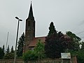
 Cyrkej, Dešno.JPG 1,600 × 1,200; 862 KB
-
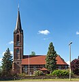 Dissen Dorfkirche 05.jpg 3,160 × 3,259; 7.23 MB
-
 Dissen Kirche.jpg 3,556 × 2,438; 3.99 MB
-
 Dissen-Striesow, Blick zur Dissener Dorfkirche.jpg 2,551 × 1,701; 1.01 MB
-
 Dorfkirche dissen 2020-05-22.jpg 3,648 × 2,736; 2.27 MB
-
 Heimatmuseum dissen 2020-05-22.jpg 3,648 × 2,736; 2.4 MB


