Category:Dorfkirche Fredersdorf
Jump to navigation
Jump to search
| Object location | | View all coordinates using: OpenStreetMap |
|---|
 | |||||
| Upload media | |||||
| Instance of | |||||
|---|---|---|---|---|---|
| Location | Fredersdorf-Vogelsdorf, Märkisch-Oderland District, Brandenburg, Germany | ||||
| Heritage designation | |||||
 | |||||
This is the category of the Brandenburger Baudenkmal (cultural heritage monument) with the ID 09180435 (Wikidata)
|
English: Pictures of the church in Fredersdorf, Fredersdorf-Vogelsdorf municipality, Märkisch-Oderland district, Brandenburg state, Germany. It is owned and used by a Lutheran congregation within the Evangelical Church of Berlin-Brandenburg-Silesian Upper Lusatia, a united Protestant church body of Calvinist, Lutheran and united congregations.
Deutsch: Bilder der Kirche in Fredersdorf, Gemeinde Fredersdorf-Vogelsdorf, Landkreis Märkisch-Oderland, Land Brandenburg, Deutschland. Sie gehört und dient einer lutherischen Gemeinde der unierten Evangelischen Kirche Berlin-Brandenburg-Schlesische Oberlausitz.
Français : Photos de l'église à Fredersdorf, commune de Fredersdorf-Vogelsdorf, arrondissement de Märkisch-Oderland, état fédéral de Brandebourg, Allemagne
Subcategories
This category has only the following subcategory.
M
Media in category "Dorfkirche Fredersdorf"
The following 16 files are in this category, out of 16 total.
-
 20230824 xl 1641-Fredersdorf-Vogelsdorf.jpg 3,072 × 4,080; 4.65 MB
-
 Dorfkirche Fredersdorf0.JPG 3,872 × 2,592; 2.39 MB
-
 Dorfkirche Fredersdorf1.JPG 2,592 × 3,872; 2.34 MB
-
 Dorfkirche Fredersdorf10.jpg 3,872 × 2,592; 5.62 MB
-
 Dorfkirche Fredersdorf11.JPG 2,592 × 3,872; 2.35 MB
-
 Dorfkirche Fredersdorf2.JPG 2,592 × 3,872; 2.43 MB
-
 Dorfkirche Fredersdorf3.JPG 2,592 × 3,872; 2.28 MB
-
 Dorfkirche Fredersdorf4.JPG 3,872 × 2,592; 2.35 MB
-
 Dorfkirche Fredersdorf7.JPG 2,592 × 3,872; 2.33 MB
-
 Dorfkirche Fredersdorf8.JPG 3,872 × 2,592; 2.41 MB
-
 Dorfkirche Fredersdorf9.JPG 3,872 × 2,592; 2.41 MB
-
 Fredersdorf Dorfkirche 2008-10.jpg 1,960 × 2,707; 4.26 MB
-
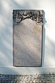
 Fredersdorf,Denkmal 1914-18.JPG 2,592 × 1,944; 1.92 MB
-
 Fredersdorf,Kirche,Wappenbaum.jpg 2,592 × 1,944; 1.01 MB
-
 Kirche fredersdorf feb2018 - 1.jpg 3,120 × 4,160; 4.13 MB
-
 Kirche fredersdorf feb2018 - 2.jpg 3,120 × 4,160; 3.43 MB


