Category:Dorfkirche Friedersdorf (Rückersdorf)
Jump to navigation
Jump to search
| Object location | | View all coordinates using: OpenStreetMap |
|---|
This is the category of the Brandenburger Baudenkmal (cultural heritage monument) with the ID 09135122 (Wikidata)
|
church building in Rückersdorf municipality, BRandenburg state, Germany  | |||||
| Upload media | |||||
| Instance of | |||||
|---|---|---|---|---|---|
| Location | Friedersdorf (Rückersdorf), Rückersdorf, Elbe-Elster District, Brandenburg, Germany | ||||
| Street address |
| ||||
| Heritage designation | |||||
| Inception |
| ||||
| Religion or worldview | |||||
 | |||||
Media in category "Dorfkirche Friedersdorf (Rückersdorf)"
The following 9 files are in this category, out of 9 total.
-
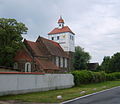
 Friedersdorf Rückersdorf Dorfkirche 2009 Kirchturm.jpg 843 × 742; 126 KB
-
 Friedersdorf16a.jpg 1,849 × 1,598; 978 KB
-
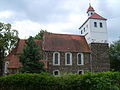 Friedersdorf19.JPG 2,560 × 1,920; 1.21 MB
-
 FriedersdorfKircheMauer.jpg 3,547 × 2,654; 3.92 MB
-
 FriedersdorfKircheNW.jpg 3,648 × 2,736; 3.37 MB
-
 FriedersdorfKircheSüdeingang.jpg 3,648 × 2,736; 4.68 MB
-
 FriedersdorfKircheWestportal.jpg 3,398 × 2,547; 4.13 MB
-
 FriedersdorfKirchhofBaum.jpg 3,347 × 2,510; 4.29 MB
-
 FriedersdorfKirchhofGrabmale.jpg 3,648 × 2,736; 5.29 MB


