Category:Dorfkirche Gortz
Jump to navigation
Jump to search
| Object location | | View all coordinates using: OpenStreetMap |
|---|
 | |||||
| Upload media | |||||
| Instance of | |||||
|---|---|---|---|---|---|
| Made from material | |||||
| Location | Beetzseeheide, Amt Beetzsee, Potsdam-Mittelmark District, Brandenburg, Germany | ||||
| Architectural style | |||||
| Heritage designation | |||||
 | |||||
Media in category "Dorfkirche Gortz"
The following 12 files are in this category, out of 12 total.
-
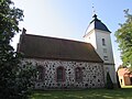
 Dorfkirche Gortz.jpg 4,000 × 3,000; 5.49 MB
-
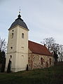
 Gortz Dorfkirche 1.jpg 2,099 × 1,926; 2.49 MB
-
 Gortz Dorfkirche 2.JPG 1,652 × 2,480; 2.26 MB
-
 Gortz kirche baudenkmal - 8.jpg 2,336 × 4,160; 2.58 MB
-
 Grundrissskizze dorfkirche gortz.svg 771 × 411; 6 KB
-
 Kirche gortz 1.JPG 2,816 × 2,112; 2 MB
-
 Kirche gortz 2.JPG 2,663 × 2,000; 946 KB
-
 Kirchegortz ecke südost.JPG 1,944 × 2,592; 1.69 MB
-
 Kirchegortz norden.JPG 2,592 × 1,944; 1.69 MB
-
 Kirchegortz osten.JPG 2,592 × 1,944; 1.43 MB
-
 Kirchegortz1.JPG 1,944 × 2,592; 1.14 MB
-
 Orgel dorfkirche gortz.JPG 2,500 × 1,875; 982 KB


