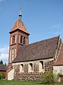
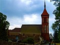
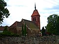
Category:Dorfkirche Gruhno
Jump to navigation
Jump to search
| Object location | | View all coordinates using: OpenStreetMap |
|---|
church building in Brandenburg state, Germany  | |||||
| Upload media | |||||
| Instance of | |||||
|---|---|---|---|---|---|
| Location | Gruhno, Schönborn, Elbe-Elster District, Brandenburg, Germany | ||||
| Street address |
| ||||
| Heritage designation | |||||
| Inception |
| ||||
| Width |
| ||||
| Length |
| ||||
| Area |
| ||||
| Religion or worldview | |||||
 | |||||
This is the category of the Brandenburger Baudenkmal (cultural heritage monument) with the ID 09135068 (Wikidata)
|
Media in category "Dorfkirche Gruhno"
The following 6 files are in this category, out of 6 total.
-
 Gruhno Kirche 2014.jpg 2,304 × 3,072; 3.03 MB
-
 Gruhno Kirche.jpg 400 × 300; 76 KB
-
 Gruhno14.jpg 2,560 × 1,920; 3.11 MB
-
 Gruhno15.jpg 1,243 × 1,846; 1.3 MB
-
 Gruhno17.jpg 2,560 × 1,920; 1.76 MB
-
 Kirche Gruhno.jpg 1,280 × 960; 771 KB


