Category:Dorfkirche Güterfelde
Jump to navigation
Jump to search
| Object location | | View all coordinates using: OpenStreetMap |
|---|
church building in Stahnsdorf, Brandenburg state, Germany  | |||||
| Upload media | |||||
| Instance of | |||||
|---|---|---|---|---|---|
| Location | Güterfelde, Stahnsdorf, Potsdam-Mittelmark District, Brandenburg, Germany | ||||
| Heritage designation | |||||
 | |||||
This is the category of the Brandenburger Baudenkmal (cultural heritage monument) with the ID 09190208 (Wikidata)
|
Media in category "Dorfkirche Güterfelde"
The following 20 files are in this category, out of 20 total.
-
 Dorfkirche gueterfelde.JPG 2,448 × 3,264; 1.7 MB
-
 Dorfkirche Güterfelde 04.jpg 800 × 533; 247 KB
-
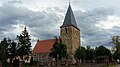
 Dorfkirche Güterfelde Ansicht Norden.JPG 2,592 × 1,944; 2 MB
-
 Dorfkirche Güterfelde Ansicht Südost.JPG 2,524 × 1,944; 3.47 MB
-
 Dorfkirche Güterfelde Ansicht Südwest.JPG 2,592 × 1,944; 3.03 MB
-
 Dorfkirche Güterfelde Eingangsportal Westturm.JPG 2,592 × 1,944; 3.31 MB
-
 Dorfkirche Güterfelde Nordansicht Kirchenschiff.JPG 2,592 × 1,944; 2.2 MB
-
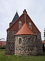 Dorfkirche Güterfelde Ostapsis mit Ostgiebel.JPG 1,944 × 2,592; 1.73 MB
-
 Dorfkirche Güterfelde Westturm Ansicht Nordwest.JPG 1,944 × 2,592; 1.76 MB
-
 Dorfkirche Güterfelde Westturm Ansicht Südwest.JPG 1,944 × 2,592; 1.76 MB
-
 Dorfkirche Güterfelde zugemauertes Nordportal.JPG 2,592 × 1,944; 3.08 MB
-
 Dorfkirche Güterfelde zugemauertes Südportal.JPG 2,592 × 1,944; 3.2 MB
-
 Dorfkirche Güterfelde.jpg 3,264 × 1,836; 712 KB
-
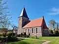 Dorfkirche Gütersfelde.jpg 4,624 × 3,468; 4.83 MB
-
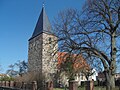
 Güterfelde Dorfkirche Nordseite.jpg 3,153 × 2,109; 5.64 MB
-
 Güterfelde Kirche.JPG 560 × 420; 69 KB
-
 Kirchegüterfelde2.JPG 2,448 × 3,264; 1.72 MB
-
 Kirchegüterfelde3.JPG 2,448 × 3,264; 1.66 MB
-
 Kirchegüterfelde4.JPG 3,264 × 2,448; 1.74 MB
-
 Kirchplatz16 Güterfelde.jpg 3,264 × 2,176; 2.31 MB


