Category:Dorfkirche Heinersdorf, Schwedt
Jump to navigation
Jump to search
| Object location | | View all coordinates using: OpenStreetMap |
|---|
church building in Brandenburg state, Germany  | |||||
| Upload media | |||||
| Instance of | |||||
|---|---|---|---|---|---|
| Location | Heinersdorf, Schwedt, Schwedt/Oder, Uckermark District, Brandenburg, Germany | ||||
| Heritage designation | |||||
 | |||||
This is the category of the Brandenburger Baudenkmal (cultural heritage monument) with the ID 09130662 (Wikidata)
|
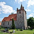
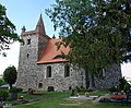
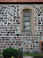
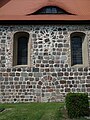
English: Church in Heinersdorf, Schwedt/Oder municipality, Uckermark district, Brandenburg state, Germany
Deutsch: Kirche in Heinersdorf, Stadt Schwedt/Oder, Landkreis Uckermark, Land Brandenburg, Deutschland.
Français : Église de Heinersdorf, ville de Schwedt/Oder, arrondissement Uckermark, état fédéral de Brandebourg, Allemagne
Media in category "Dorfkirche Heinersdorf, Schwedt"
The following 10 files are in this category, out of 10 total.
-
 Dorfkirche Heinersdorf, Schwedt 2019 NNE.jpg 4,450 × 3,714; 7.27 MB
-
 Dorfkirche Heinersdorf, Schwedt 2019 NW.jpg 4,188 × 4,226; 6.75 MB
-
 Dorfkirche Heinersdorf, Schwedt 2019 SSE.jpg 4,553 × 3,765; 7.97 MB
-
 Dorfkirche Heinersdorf, Schwedt 2019 SSW.jpg 4,788 × 4,640; 10.84 MB
-
 Dorfkirche Heinersdorf, Schwedt 2019 SW.jpg 4,864 × 3,648; 7.43 MB
-
 Dorfkirche Heinersdorf, Schwedt 2019 Turmhaube.jpg 4,864 × 3,648; 5.02 MB
-
 Dorfkirche Heinersdorf, Schwedt 2019 vermauertes Nordportal.jpg 3,648 × 4,864; 6.33 MB
-
 Dorfkirche Heinersdorf, Schwedt 2019 vermauertes Südportal.jpg 3,648 × 4,864; 7.25 MB
-
 Dorfkirche Heinersdorf, Schwedt 2019 Westportal.jpg 3,644 × 4,860; 8.77 MB
-
 Heinersdorf, Dorfkirche.jpg 1,828 × 1,435; 1.79 MB


