Category:Dorfkirche Herzberg (Rietz-Neuendorf)
Jump to navigation
Jump to search
| Object location | | View all coordinates using: OpenStreetMap |
|---|
church building in Oder-Spree district, Brandenburg state, Germany _Ostgiebel_2016-10-02.JPG) | |||||
| Upload media | |||||
| Instance of | |||||
|---|---|---|---|---|---|
| Location | Herzberg (Rietz-Neuendorf), Rietz-Neuendorf, Oder-Spree District, Brandenburg, Germany | ||||
| Heritage designation | |||||
 | |||||
This is the category of the Brandenburger Baudenkmal (cultural heritage monument) with the ID 09115382 (Wikidata)
|
Media in category "Dorfkirche Herzberg (Rietz-Neuendorf)"
The following 39 files are in this category, out of 39 total.
-
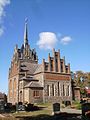 Dorfkirche Herzberg (Rietz-Neuendorf) Ost.JPG 1,920 × 2,560; 1.07 MB
-
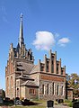 Dorfkirche Herzberg (Rietz-Neuendorf) Ostgiebel 2016-10-02.JPG 1,800 × 2,451; 1.18 MB
-
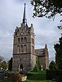
 Dorfkirche Herzberg (Rietz-Neuendorf) Sued.JPG 1,920 × 2,560; 1.15 MB
-
 Dorfkirche Herzberg Chor Nordansicht.jpg 3,024 × 4,032; 2.48 MB
-
 Dorfkirche Herzberg Denkmal Weltkriege.jpg 3,024 × 4,032; 5.54 MB
-
 Dorfkirche Herzberg Kirchenschiff Südansicht.jpg 4,032 × 3,024; 4.81 MB
-
 Dorfkirche Herzberg Nordansicht mit Einfriedung.jpg 4,032 × 3,024; 3.08 MB
-
 Dorfkirche Herzberg Nordansicht.jpg 3,024 × 4,032; 1.99 MB
-
 Dorfkirche Herzberg Ostansicht.jpg 3,024 × 4,032; 1.91 MB
-
 Dorfkirche Herzberg Südansicht.jpg 3,024 × 4,032; 3.81 MB
-
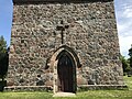 Dorfkirche Herzberg Westportal.jpg 4,032 × 3,024; 6.02 MB
-
 Dorfkirche Herzberg Westturm Nordansicht.jpg 3,024 × 4,032; 2.58 MB
-
 Dorfkirche Herzberg Westturm Südansicht.jpg 3,024 × 4,032; 4.05 MB
-
 Dorfkirche Herzberg Westturm Südwestansicht.jpg 3,024 × 4,032; 3.72 MB
-
 Dorfkirche Herzberg Westturm Westansicht.jpg 3,024 × 4,032; 4.33 MB
-
 Herzberg bei Beeskow - Dorfkirche - panoramio.jpg 480 × 640; 61 KB
-
 HerzbergKirkeSkakbrætsten1&2.JPG 560 × 880; 68 KB
-
 HerzbergKirkeSkakbrætsten1.JPG 208 × 175; 31 KB
-
 HerzbergKirkeSkakbrætsten2.JPG 247 × 181; 32 KB
-
 HerzbergKirkeSkakbrætsten3&7.JPG 960 × 1,195; 87 KB
-
 HerzbergKirkeSkakbrætsten3.JPG 282 × 202; 31 KB
-
 HerzbergKirkeSkakbrætsten4.JPG 240 × 174; 24 KB
-
 HerzbergKirkeSkakbrætsten5&9.JPG 560 × 880; 56 KB
-
 HerzbergKirkeSkakbrætsten5.JPG 170 × 143; 32 KB
-
 HerzbergKirkeSkakbrætsten6,4&8.JPG 981 × 660; 60 KB
-
 HerzbergKirkeSkakbrætsten6.JPG 211 × 138; 23 KB
-
 HerzbergKirkeSkakbrætsten7.JPG 324 × 247; 32 KB
-
 HerzbergKirkeSkakbrætsten8.JPG 177 × 110; 22 KB
-
 HerzbergKirkeSkakbrætsten9.JPG 312 × 178; 31 KB
-
 HerzbergKirkeSkakbrætstenØstmuren.JPG 1,280 × 960; 597 KB
-
 Rietz-Neuendorf Herzberg Kirche.jpg 3,872 × 2,592; 529 KB
-
 Rietz-Neuendorf Herzberg Schachbrettstein.jpg 3,872 × 2,592; 1.16 MB
-
 Totenkrone Dorfkirche Herzberg 1.jpg 1,200 × 1,600; 191 KB
-
 Totenkrone Dorfkirche Herzberg 2.jpg 1,600 × 1,200; 180 KB
-
 Totenkrone Dorfkirche Herzberg 3.jpg 1,600 × 1,200; 192 KB
-
 Totenkrone Dorfkirche Herzberg 4.jpg 1,600 × 1,200; 207 KB
-
 Totenkrone Dorfkirche Herzberg 5.jpg 1,600 × 1,200; 195 KB
-
 Totenkrone Dorfkirche Herzberg 6.jpg 1,600 × 1,200; 163 KB
-
 Totenkrone Dorfkirche Herzberg 7.jpg 1,200 × 1,600; 173 KB
_Ost.JPG)
_Sued.JPG)


