Category:Dorfkirche Kolkwitz/Gołkojce
Jump to navigation
Jump to search
| Object location | | View all coordinates using: OpenStreetMap |
|---|
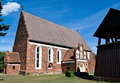
church building in Brandenburg state, Germany  | |||||
| Upload media | |||||
| Instance of | |||||
|---|---|---|---|---|---|
| Location | Kolkwitz, Spree-Neiße District, Brandenburg, Germany | ||||
| Street address |
| ||||
| Heritage designation | |||||
 | |||||
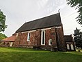
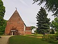
This is the category of the Brandenburger Baudenkmal (cultural heritage monument) with the ID 09125204 (Wikidata)
|
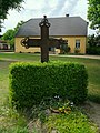
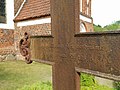
English: Pictures of the church in Kolkwitz, Kolkwitz municipality, Spree-Neiße district, Brandenburg state, Germany.
Deutsch: Ansichten der Kirche in Kolkwitz, Gemeinde Kolkwitz, Landkreis Spree-Neiße, Land Brandenburg, Deutschland.
Français : Photos de l'église à Kolkwitz, commune de Kolkwitz, arrondissement de Spree-Neiße, état fédéral de Brandebourg, Allemagne
Español: Vistas de la iglesia en Kolkwitz, municipio de Kolkwitz, distrito de Spree-Neiße, estado federado de Brandeburgo, Alemania
Address: Schulstraße 1a, Kolkwitz, 03099 Kolkwitz
Subcategories
This category has the following 3 subcategories, out of 3 total.
Media in category "Dorfkirche Kolkwitz/Gołkojce"
The following 20 files are in this category, out of 20 total.
-
 Dorfkirche kolkwitz 2020-05-22 11.jpg 3,648 × 2,736; 2.97 MB
-
 Dorfkirche kolkwitz 2020-05-22 12.jpg 3,648 × 2,736; 3.11 MB
-
 Dorfkirche kolkwitz 2020-05-22 13.jpg 3,648 × 2,736; 3.22 MB
-
 Dorfkirche kolkwitz 2020-05-22 14.jpg 3,648 × 2,736; 3.44 MB
-
 Dorfkirche kolkwitz 2020-05-22 15.jpg 3,648 × 2,736; 3.49 MB
-
 Dorfkirche kolkwitz 2020-05-22 16.jpg 2,736 × 3,648; 4.15 MB
-
 Dorfkirche kolkwitz 2020-05-22 17.jpg 2,736 × 3,648; 4.35 MB
-
 Dorfkirche kolkwitz 2020-05-22 18.jpg 5,120 × 3,840; 4.96 MB
-
 Dorfkirche kolkwitz 2020-05-22 19.jpg 5,120 × 3,840; 5.06 MB
-
 Dorfkirche kolkwitz 2020-05-22 20.jpg 5,120 × 3,840; 5.59 MB
-
 Grabkreuz Dorfkirche kolkwitz 2020-05-22 2.jpg 3,648 × 2,736; 3.29 MB
-
 Grabkreuz Dorfkirche kolkwitz 2020-05-22 3.jpg 3,648 × 2,736; 3.47 MB
-
 Grabkreuz Dorfkirche kolkwitz 2020-05-22 4.jpg 3,648 × 2,736; 4.7 MB
-
 Grabkreuz Dorfkirche kolkwitz 2020-05-22 5.jpg 2,736 × 3,648; 3.92 MB
-
 Grabkreuz Dorfkirche kolkwitz 2020-05-22.jpg 3,648 × 2,736; 2.51 MB
-
 Kolkwitz, Dorfkirche (500th anniversary of The Reformation).png 1,987 × 3,000; 11.26 MB
-
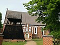
 Kolkwitz, Dorfkirche (profile).png 3,000 × 1,817; 10.17 MB
-
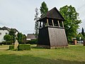
 Kolkwitz, Dorfkirche (with bell tower and WWI memorial).png 3,000 × 2,033; 11.95 MB
-
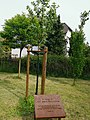
 Kolkwitz, Dorfkirche (WWI memorial).png 2,983 × 1,962; 10.4 MB
-
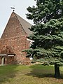
 Kolkwitz, Dorfkirche.png 3,000 × 2,082; 10.46 MB


.png)
.png)
.png)
.png)
