Category:Dorfkirche Kreuzbruch (Liebenwalde)
Jump to navigation
Jump to search
| Object location | | View all coordinates using: OpenStreetMap |
|---|
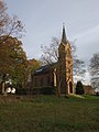
church building in Oberhavel district, Brandenburg state, Germany _2020_SE.jpg) | |||||
| Upload media | |||||
| Instance of | |||||
|---|---|---|---|---|---|
| Location | Kreuzbruch, Liebenwalde, Oberhavel District, Brandenburg, Germany | ||||
| Architectural style | |||||
| Heritage designation | |||||
| Inception |
| ||||
 | |||||
This is the category of the Brandenburger Baudenkmal (cultural heritage monument) with the ID 09165534 (Wikidata)
|
English: Former church in Kreuzbruch, Liebenwalde municipality, Oberhavel district, Brandenburg state, Germany
Deutsch: Frühere Dorfkirche Kreuzbruch, Stadt Liebenwalde, Landkreis Oberhavel, Land Brandenburg, Deutschland
Français : Ancienne église de Kreuzbruch, ville de Liebenwalde, arrondissement de Haute-Havel, état fédéral de Brandebourg, Allemagne
Pages in category "Dorfkirche Kreuzbruch (Liebenwalde)"
This category contains only the following page.
Media in category "Dorfkirche Kreuzbruch (Liebenwalde)"
The following 11 files are in this category, out of 11 total.
-
 Dorfkirche Kreuzbruch (Liebenwalde) 2020 ESE.jpg 4,864 × 3,648; 5.75 MB
-
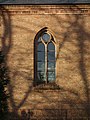 Dorfkirche Kreuzbruch (Liebenwalde) 2020 Fenster.jpg 3,648 × 4,864; 6.2 MB
-
 Dorfkirche Kreuzbruch (Liebenwalde) 2020 NE.jpg 4,864 × 3,648; 8.55 MB
-
 Dorfkirche Kreuzbruch (Liebenwalde) 2020 NW.jpg 3,648 × 4,864; 5.69 MB
-
 Dorfkirche Kreuzbruch (Liebenwalde) 2020 SE Panorama.jpg 4,864 × 3,648; 7.02 MB
-
 Dorfkirche Kreuzbruch (Liebenwalde) 2020 SE.jpg 4,864 × 3,648; 5.67 MB
-
 Dorfkirche Kreuzbruch (Liebenwalde) 2020 SW Panorama.jpg 6,459 × 3,315; 7.48 MB
-
 Dorfkirche Kreuzbruch (Liebenwalde) 2020 SW.jpg 3,648 × 4,864; 5.6 MB
-
 Dorfkirche Kreuzbruch (Liebenwalde) 2020 Turmhaube.jpg 3,648 × 4,864; 5.68 MB
-
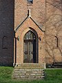 Dorfkirche Kreuzbruch (Liebenwalde) 2020 Westportal.jpg 3,648 × 4,864; 5.92 MB
-
 Kreuzbruch church.jpg 2,130 × 2,520; 926 KB
_2020_ESE.jpg)
_2020_Fenster.jpg)
_2020_NE.jpg)
_2020_NW.jpg)
_2020_SE_Panorama.jpg)
_2020_SW_Panorama.jpg)
_2020_SW.jpg)
_2020_Turmhaube.jpg)
_2020_Westportal.jpg)
