Category:Dorfkirche Nieska
Jump to navigation
Jump to search
| Object location | | View all coordinates using: OpenStreetMap |
|---|
| Upload media | |||||
| Instance of | |||||
|---|---|---|---|---|---|
| Location | Gröditz, Meissen District, Saxony, Germany | ||||
| Street address |
| ||||
| Heritage designation | |||||
| Inception |
| ||||
 | |||||
Media in category "Dorfkirche Nieska"
The following 11 files are in this category, out of 11 total.
-
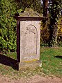
 Dorfkirche Nieska 15 Apr 2018 P1120563.jpg 4,608 × 3,456; 2.05 MB
-
 Dorfkirche Nieska 15 Apr 2018 P1120569.jpg 3,441 × 2,139; 1.65 MB
-
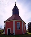
 Dorfkirche Nieska 15 Apr 2018 P1120570.jpg 3,456 × 4,608; 3.74 MB
-
 Dorfkirche Nieska 15 Apr 2018 P1120572 b.jpg 3,456 × 2,754; 1.99 MB
-
 Dorfkirche Nieska 15 Apr 2018 P1120572.jpg 3,456 × 4,608; 2.79 MB
-
 Dorfkirche Nieska 15 Apr 2018 P1120576.jpg 3,434 × 3,397; 2.28 MB
-
 Dorfkirche Nieska 15 Apr 2018 P1120577.jpg 2,189 × 2,066; 539 KB
-
 Dorfkirche Nieska 15 Apr 2018 P1120579.jpg 3,192 × 3,804; 832 KB
-
 Dorfkirche Nieska 15 Apr 2018 P1120581.jpg 3,449 × 3,557; 676 KB
-
 Dorfkirche Nieska 15 Apr 2018 P1120582.jpg 3,456 × 3,310; 2.02 MB
-
 Dorfkirche Nieska 15 Apr 2018 P1120585.jpg 2,974 × 3,223; 804 KB


