Category:Dorfkirche Rückersdorf
Jump to navigation
Jump to search
| Object location | | View all coordinates using: OpenStreetMap |
|---|
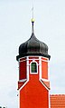
church building in Rückersdorf, Brandenburg state, Germany  | |||||
| Upload media | |||||
| Instance of | |||||
|---|---|---|---|---|---|
| Location | Rückersdorf, Elbe-Elster District, Brandenburg, Germany | ||||
| Street address |
| ||||
| Heritage designation | |||||
| Inception |
| ||||
| Religion or worldview | |||||
 | |||||
This is the category of the Brandenburger Baudenkmal (cultural heritage monument) with the ID 09135123 (Wikidata)
|
Media in category "Dorfkirche Rückersdorf"
The following 4 files are in this category, out of 4 total.
-
 KircheRückersdorf.JPG 4,752 × 3,168; 7.51 MB
-
 Rückersdorf Kirche 8 b.jpg 389 × 647; 65 KB
-
 Rückersdorf Kirche 8.jpg 1,341 × 1,270; 834 KB
-
 Rückersdorf9.JPG 2,560 × 1,920; 1.22 MB


