Category:Dorfkirche Sternebeck
Jump to navigation
Jump to search
| Object location | | View all coordinates using: OpenStreetMap |
|---|
church building in Brandenburg state, Germany  | |||||
| Upload media | |||||
| Instance of | |||||
|---|---|---|---|---|---|
| Location | Sternebeck, Prötzel, Märkisch-Oderland District, Brandenburg, Germany | ||||
| Heritage designation | |||||
| Inception |
| ||||
 | |||||
This is the category of the Brandenburger Baudenkmal (cultural heritage monument) with the ID 09180694 (Wikidata)
|
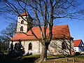
Deutsch: Bilder der Kirche in Sternebeck, Gemeinde Prötzel, Landkreis Märkisch-Oderland, Land Brandenburg, Deutschland.
English: Pictures of the church in Sternebeck, Prötzel municipality, Märkisch-Oderland district, Brandenburg state, Germany
Français : Photos de l'église à Sternebeck, commune de Prötzel, arrondissement de Märkisch-Oderland, état fédéral de Brandebourg, Allemagne
Media in category "Dorfkirche Sternebeck"
The following 4 files are in this category, out of 4 total.
-
 Dorfkirche Sternebeck.JPG 4,320 × 3,240; 4.87 MB
-
 Prötzel - Sternebeck - Kirche - 1.JPG 3,072 × 4,608; 6.47 MB
-
 Prötzel - Sternebeck - Kirche - 2.JPG 3,072 × 4,608; 5.97 MB
-
 Prötzel - Sternebeck - Kirche - 4.JPG 4,608 × 3,072; 7.14 MB


