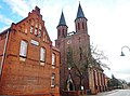
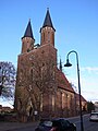
Category:Dorfkirche Vockerode
Jump to navigation
Jump to search
| Object location | | View all coordinates using: OpenStreetMap |
|---|
church building in Oranienbaum-Wörlitz, Saxony-Anhalt, Germany  | |||||
| Upload media | |||||
| Instance of | |||||
|---|---|---|---|---|---|
| Location | Vockerode, Oranienbaum-Wörlitz, Wittenberg, Saxony-Anhalt, Germany | ||||
| Architectural style | |||||
| Heritage designation | |||||
 | |||||
This is the category of the Saxony-Anhalt Kulturdenkmal (cultural heritage monument) with the ID 09440586 (Wikidata)
|
Media in category "Dorfkirche Vockerode"
The following 8 files are in this category, out of 8 total.
-
 Dorfkirche Vockerode -Südwestansicht hochkant- Mitte Januar 2023.jpg 3,000 × 4,000; 3.98 MB
-
-
 Evangelische Kirche zu Vockerode - Erbaut 1810-12 (2011-10) - panoramio.jpg 2,286 × 1,080; 295 KB
-
 Vockerode Kirche 1.JPEG 1,600 × 1,200; 708 KB
-
 Vockerode Kirche 2.JPEG 1,600 × 1,200; 900 KB
-
 Vockerode, Kirche 2013.jpg 2,592 × 1,944; 1.09 MB
-
 Vockerode, Kirche.jpg 1,200 × 1,600; 458 KB
-
 Vockerode,Kirche.jpg 4,530 × 3,000; 1.72 MB


_-_panoramio.jpg)


