Category:Dorfkirche Werben
Jump to navigation
Jump to search
| Object location | | View all coordinates using: OpenStreetMap |
|---|
church building in Brandenburg state, Germany  | |||||
| Upload media | |||||
| Instance of | |||||
|---|---|---|---|---|---|
| Location | Werben, Spree-Neiße District, Brandenburg, Germany | ||||
| Heritage designation | |||||
| Inception |
| ||||
 | |||||
This is the category of the Brandenburger Baudenkmal (cultural heritage monument) with the ID 09125285 (Wikidata)
|
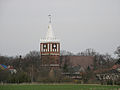
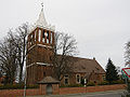
English: Pictures of the church in Werben, Werben municipality, Spree-Neiße district, Brandenburg state, Germany.
Deutsch: Ansichten der Kirche in Werben, Gemeinde Werben, Landkreis Spree-Neiße, Land Brandenburg, Deutschland.
Français : Photos de l'église à Werben, commune de Werben, arrondissement de Spree-Neiße, état fédéral de Brandebourg, Allemagne
Español: Vistas de la iglesia en Werben, municipio de Werben, distrito de Spree-Neiße, estado federado de Brandeburgo, Alemania
Address: Am Anger, 03096 Werben
Subcategories
This category has the following 2 subcategories, out of 2 total.
G
- Gedenkstein Kirchhof Werben (2 F)
- Grabsteine Kirchhof Werben (10 F)
Media in category "Dorfkirche Werben"
The following 9 files are in this category, out of 9 total.
-
 Dorfkirche Werben 20170619 151628-EFFECTS.jpg 1,653 × 1,240; 871 KB
-
 Dorfkirche werben 2020-08-23.jpg 3,648 × 2,736; 3.58 MB
-
 Werben (Spreewald), die Dorfkirche.jpg 2,551 × 1,701; 948 KB
-
 Werben (Spreewald), the village church.jpg 1,701 × 2,551; 904 KB
-
 Werben - Kirche 0001.jpg 1,200 × 899; 329 KB
-
 Werben Dorfkirche.JPG 3,008 × 2,000; 1.56 MB
-
 Werben Spreewald 01.jpg 1,134 × 852; 974 KB
-
 Werben Spreewald 02.jpg 1,134 × 851; 1.07 MB
-
 Werben Spreewald 03.jpg 851 × 1,134; 1.13 MB


,_die_Dorfkirche.jpg)
,_the_village_church.jpg)


