Category:Dorfkirche Wusterwitz
Jump to navigation
Jump to search
| Object location | | View all coordinates using: OpenStreetMap |
|---|
church building in Brandenburg, Germany   | |||||
| Upload media | |||||
| Instance of | |||||
|---|---|---|---|---|---|
| Made from material | |||||
| Location | Wusterwitz, Potsdam-Mittelmark District, Brandenburg, Germany | ||||
| Architectural style | |||||
| Heritage designation | |||||
 | |||||
This is the category of the Brandenburger Baudenkmal (cultural heritage monument) with the ID 09190544 (Wikidata)
|
Media in category "Dorfkirche Wusterwitz"
The following 31 files are in this category, out of 31 total.
-
 Apsis querhaus und chor wusterwitz.JPG 2,592 × 1,944; 1.81 MB
-
 Dorfkirche wusterwitz 2020-11-22 1.jpg 3,648 × 2,736; 3.55 MB
-
 Dorfkirche wusterwitz 2020-11-22 2.jpg 3,648 × 2,736; 3.75 MB
-
 Dorfkirche wusterwitz 2020-11-22 3.jpg 3,648 × 2,736; 3.42 MB
-
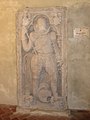 Grabplatte Christof von Britzke.jpg 1,410 × 1,884; 415 KB
-
 Grundriss wusterwitz.jpg 592 × 420; 19 KB
-
 Kirche wusterwitz altar.JPG 1,944 × 2,592; 1.2 MB
-
 Kirche wusterwitz chor außen.JPG 1,944 × 2,592; 1.82 MB
-
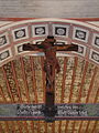 Kirche wusterwitz christusfigur.JPG 1,944 × 2,592; 1.59 MB
-
 Kirche wusterwitz deckenmalerei chor.JPG 1,944 × 2,592; 1.52 MB
-
 Kirche wusterwitz deckenmalerei schiff.JPG 2,592 × 1,944; 1.42 MB
-
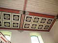
 Kirche wusterwitz deckenmalerei.JPG 2,592 × 1,944; 1.41 MB
-
 Kirche wusterwitz fenster 1.JPG 1,944 × 2,592; 808 KB
-
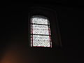 Kirche wusterwitz fenster 2.JPG 2,592 × 1,944; 690 KB
-
 Kirche wusterwitz kanzel.JPG 1,944 × 2,592; 1.14 MB
-
 Kirche wusterwitz malerei bogen chor vierung.JPG 1,944 × 2,592; 1.45 MB
-
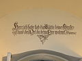 Kirche wusterwitz psalm durchgang turm-schiff.JPG 1,549 × 1,162; 209 KB
-
 Kirche wusterwitz relieftafel.JPG 1,944 × 2,592; 1.02 MB
-
 Kirche wusterwitz südempore querschiff.JPG 2,592 × 1,944; 1.17 MB
-
 Kirche wusterwitz taufbecken.JPG 1,944 × 2,592; 1.3 MB
-
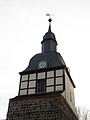 Kirche wusterwitz turm haube.JPG 1,944 × 2,592; 732 KB
-
 Kirche wusterwitz tür westportal.JPG 1,944 × 2,592; 1.62 MB
-
 Kirche wusterwitz westempore orgel.JPG 2,592 × 1,944; 1.34 MB
-
 Kirche wusterwitz westportal.JPG 1,944 × 2,592; 2.07 MB
-
 Kirchewusterwitz südportal querhaus.JPG 1,944 × 2,592; 1.46 MB
-
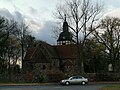
 Kirchewusterwitznordwest.JPG 2,337 × 1,751; 793 KB
-
 Schiffwusterwitz süden.JPG 2,592 × 1,944; 1.76 MB
-
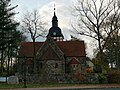
 Wusterwitz Kirche (01).jpg 2,400 × 2,400; 1.53 MB
-
 Wusterwitz Kirche (02).jpg 2,800 × 2,100; 1.53 MB
-
 Wusterwitz Kirche (03).jpg 2,800 × 2,100; 1.63 MB
-
 Wusterwitz Kirche.jpg 3,872 × 2,592; 6.88 MB


.jpg)
.jpg)
.jpg)
