Category:Douglas, County Cork
Перайсьці да навігацыі
Перайсьці да пошуку
English: Douglas is a suburb in Metropolitan Cork that is situated 4 km south of Cork, Ireland. As its borders are ill-defined and it straddles the boundary between Cork City and County Cork, it is difficult to ascertain the exact population. The CSO gives a figure of 18,192 for the parts of Douglas that lie within Cork County. No figure is provided for the parts within Cork City, although the combined population of the Tramore A, Tramore B and Tramore C electoral divisions, which lie in Douglas, is 5,001.
Français : Douglas est une banlieue de Cork située 4km au sud du centre-ville, qui compte 23 193 habitants.
Gaeilge: Ceann de bhruachbhailte Chorcaí é Dúglas (i mBéarla: Douglas), ar thaobh theas na cathrach, timpeall ar cheathar chiliméadar ó lár na cathrach. Tá 23,193 duine ina gcónaí i nDúglas.
Polski: Douglas ( irl. Dúglas) - przedmieście miasta Cork (hrabstwo Cork) w Irlandii, liczy 18 tys. mieszkańców (2006). Ośrodek przemysłu spożywczego.
прадмесьце Корку (Ірляндыя) .jpg) | |||||
| Загрузіць мэдыя | |||||
| Асобны выпадак панятку | |||||
|---|---|---|---|---|---|
| Цяперашняе месцазнаходжаньне | Корк, Манстэр, Ірляндыя | ||||
| Ня блытаць з | |||||
 | |||||
Падкатэгорыі
Гэтая катэгорыя зьмяшчае наступныя 4 падкатэгорыі з 4 агулам.
D
- Donnybrook, Cork (3 F)
M
- Cillian Murphy (41 F)
S
- St Columba's Church, Douglas (2 F)
- St Luke's Church, Douglas (24 F)
Файлы ў катэгорыі «Douglas, County Cork»
Паказаныя 47 файлаў гэтай катэгорыі з 47.
-
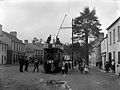 A street scene in Cork with tram and passengers! (16222787771).jpg 2000 × 1495; 1,54 Мб
-
 Ard Field - geograph.org.uk - 757687.jpg 640 × 480; 61 кб
-
 Cillian Murphy Photo Call The Party Berlinale 2017 cropped.jpg 625 × 834; 815 кб
-
 Cillian Murphy Press Conference The Party Berlinale 2017 01.jpg 4630 × 3087; 12,3 Мб
-
 Cillian Murphy Press Conference The Party Berlinale 2017 02 (cropped).jpg 1278 × 1762; 2,21 Мб
-
 Cillian Murphy Press Conference The Party Berlinale 2017 02.jpg 1970 × 2955; 5,45 Мб
-
 Cillian Murphy-2014.jpg 1333 × 1947; 505 кб
-
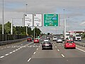 Cork South Ring Road at Junction 7 - geograph.org.uk - 5840853.jpg 800 × 600; 512 кб
-
 Country road meets the National Route N28 - geograph.org.uk - 4868742.jpg 1600 × 1012; 290 кб
-
 County Cork - St Luke's Church - 20180906110829.jpg 2377 × 2907; 1,18 Мб
-
 Cycle and walking path - geograph.org.uk - 4170782.jpg 4000 × 2664; 4,08 Мб
-
 Derelict farm house in Fourmile Bridge - geograph.org.uk - 4871099.jpg 1600 × 989; 468 кб
-
 Douglas Hall AFC grounds ^ public school - geograph.org.uk - 4871122.jpg 1600 × 989; 176 кб
-
-
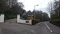 Entrance gate to Capuchin Friary - geograph.org.uk - 4873633.jpg 1600 × 894; 324 кб
-
 Farm buildings observed down a trackway - geograph.org.uk - 4868736.jpg 1600 × 1200; 373 кб
-

-

-
 Grange Road - geograph.org.uk - 760164.jpg 640 × 480; 70 кб
-
 Hartys Quay from Jacob's Island, Cork - geograph.org.uk - 3053031.jpg 2261 × 2257; 2,02 Мб
-
 Housing Estate near Donnybrook - geograph.org.uk - 4871110.jpg 1600 × 989; 187 кб
-
 Jack Lynch Tunnel, Northbound Bore - geograph.org.uk - 5832421.jpg 800 × 533; 633 кб
-
 K.C.'s Chipper - geograph.org.uk - 2882149.jpg 640 × 480; 59 кб
-
 Keep Douglas Clean - geograph.org.uk - 757655.jpg 640 × 480; 74 кб
-
 Muck spreading west of Monkstown - geograph.org.uk - 4871228.jpg 1600 × 989; 256 кб
-

-
 Near Carrigaline - geograph.org.uk - 4656909.jpg 4000 × 2664; 4,48 Мб
-
 Near Carrigaline - geograph.org.uk - 4656921.jpg 4000 × 2664; 4,73 Мб
-
 Near Rochestown - geograph.org.uk - 4166597.jpg 4000 × 2664; 4,08 Мб
-
 Old derelict gate house - geograph.org.uk - 4873639.jpg 1600 × 894; 450 кб
-
 On the L2489 - geograph.org.uk - 4656914.jpg 4000 × 2664; 5,06 Мб
-
 On the R610 - geograph.org.uk - 4166569.jpg 4000 × 2664; 2,26 Мб
-
 Raonaithe Nemo club building (geograph 4530285).jpg 1024 × 633; 68 кб
-
 Ringmahon Point and Lough Mahon - geograph.org.uk - 3032107.jpg 3648 × 2736; 2,87 Мб
-
 Road Junction - geograph.org.uk - 4656900.jpg 4000 × 2664; 6,89 Мб
-
 Rochestown Park Hotel - geograph.org.uk - 5008651.jpg 1024 × 768; 153 кб
-
 Scoil Nioclais - geograph.org.uk - 757696.jpg 480 × 640; 55 кб
-
 Sculpture in St. Johns Cemetery, Ballinrea - geograph.org.uk - 4868731.jpg 1600 × 989; 179 кб
-
 Soccer fields - geograph.org.uk - 4871116.jpg 1600 × 1200; 275 кб
-

-

-
 Spreading the natural fertilizer - geograph.org.uk - 4871235.jpg 1600 × 989; 248 кб
-
 St. Patrick's Church - geograph.org.uk - 4871130.jpg 1600 × 988; 371 кб
-
 Stream near Douglas - geograph.org.uk - 757665.jpg 480 × 640; 123 кб
-
 Tramore House.jpg 3024 × 4032; 6,09 Мб
-
 Us and Cillian (4793237919).jpg 2592 × 1944; 813 кб
-
 View from bridge over N28 - geograph.org.uk - 4871188.jpg 1599 × 990; 257 кб


.jpg)


.jpg)


.jpg)
