Category:Draaibrug Buitenhaven ('s-Hertogenbosch)
Jump to navigation
Jump to search
| Object location | | View all coordinates using: OpenStreetMap |
|---|
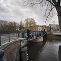
bridge in 's-Hertogenbosch, Netherlands  | |||||
| Upload media | |||||
| Instance of | |||||
|---|---|---|---|---|---|
| Location | 's-Hertogenbosch, North Brabant, Netherlands | ||||
| Street address |
| ||||
| Crosses | |||||
| Heritage designation |
| ||||
 | |||||
|
This is a category about rijksmonument number 522443
|
| Address |
|
Media in category "Draaibrug Buitenhaven ('s-Hertogenbosch)"
The following 13 files are in this category, out of 13 total.
-
 Brug - 's-Hertogenbosch - 20109213 - RCE.jpg 788 × 1,200; 166 KB
-
 Brug - 's-Hertogenbosch - 20109214 - RCE.jpg 1,200 × 788; 178 KB
-
 Brugstraat - 's-Hertogenbosch - 20340210 - RCE.jpg 1,200 × 956; 275 KB
-
 Brugstraat - 's-Hertogenbosch - 20340211 - RCE.jpg 1,200 × 1,200; 316 KB
-
 Brugstraat - 20340209 - RCE.jpg 1,200 × 1,200; 260 KB
-
 Buitenhaven - 20340206 - RCE.jpg 1,198 × 1,200; 331 KB
-
 Draaibrug Den Bosch.JPG 2,592 × 1,944; 514 KB
-
 Overzicht vanaf de Brugstraat - 20340204 - RCE.jpg 1,200 × 956; 186 KB
-
 Overzicht vanaf de Brugstraat - 20340205 - RCE.jpg 1,200 × 956; 224 KB
-
 Overzicht vanaf de Havensingel - 20340208 - RCE.jpg 1,200 × 1,200; 401 KB
-
 Overzicht vanaf de Oliemolensingel - 's-Hertogenbosch - 20340197 - RCE.jpg 1,200 × 1,200; 338 KB
-
 Overzicht vanaf de Oliemolensingel - 's-Hertogenbosch - 20340203 - RCE.jpg 1,200 × 1,200; 271 KB
-
 Overzicht zijde Buitenhaven - 20340207 - RCE.jpg 1,200 × 1,200; 230 KB


