Category:Dundonnell and Fisherfield Forest
Jump to navigation
Jump to search
 | |||||
| Upload media | |||||
| Instance of | |||||
|---|---|---|---|---|---|
| Location | Highland, Scottish Highlands, Scotland | ||||
 | |||||
Media in category "Dundonnell and Fisherfield Forest"
The following 36 files are in this category, out of 36 total.
-
 A832 through Dundonnell Forest - geograph.org.uk - 14372.jpg 450 × 300; 11 KB
-
 Allt a' Chlaiginn - geograph.org.uk - 3619170.jpg 640 × 480; 278 KB
-
 Allt a' Chlaiginn - geograph.org.uk - 3913517.jpg 640 × 427; 123 KB
-
 Approach to communications mast - geograph.org.uk - 3649107.jpg 1,280 × 960; 888 KB
-
 Beinn a' Chaisgein Beag - geograph.org.uk - 2991002.jpg 3,264 × 2,448; 1.73 MB
-
 Beinn a' Chaisgein Beag from the north - geograph.org.uk - 2991692.jpg 3,264 × 2,448; 1.63 MB
-
 Beinn a' Chaisgein Beag north top - geograph.org.uk - 2990881.jpg 3,264 × 2,448; 2.14 MB
-
 Beinn a' Chaisgein Beag north top - geograph.org.uk - 2990889.jpg 3,264 × 2,448; 1.89 MB
-
 Beinn a' Chaisgein Mor - geograph.org.uk - 2263560.jpg 2,200 × 1,559; 729 KB
-
 Beinn a'Chaisgein Mor - geograph.org.uk - 2259611.jpg 2,335 × 1,552; 650 KB
-
 Boggy tops, Dundonnell Forest - geograph.org.uk - 1248131.jpg 640 × 480; 124 KB
-
 Dundonnel Forest - 1981 - geograph.org.uk - 2763138.jpg 2,272 × 1,512; 627 KB
-
 Dundonnell Forest - 1981 - geograph.org.uk - 2249831.jpg 2,272 × 1,515; 530 KB
-

-
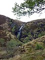 Eas Ban, Cromartyshire - geograph-1891151.jpg 480 × 640; 132 KB
-
 Fisherfield approach - geograph.org.uk - 1550542.jpg 640 × 480; 107 KB
-
-
 Fisherfield high camp - geograph.org.uk - 3248025.jpg 3,264 × 2,448; 3.7 MB
-
 Foot of Beinn a' Chaisgein Mor western slopes - geograph.org.uk - 2991781.jpg 3,264 × 2,448; 2.45 MB
-
 Footpath to Coire Mhic Fhearchair - geograph.org.uk - 713058.jpg 640 × 480; 63 KB
-
 Knoll on east shore of Meall an Duibhe loch above Dundonell - geograph.org.uk - 2686016.jpg 3,648 × 2,736; 4.84 MB
-

-

-
 Moorland above Dundonnell - geograph.org.uk - 1811997.jpg 640 × 480; 123 KB
-
 Moorland above Dundonnell - geograph.org.uk - 1812007.jpg 640 × 480; 127 KB
-
 Moorland above Dundonnell - geograph.org.uk - 3624619.jpg 4,608 × 3,456; 4.57 MB
-
 North of Allt an Duibhe above Dundonell - geograph.org.uk - 2686285.jpg 3,648 × 2,736; 4.79 MB
-
 On the South East side of Sail Liath - geograph.org.uk - 242442.jpg 640 × 421; 47 KB
-
 Path above Dundonnell House - geograph.org.uk - 1752810.jpg 640 × 424; 100 KB
-
 Rough grazing above Dundonnell - geograph.org.uk - 3624609.jpg 4,608 × 3,456; 3.6 MB
-
 Sunrise on Slioch - geograph.org.uk - 621329.jpg 634 × 462; 106 KB
-
 The Dundonnell River at Airigh Ghiorid.jpg 3,024 × 4,032; 6.18 MB
-
 The summit of Beinn a' Chlaidheimh - geograph.org.uk - 1477996.jpg 640 × 417; 126 KB
-
 View towards Fisherfield Munros - geograph.org.uk - 3433742.jpg 800 × 505; 515 KB
-
 Wet ground across Dundonnell Forest - geograph.org.uk - 1248096.jpg 640 × 480; 130 KB
-
 View from Meall na Meine - geograph.org.uk - 253005.jpg 640 × 480; 95 KB


