Category:Dunham-on-the-Hill
Aller à la navigation
Aller à la recherche
English: Dunham-on-the-Hill is a village and former civil parish in the Borough of Cheshire West and Chester and the ceremonial county of Cheshire in England. It is located on the A56 main road, near Helsby.
village britannique  | |||||
| Téléverser des médias | |||||
| Nature de l’élément |
| ||||
|---|---|---|---|---|---|
| Lieu | Dunham-on-the-Hill and Hapsford, Cheshire West and Chester, Cheshire, Angleterre du Nord-Ouest, Angleterre | ||||
| site officiel | |||||
 | |||||
Sous-catégories
Cette catégorie comprend 2 sous-catégories, dont les 2 ci-dessous.
D
- Dunham Hill No. 2 signal box (5 F)
L
Média dans la catégorie « Dunham-on-the-Hill »
Cette catégorie comprend 34 fichiers, dont les 34 ci-dessous.
-
 Barrow - Middlehurst Farm - geograph.org.uk - 224896.jpg 633 × 475 ; 263 kio
-
 Cottage in Dunham-on-the-Hill, Cheshire.JPG 1 200 × 900 ; 179 kio
-
 Dunham Hall, Dunham-on-the-Hill, Cheshire.JPG 1 200 × 900 ; 176 kio
-

-
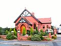 Dunham on the Hill - Converted Chapel.jpg 640 × 480 ; 143 kio
-

-
 Dunham-on-The-Hill - geograph.org.uk - 4656310.jpg 640 × 480 ; 683 kio
-
 Dunham-on-The-Hill, Chester Road - geograph.org.uk - 4656312.jpg 640 × 481 ; 415 kio
-
 Dunham-on-The-Hill, Gate on Rake Lane - geograph.org.uk - 4656325.jpg 640 × 481 ; 548 kio
-
 Dunham-on-the-Hill, Rake Lane - geograph.org.uk - 4656330.jpg 640 × 481 ; 533 kio
-
 Electricity box, Dunham-on-the-Hill - geograph.org.uk - 2461346.jpg 4 000 × 3 000 ; 3,42 Mio
-
 Footpath stile near Dunham-on-the-Hill - geograph.org.uk - 2461367.jpg 4 000 × 3 000 ; 3,4 Mio
-
 Footpath to Dunham-on-the-Hill - geograph.org.uk - 2439029.jpg 4 000 × 3 000 ; 3,51 Mio
-
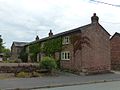
 Horns Farmhouse, Dunham-on-the-Hill, Cheshire.JPG 1 200 × 900 ; 172 kio
-
 Manor Farm, Dunham-on-the-Hill, Cheshire 01.JPG 1 200 × 900 ; 198 kio
-
 Pear Tree Farm, Dunham-on-the-Hill, Cheshire.JPG 1 200 × 900 ; 173 kio
-
 Rake Lane, Dunham-on-the-Hill - geograph.org.uk - 2461324.jpg 4 000 × 3 000 ; 3,13 Mio
-
 Rock Cottages, Dunham-on-the-Hill, Cheshire.JPG 1 200 × 900 ; 193 kio
-
 Seen better days - geograph.org.uk - 189040.jpg 640 × 421 ; 63 kio
-
 Site of Dunham Hill station geograph-3316171-by-Ben-Brooksbank.jpg 2 394 × 1 445 ; 2,39 Mio
-
 Smithy Farmhouse, Dunham-on-the-Hill.jpg 1 200 × 900 ; 199 kio
-
 The Plum Tree (now The Dunham Arms), Chester Road - geograph.org.uk - 2460582.jpg 4 000 × 3 000 ; 2,34 Mio
-
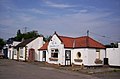
 The Wheatsheaf - geograph.org.uk - 1208128.jpg 640 × 426 ; 38 kio
-
 The Wheatsheaf, Dunham-on-the-Hill - geograph.org.uk - 2460611.jpg 4 000 × 3 000 ; 2,82 Mio
-
 The Wheatsheaf, Dunham-on-The-Hill - geograph.org.uk - 4656316.jpg 640 × 480 ; 465 kio
-
 Town Farm, Dunham-on-the-Hill, Cheshire.JPG 1 200 × 900 ; 159 kio
-
 Village Road Dunham-on-the-Hill - geograph.org.uk - 2996195.jpg 640 × 480 ; 56 kio
-
 Barrow Brook - geograph.org.uk - 224892.jpg 640 × 480 ; 95 kio
-
 Barrow Lane Farm, Dunham-on-the-Hill - geograph.org.uk - 165614.jpg 640 × 480 ; 98 kio
-
 Cornhill Farm, near Dunham-on-the-Hill - geograph.org.uk - 189034.jpg 640 × 421 ; 88 kio
-
 Dunham-on-the-Hill - the green - geograph.org.uk - 165619.jpg 640 × 480 ; 76 kio
-
 Early cut benchmark outside Station Farmhouse - geograph.org.uk - 110950.jpg 640 × 480 ; 134 kio
-
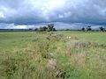
 Pasture near Dunham-on-the-Hill - geograph.org.uk - 189031.jpg 640 × 421 ; 66 kio
-
 Railway bridge near Long Green - geograph.org.uk - 109593.jpg 640 × 480 ; 147 kio


,_Chester_Road_-_geograph.org.uk_-_2460582.jpg)


