Category:Dunragit
Aller à la navigation
Aller à la recherche
village au Royaume-Uni  | |||||
| Téléverser des médias | |||||
| Nature de l’élément | |||||
|---|---|---|---|---|---|
| Lieu |
| ||||
 | |||||
Cymraeg: Mae Dunragit ( Gaeleg: Dùn Reicheit) yn bentref ar yr A75, rhwng Stranraer a Glenluce yn Dumfries a Galloway (Swydd Wigtown cyn hynny) yn ne-orllewin yr Alban. Tyfodd y pentref presennol oddi amgylch porth gorllewinol Plas Dunragit, sy'n dyddio i'r 18fed ganrif. Tyfodd yn sylweddol yn y 1950au.
English: Dunragit ( Gaelic: Dùn Reicheit) is a village on the A75, between Stranraer and Glenluce in Dumfries and Galloway (previously Wigtownshire) in south-west Scotland. It grew up around the west gate of Dunragit House, an 18th century three-storey four-bay country house. It expanded considerably in the 1950s. The major employer was always the Creamery, but this is no longer in use.
Italiano: Dunragit è un villaggio sulla A75, tra Stranraer e Glenluce, nel Dumfries e Galloway (prima Wigtownshire), nella Scozia sud-occidentale. Si è sviluppato intorno alla porta occidentale della Dunragit House, una country house di XVIII secolo. Si sviluppò in maniera considerevole negli anni cinquanta del XX secolo.
Sous-catégories
Cette catégorie comprend 3 sous-catégories, dont les 3 ci-dessous.
D
- Droughduil Mote, Dunragit (1 F)
- Dunragit railway station (2 F)
G
- Glenwhan Gardens (64 F)
Média dans la catégorie « Dunragit »
Cette catégorie comprend 31 fichiers, dont les 31 ci-dessous.
-
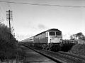 47442 approaches Dunragit level crossing.jpg 1 024 × 768 ; 305 kio
-
 Bend in the lower reaches of the Piltanton Burn - geograph.org.uk - 163835.jpg 640 × 480 ; 120 kio
-
 Drochduil Primary School - geograph.org.uk - 163840.jpg 640 × 480 ; 82 kio
-
 Droughduil - geograph.org.uk - 315288.jpg 640 × 480 ; 68 kio
-
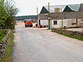
 Drumflower, Dunragit - geograph.org.uk - 746150.jpg 640 × 480 ; 71 kio
-
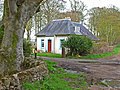
 Dunragit House - geograph.org.uk - 596165.jpg 640 × 480 ; 91 kio
-
 Dunragit level crossing and signalbox. Dumfries & Galloway.jpg 1 920 × 1 080 ; 673 kio
-
 Dunragit passing loop and old station house. Dumfries & Galloway.jpg 1 920 × 1 080 ; 758 kio
-
 Dunragit passing loop and signalbox. Dumfries & Galloway.jpg 1 920 × 1 080 ; 821 kio
-
 Dunragit Signal Box Geograph-2019865-by-Andy-Farrington.jpg 3 648 × 2 736 ; 4,69 Mio
-
 Dunragit signalbox and level crossing, Dumfries and Galloway, Scotland.jpg 1 920 × 1 080 ; 732 kio
-
 Dunragit, East - geograph.org.uk - 746128.jpg 640 × 480 ; 89 kio
-
 East Challoch - geograph.org.uk - 163156.jpg 640 × 480 ; 76 kio
-
 Flooded field near Genoch Mains - geograph.org.uk - 662157.jpg 482 × 640 ; 117 kio
-
 Genoch Mains - geograph.org.uk - 163831.jpg 640 × 480 ; 78 kio
-
 Genoch Mains - geograph.org.uk - 313187.jpg 640 × 480 ; 78 kio
-
 Harebells by stone dyke at Torrs Warren - geograph.org.uk - 307205.jpg 640 × 480 ; 170 kio
-
 It's a long way to Murrayfield.... - geograph.org.uk - 561588.jpg 640 × 490 ; 77 kio
-
 Junction on the A75 - geograph.org.uk - 163843.jpg 640 × 480 ; 79 kio
-
 Junction on the A75 - geograph.org.uk - 315290.jpg 640 × 480 ; 70 kio
-
 Level crossing at Dunragit.jpg 640 × 480 ; 96 kio
-
 Lodge for Genoch Mains - geograph.org.uk - 313186.jpg 640 × 480 ; 96 kio
-
 Low Chlenry farmhouse, abandoned - geograph.org.uk - 537570.jpg 640 × 480 ; 87 kio
-
 Mapa Dhùn Reicheit.jpg 2 004 × 1 363 ; 599 kio
-
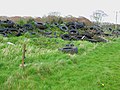 Mountain of old tyres - geograph.org.uk - 163830.jpg 640 × 480 ; 82 kio
-
 Old bombing target - geograph.org.uk - 561464.jpg 480 × 640 ; 130 kio
-
 Old bombing target on Luce sands - geograph.org.uk - 560957.jpg 640 × 480 ; 76 kio
-
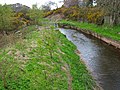 Piltanton Burn - geograph.org.uk - 163836.jpg 640 × 480 ; 92 kio
-
 Piltanton Burn - geograph.org.uk - 315283.jpg 640 × 480 ; 69 kio
-
 Private level crossing at East Challoch - geograph.org.uk - 315291.jpg 640 × 480 ; 98 kio
-
 Sand patterns - geograph.org.uk - 561589.jpg 640 × 480 ; 155 kio


