Category:Dumfries and Galloway
Jump to navigation
Jump to search
Council areas (municipalities) of Scotland: Aberdeen · Aberdeenshire · Angus · Argyll and Bute · Clackmannanshire · Dumfries and Galloway · Dundee · East Ayrshire · East Dunbartonshire · East Lothian · East Renfrewshire · Edinburgh · Falkirk · Fife · Glasgow · Highland · Inverclyde · Midlothian · Moray · North Ayrshire · North Lanarkshire · Outer Hebrides · Orkney Islands · Perth and Kinross · Renfrewshire · Scottish Borders · Shetland Islands · South Ayrshire · South Lanarkshire · Stirling · West Dunbartonshire · West Lothian
Former regions and island areas of Scotland: Central Region · Dumfries and Galloway · Fife · Grampian · Highland · Lothian · Orkney Islands · Outer Hebrides · Scottish Borders · Shetland Islands · Strathclyde · Tayside
unitary council area of Scotland    | |||||
| Upload media | |||||
| Instance of | |||||
|---|---|---|---|---|---|
| Location | Scotland | ||||
| Capital | |||||
| Legislative body |
| ||||
| Inception |
| ||||
| Population |
| ||||
| Area |
| ||||
| official website | |||||
 | |||||
English: Dumfries and Galloway (Scots: Cooncil o Dumfries an Gallowa; Scottish Gaelic: Siorrachd Dùn Phris agus an Gall-Ghaidhealaibh) is one of 32 council areas of Scotland.

Subcategories
This category has the following 22 subcategories, out of 22 total.
Media in category "Dumfries and Galloway"
The following 200 files are in this category, out of 1,896 total.
(previous page) (next page)-
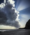 "Cloudburst" - geograph.org.uk - 5621462.jpg 3,812 × 4,426; 7.56 MB
-
 A path by the Tarf Water - geograph.org.uk - 5535728.jpg 1,024 × 768; 806 KB
-
 Above Glenstocken Shore East of Barcloy Hill - geograph.org.uk - 6274162.jpg 1,024 × 768; 420 KB
-
 Airds Bay - geograph.org.uk - 5501473.jpg 4,925 × 3,515; 3.15 MB
-
 Airds Bay, Fleet Estuary - geograph.org.uk - 5379756.jpg 4,848 × 3,232; 3.68 MB
-
 Airds Bay, Sandgreen - geograph.org.uk - 6205792.jpg 3,264 × 2,448; 4.15 MB
-
 Airds Bay, Sandgreen - geograph.org.uk - 6205805.jpg 3,264 × 2,448; 3.91 MB
-
 Airds Heugh - geograph.org.uk - 5396277.jpg 1,600 × 967; 286 KB
-
 Almorness Point - geograph.org.uk - 5630304.jpg 4,378 × 2,918; 7.82 MB
-
 Almorness, from above the Nith Estuary - geograph.org.uk - 5461505.jpg 3,264 × 2,448; 3.76 MB
-
 An Abandoned "Beetle" - geograph.org.uk - 5251590.jpg 4,608 × 3,456; 4.33 MB
-
 Annadales Historical Map.png 368 × 456; 16 KB
-
 Approaching Ardwall Isle across the tidal flats - geograph.org.uk - 5501598.jpg 5,053 × 3,713; 4.05 MB
-
 Ardwall Isle - geograph.org.uk - 5900003.jpg 1,600 × 900; 263 KB
-
 Ardwall Isle - geograph.org.uk - 6138605.jpg 2,976 × 1,984; 1.15 MB
-
 Ardwall Isle - geograph.org.uk - 6138606.jpg 2,976 × 1,984; 2.4 MB
-
 Ardwall Isle - geograph.org.uk - 6138714.jpg 2,976 × 1,984; 3.1 MB
-
 Ardwall Isle - geograph.org.uk - 6138740.jpg 2,883 × 1,905; 904 KB
-
 Ardwall Isle - geograph.org.uk - 6138742.jpg 2,976 × 1,984; 2.68 MB
-
 Ardwall Isle - geograph.org.uk - 6138790.jpg 2,592 × 1,728; 2.29 MB
-
 Ardwall Isle - geograph.org.uk - 6138792.jpg 2,592 × 1,728; 2.01 MB
-
 Ardwall Isle - the shoreline - geograph.org.uk - 5501660.jpg 3,585 × 4,960; 4.37 MB
-
 At Brighouse Bay - geograph.org.uk - 5372237.jpg 4,896 × 3,264; 4.52 MB
-
 At Nun Mill Bay - geograph.org.uk - 5372589.jpg 3,017 × 2,050; 1.97 MB
-
 At Point Of The Isle - geograph.org.uk - 5927274.jpg 640 × 426; 101 KB
-
 Back Bay - geograph.org.uk - 5546587.jpg 640 × 427; 323 KB
-
 Back Bay - geograph.org.uk - 5546619.jpg 2,150 × 480; 560 KB
-
 Back Bay - geograph.org.uk - 6000885.jpg 4,377 × 3,283; 2.14 MB
-
 Back Bay - Monreith - geograph.org.uk - 6040096.jpg 2,736 × 1,824; 6.53 MB
-
 Balcary Bay - geograph.org.uk - 5713409.jpg 640 × 480; 76 KB
-
 Balcary Bay - geograph.org.uk - 6298297.jpg 1,024 × 549; 119 KB
-
 Balcary Bay Hotel - geograph.org.uk - 5577273.jpg 1,600 × 985; 255 KB
-
 Balcary Tower - geograph.org.uk - 5246603.jpg 2,830 × 1,886; 6.67 MB
-
 Barlocco beach Knockbrex Dumfries and Galloway - geograph.org.uk - 5461645.jpg 5,184 × 3,888; 4.48 MB
-
 Barlocco beach Knockbrex Dumfries and Galloway - geograph.org.uk - 5461661.jpg 5,184 × 3,888; 6.25 MB
-
 Barlocco beach Knockbrex Dumfries and Galloway - geograph.org.uk - 5461663.jpg 5,184 × 3,888; 6.24 MB
-
 Barlooco beach Knockbrex Dumfries and Galloway - geograph.org.uk - 5461638.jpg 5,184 × 3,888; 5.42 MB
-
 Barnacles and foam - geograph.org.uk - 3839456.jpg 421 × 640; 76 KB
-
 Barnhourie burn enters Sandyhills bay. - geograph.org.uk - 6294683.jpg 1,024 × 683; 118 KB
-
 Bay at Barcloy Heugh - geograph.org.uk - 6274072.jpg 1,024 × 768; 465 KB
-
 Bay at Barr Point - geograph.org.uk - 5669183.jpg 2,976 × 1,984; 3.63 MB
-
 Beach at Powillimount - geograph.org.uk - 5353659.jpg 1,066 × 800; 226 KB
-
 Beach Lodge - geograph.org.uk - 6202575.jpg 640 × 480; 397 KB
-
 Beach near the Thirl Stane - geograph.org.uk - 5772611.jpg 1,600 × 1,028; 411 KB
-
 Bells Isle - geograph.org.uk - 6279736.jpg 768 × 1,024; 532 KB
-
 Below The Torrs at low tide - geograph.org.uk - 5573428.jpg 1,024 × 589; 210 KB
-
 Between Bloody Rock and Bloody Slouch - geograph.org.uk - 5551712.jpg 477 × 640; 391 KB
-
 Binoculars at the Wig - geograph.org.uk - 5682904.jpg 2,904 × 1,918; 1.31 MB
-
 Blowing In The Wind - geograph.org.uk - 5761683.jpg 4,397 × 2,371; 6.78 MB
-
 Boathouse and quay, East Tarbet - geograph.org.uk - 5584775.jpg 2,000 × 1,466; 738 KB
-
 Boats moored at Kingholm Quay - geograph.org.uk - 5739346.jpg 1,600 × 900; 305 KB
-
 Braid Port - geograph.org.uk - 5551657.jpg 640 × 427; 433 KB
-
 Braid Port - geograph.org.uk - 5551660.jpg 640 × 427; 383 KB
-
 Brandy Cove near Portling - geograph.org.uk - 6274411.jpg 1,024 × 768; 420 KB
-
 Breaking waves, near Rough Point - geograph.org.uk - 5395119.jpg 1,600 × 1,025; 365 KB
-
 Bunker Snack Bar - geograph.org.uk - 5801930.jpg 2,976 × 1,984; 3.12 MB
-
 Burn approaching the Solway - geograph.org.uk - 5392205.jpg 1,600 × 1,067; 265 KB
-
 Cailiness Sand - geograph.org.uk - 5560577.jpg 4,272 × 2,848; 1.62 MB
-
 Cairn on Barlaes Hill - geograph.org.uk - 998847.jpg 640 × 480; 96 KB
-
 Cairn on Craiglarie Fell - geograph.org.uk - 1521530.jpg 640 × 428; 59 KB
-
 Cairn on Meikle Knypes hillside - geograph.org.uk - 780690.jpg 640 × 480; 157 KB
-
 Cairn on Mulloch Hill - panoramio.jpg 1,980 × 1,320; 2.01 MB
-
 Cairn on the Rig of Craig Gilbert. - geograph.org.uk - 1005323.jpg 480 × 640; 60 KB
-
 Calm before the Storm - geograph.org.uk - 3793242.jpg 615 × 640; 62 KB
-
 Car and horse - geograph.org.uk - 162954.jpg 640 × 480; 97 KB
-
 Car Remains At Redkirk Point - geograph.org.uk - 4106486.jpg 3,448 × 4,592; 2.96 MB
-
 Caravan site - geograph.org.uk - 925543.jpg 640 × 480; 88 KB
-
 Carco Back Wood - geograph.org.uk - 870940.jpg 640 × 480; 93 KB
-
 Carewoodrig Hope - geograph.org.uk - 303490.jpg 640 × 480; 180 KB
-
 Carleton Port - geograph.org.uk - 2401525.jpg 640 × 480; 69 KB
-
 Carleton Port - geograph.org.uk - 2401539.jpg 640 × 480; 72 KB
-
 Carleton Port - geograph.org.uk - 2401548.jpg 640 × 481; 72 KB
-
 Carleton Port - geograph.org.uk - 2401565.jpg 640 × 480; 82 KB
-
 Carrick Bay - geograph.org.uk - 2733914.jpg 1,000 × 750; 261 KB
-
 Carrick Bay - geograph.org.uk - 6138729.jpg 2,976 × 1,984; 2.55 MB
-
 Carrick Bay - geograph.org.uk - 6138746.jpg 2,976 × 1,984; 3.79 MB
-
 Carrick Bay - geograph.org.uk - 6138750.jpg 2,976 × 1,984; 1.32 MB
-
 Carrick Bay at low tide - geograph.org.uk - 5501605.jpg 4,850 × 3,593; 3.25 MB
-
 Carrick Shore - geograph.org.uk - 4075429.jpg 4,800 × 3,200; 7.6 MB
-
 Carrick Shore - geograph.org.uk - 5853224.jpg 3,592 × 2,030; 7.7 MB
-
 Carrifran in Moffat Dale - geograph.org.uk - 1292955.jpg 640 × 480; 77 KB
-
 Carse Bay - geograph.org.uk - 2357864.jpg 640 × 424; 173 KB
-
 Carse of Barr - geograph.org.uk - 2122282.jpg 3,648 × 2,736; 4.67 MB
-
 Carse of Barr - geograph.org.uk - 2122405.jpg 3,648 × 2,736; 4.73 MB
-
 Carving in Queensberry vault - geograph.org.uk - 925517.jpg 640 × 480; 48 KB
-

-
 Cattle on Barlaes Farm - panoramio.jpg 1,980 × 1,320; 1.99 MB
-
 Causeway to the Garvellan Rocks - geograph.org.uk - 2251181.jpg 3,020 × 2,234; 1.62 MB
-
 Changing moods - after the squall - geograph.org.uk - 2855863.jpg 3,890 × 2,850; 1.52 MB
-
 Changing moods - low clouds - geograph.org.uk - 2855872.jpg 3,976 × 2,968; 1.25 MB
-
 Changing moods - setting sun - geograph.org.uk - 2855880.jpg 3,954 × 2,938; 1.39 MB
-
 Changing water channels - geograph.org.uk - 3324559.jpg 2,560 × 1,920; 2.81 MB
-
 Chapel Cross - panoramio (1).jpg 3,872 × 2,592; 5.71 MB
-
 Chapel Cross - panoramio.jpg 3,872 × 2,592; 5.69 MB
-
 Charles Coid, Butcher (30843979208).jpg 3,557 × 5,335; 9.67 MB
-

-
 Clayshant Burn - geograph.org.uk - 4296545.jpg 640 × 384; 55 KB
-
 Clear fell area and lumber - geograph.org.uk - 424289.jpg 640 × 480; 128 KB
-

-
 Cleuch Burn - geograph.org.uk - 1326676.jpg 640 × 480; 74 KB
-
 Cliff Inlet - geograph.org.uk - 5528352.jpg 4,272 × 2,848; 5.32 MB
-
 Cliff Vegetation - geograph.org.uk - 5527711.jpg 4,272 × 2,848; 4.19 MB
-
 Cliff View - geograph.org.uk - 2913589.jpg 640 × 480; 86 KB
-
 Cliffs above Lagmuck Sands - geograph.org.uk - 4851063.jpg 3,504 × 2,336; 3.24 MB
-
 Cliffs and Rocky Outcrop - geograph.org.uk - 2994754.jpg 495 × 640; 104 KB
-
 Cliffs at East Tarbet Bay - geograph.org.uk - 5589889.jpg 5,184 × 3,888; 609 KB
-
 Cliffs at Port O' Warren Bay - geograph.org.uk - 1986931.jpg 3,060 × 2,288; 1.98 MB
-
 Cliffs at Portling Bay - geograph.org.uk - 1944879.jpg 2,048 × 1,536; 824 KB
-
 Cliffs at Scart Cave - geograph.org.uk - 5549964.jpg 478 × 640; 451 KB
-
 Cliffs below Torrs Hill - geograph.org.uk - 1949732.jpg 3,072 × 2,304; 2.28 MB
-
 Cliffs by Bloody Neuk - geograph.org.uk - 2858961.jpg 480 × 640; 114 KB
-
 Cliffs by Bloody Neuk - geograph.org.uk - 2859845.jpg 640 × 480; 81 KB
-
 Cliffs by Broom Point - geograph.org.uk - 3000994.jpg 468 × 640; 97 KB
-
 Cliffs by Broom Point - geograph.org.uk - 3001000.jpg 480 × 640; 109 KB
-
 Cliffs by Broom Point - geograph.org.uk - 3001022.jpg 640 × 479; 73 KB
-
 Cliffs by Cruggleton - geograph.org.uk - 2994114.jpg 480 × 640; 89 KB
-
 Cliffs south of White Port - geograph.org.uk - 2995312.jpg 478 × 640; 89 KB
-
 Cliffs to the east of the Cow's Snout - geograph.org.uk - 1986949.jpg 2,902 × 2,070; 1.45 MB
-
 Clifftop footpath to Rascarrel Bay - geograph.org.uk - 5800061.jpg 4,608 × 3,456; 6.82 MB
-
 Clone Point - geograph.org.uk - 2218609.jpg 640 × 480; 77 KB
-
 Clone Point - geograph.org.uk - 2218684.jpg 640 × 480; 84 KB
-
 Clone Point - geograph.org.uk - 2218699.jpg 640 × 480; 72 KB
-
 Clone Point - geograph.org.uk - 2218715.jpg 640 × 472; 72 KB
-
 Clone Point - geograph.org.uk - 2218723.jpg 640 × 467; 71 KB
-
 Clone Point - geograph.org.uk - 2218788.jpg 640 × 470; 76 KB
-
 Clone Point - geograph.org.uk - 2218814.jpg 640 × 480; 74 KB
-
 Clone Point - geograph.org.uk - 2218840.jpg 640 × 480; 79 KB
-
 Clone Point - geograph.org.uk - 2218852.jpg 640 × 480; 72 KB
-
 Clone Point - geograph.org.uk - 2218859.jpg 640 × 480; 73 KB
-
 Cloud street above Todholes Hill - geograph.org.uk - 1316534.jpg 640 × 480; 42 KB
-
 Cloudberry, Rubus chamaemorus - geograph.org.uk - 912451.jpg 640 × 480; 133 KB
-
 Cloudy day, Rockcliffe - geograph.org.uk - 1963504.jpg 800 × 600; 107 KB
-
-
 Coast by Bloody Neuk - geograph.org.uk - 2859861.jpg 640 × 469; 56 KB
-
 Coast by Bloody Neuk - geograph.org.uk - 2860555.jpg 640 × 480; 58 KB
-
 Coast by Innerwell Plantation - geograph.org.uk - 2842253.jpg 640 × 480; 70 KB
-
 Coast by Innerwell Plantation - geograph.org.uk - 2842258.jpg 640 × 480; 57 KB
-
 Coastal Defences At Redkirk Point - geograph.org.uk - 4106443.jpg 3,448 × 4,592; 3.92 MB
-
 Coastal Footpath at Brighouse Bay - geograph.org.uk - 4047361.jpg 1,920 × 1,280; 2.11 MB
-
 Coastal Footpath at Brighouse Bay - geograph.org.uk - 4047367.jpg 1,920 × 1,280; 1.47 MB
-
 Coastal Footpath by Broom Point - geograph.org.uk - 3001028.jpg 640 × 467; 62 KB
-
 Coastal Footpath by Broom Point - geograph.org.uk - 3001031.jpg 640 × 480; 62 KB
-
 Coastal Footpath, Above Long Tongue - geograph.org.uk - 2040675.jpg 640 × 427; 245 KB
-
 Coastal Path - geograph.org.uk - 2809872.jpg 640 × 471; 86 KB
-
 Coastal Path - geograph.org.uk - 2809883.jpg 480 × 640; 96 KB
-
 Coastal Path - geograph.org.uk - 2811127.jpg 480 × 640; 103 KB
-
 Coastal Path - geograph.org.uk - 3001478.jpg 497 × 640; 100 KB
-
 Coastal Path at Brighouse Bay - geograph.org.uk - 4870614.jpg 1,920 × 1,280; 1.91 MB
-
 Coastal Path at Leffnoll - geograph.org.uk - 4842634.jpg 640 × 402; 77 KB
-
 Coastal Path at Rigg Bay - geograph.org.uk - 4857548.jpg 1,920 × 1,280; 2.52 MB
-
 Coastal Path at Rigg Bay - geograph.org.uk - 4857550.jpg 1,920 × 1,280; 2.57 MB
-
 Coastal Path at Rigg Bay - geograph.org.uk - 4857974.jpg 1,920 × 1,280; 2.32 MB
-
 Coastal Path at Rigg Bay - geograph.org.uk - 4857988.jpg 1,920 × 1,280; 2.27 MB
-
 Coastal Path by Broom Point - geograph.org.uk - 3001004.jpg 489 × 640; 76 KB
-
 Coastal path going to Castlehill Point - geograph.org.uk - 1979463.jpg 3,026 × 2,240; 2.1 MB
-
 Coastal Path to Brighouse Bay - geograph.org.uk - 4870503.jpg 1,920 × 1,280; 1.59 MB
-
 Coastal Path to Burrow Head - geograph.org.uk - 4690623.jpg 1,920 × 1,280; 1.51 MB
-
 Coastal Path to Garlieston - geograph.org.uk - 4857526.jpg 1,920 × 1,280; 2.46 MB
-
 Coastal Path to Garlieston - geograph.org.uk - 4857551.jpg 1,920 × 1,280; 2.56 MB
-
 Coastal Path to Garlieston - geograph.org.uk - 4858104.jpg 1,920 × 1,280; 2.5 MB
-
 Coastal Path to Kirkandrews - geograph.org.uk - 4870082.jpg 1,920 × 1,280; 1.38 MB
-
 Coastal Path to Kirkandrews - geograph.org.uk - 4870505.jpg 1,920 × 1,280; 1.52 MB
-
 Coastal Path to the Isle of Whithorn - geograph.org.uk - 4690742.jpg 1,920 × 1,280; 1.7 MB
-
 Coastal scenery near Rae's Port - geograph.org.uk - 6274379.jpg 1,024 × 768; 367 KB
-
 Coastal View Near Burrow Head - geograph.org.uk - 4082185.jpg 3,448 × 4,592; 3.66 MB
-
 Coastline at Craignarget - geograph.org.uk - 6182878.jpg 2,907 × 1,908; 838 KB
-
 Coastline at Garheugh Port - geograph.org.uk - 5669332.jpg 2,976 × 1,984; 3.35 MB
-
 Coastline at Garheugh Port - geograph.org.uk - 5669334.jpg 2,976 × 1,984; 3.26 MB
-
 Coastline at Rockcliffe - geograph.org.uk - 3742136.jpg 1,920 × 1,280; 1.41 MB
-
 Coastline at Rockcliffe - geograph.org.uk - 3742166.jpg 1,920 × 1,280; 1.77 MB
-
 Coastline at Rockcliffe - geograph.org.uk - 3742323.jpg 1,920 × 1,280; 1.18 MB
-
 Coastline at Spouty Dennans - geograph.org.uk - 5193120.jpg 4,000 × 3,000; 2.54 MB
-
 Coastline near Portavaddie - geograph.org.uk - 3621270.jpg 1,920 × 1,280; 1.36 MB
-
 Coastline near Portlennie - geograph.org.uk - 3621438.jpg 1,920 × 1,280; 1.78 MB
-
 Coastline Near Portobeagle - geograph.org.uk - 2040517.jpg 640 × 427; 307 KB
-
 Coastline towards East Tarbet - geograph.org.uk - 3621439.jpg 1,920 × 1,280; 1.48 MB
-
 Coastline, Ringdoo Point, Kirkcudbrightshire - geograph.org.uk - 4657251.jpg 1,425 × 905; 238 KB
-
 Coastline, The Bents, Kirkcudbrightshire - geograph.org.uk - 4657310.jpg 1,459 × 973; 276 KB
-
 Coastline, The Bents, Kirkcudbrightshire - geograph.org.uk - 4657961.jpg 1,445 × 966; 283 KB
-
 Coat of arms of the Dumfries and Galloway area council 1996.svg 1,362 × 1,059; 659 KB
-
 Colourful Cave - geograph.org.uk - 5546582.jpg 480 × 640; 499 KB
-
 Concrete Groynes At Torduff Point - geograph.org.uk - 4061196.jpg 4,592 × 3,448; 4.08 MB
-
 Concrete Pier, Loch Ryan - geograph.org.uk - 5285190.jpg 2,592 × 1,728; 2.61 MB
-
 Concrete Pier, Loch Ryan - geograph.org.uk - 5285196.jpg 2,592 × 1,728; 3.28 MB
-
 Concrete Seat - geograph.org.uk - 5682870.jpg 2,976 × 1,984; 3.23 MB
-
 Concrete Seat at the Wig - geograph.org.uk - 5682892.jpg 2,901 × 1,917; 1.06 MB
-
 Concrete Seat at the Wig - geograph.org.uk - 5682911.jpg 2,913 × 1,984; 1.07 MB
-
 Concrete Seat, Wig Sands - geograph.org.uk - 5285209.jpg 2,592 × 1,728; 2.44 MB
-
 Concrete Seat, Wig Sands - geograph.org.uk - 5285212.jpg 2,592 × 1,728; 3.21 MB
-
 Concrete Seats, Wig Bay - geograph.org.uk - 5285242.jpg 2,592 × 1,728; 2.46 MB
-
 Concrete Seats, Wig Sands - geograph.org.uk - 5285238.jpg 2,592 × 1,728; 2.75 MB
-
 Congregational Church - panoramio.jpg 1,728 × 3,072; 906 KB
-
 Contorted Rocks - geograph.org.uk - 5550047.jpg 640 × 427; 401 KB
-
 Coomon Cornsalad (Valerianella locusta) - geograph.org.uk - 1396064.jpg 640 × 427; 273 KB
-
 Cormorants And Shag Atop Target Bases - geograph.org.uk - 4083757.jpg 4,505 × 2,817; 1.48 MB
-
 Corn Kiln - geograph.org.uk - 1108392.jpg 640 × 480; 132 KB
-
 Corsewall Castle - geograph.org.uk - 1708604.jpg 1,024 × 614; 309 KB
-
 Corsewall Point Lighthouse - geograph.org.uk - 5808704.jpg 640 × 481; 337 KB
-
 Cottage just past Barvennan Farm - geograph.org.uk - 499887.jpg 640 × 480; 98 KB
-
 Cottage, Port O' Warren Bay - geograph.org.uk - 1937063.jpg 2,375 × 1,877; 1.92 MB


.jpg)

.jpg)


_-_geograph.org.uk_-_1396064.jpg)


