Category:Dutton, Cheshire
Aller à la navigation
Aller à la recherche
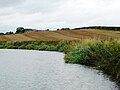
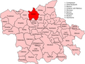
English: Dutton is a civil parish and village within the unitary authority of Cheshire West and Chester in the ceremonial county of Cheshire, England. It is located approximately east of Runcorn.
village britannique  | |||||
| Téléverser des médias | |||||
| Nature de l’élément | |||||
|---|---|---|---|---|---|
| Lieu | Cheshire West and Chester, Cheshire, Angleterre du Nord-Ouest, Angleterre | ||||
| Population |
| ||||
 | |||||
Sous-catégories
Cette catégorie comprend 4 sous-catégories, dont les 4 ci-dessous.
Média dans la catégorie « Dutton, Cheshire »
Cette catégorie comprend 122 fichiers, dont les 122 ci-dessous.
-
 200 yards warning sign, north bank, Pickering's Cut - geograph.org.uk - 5158157.jpg 1 024 × 768 ; 188 kio
-
 A tree - geograph.org.uk - 4802129.jpg 4 496 × 2 974 ; 7,92 Mio
-
 A49 at Marsh Lane- Heath Lane crossroads - geograph.org.uk - 2778359.jpg 640 × 480 ; 70 kio
-
 A49 at Smithy Lane - geograph.org.uk - 2778350.jpg 640 × 480 ; 59 kio
-
 A49 at the canal bridge - geograph.org.uk - 2778341.jpg 640 × 480 ; 76 kio
-
 A49-A533 junction - geograph.org.uk - 1826998.jpg 640 × 480 ; 52 kio
-
 A533 at Dutton Hollow - geograph.org.uk - 2894300.jpg 640 × 480 ; 72 kio
-
 A533 at Field Farm - geograph.org.uk - 2894307.jpg 640 × 480 ; 53 kio
-
 A533 west of Dones Green, Field Farm on left - geograph.org.uk - 153091.jpg 640 × 480 ; 63 kio
-
 Accessible angling area, under construction - geograph.org.uk - 5151910.jpg 1 024 × 768 ; 147 kio
-
 Badger Activity beside the Weaver - geograph.org.uk - 4071073.jpg 5 184 × 3 456 ; 3,17 Mio
-
 Bike, Davenports Tea Room - geograph.org.uk - 4355067.jpg 800 × 533 ; 259 kio
-
 Branches of The West Coast Main Line merge - geograph.org.uk - 4955085.jpg 640 × 426 ; 74 kio
-
 Bridge over River Weaver near Dutton Lock - geograph.org.uk - 6497327.jpg 1 799 × 1 199 ; 485 kio
-
 Bridge over the River Weaver - geograph.org.uk - 4067364.jpg 5 184 × 3 456 ; 3,79 Mio
-
 Bridleway and Footpath to Aston - geograph.org.uk - 4068703.jpg 3 184 × 2 123 ; 1,73 Mio
-
 Bridleway at Dutton Park - geograph.org.uk - 4068437.jpg 5 184 × 3 456 ; 6,27 Mio
-
 Bridleway junction - geograph.org.uk - 1544678.jpg 640 × 480 ; 87 kio
-
 Cafe off the A49 road near Dones Green - geograph.org.uk - 6273911.jpg 640 × 480 ; 58 kio
-
 Cannon's Underbridge at the Weaver Junction - geograph.org.uk - 4068578.jpg 5 184 × 3 456 ; 4,43 Mio
-
 Closed eatery - geograph.org.uk - 6273930.jpg 640 × 480 ; 52 kio
-
 Crossroads at Dones Green - geograph.org.uk - 5016069.jpg 640 × 427 ; 273 kio
-
 Davenports Tea Room - geograph.org.uk - 4355064.jpg 800 × 533 ; 215 kio
-
 Dones Green crossroads - geograph.org.uk - 2778351.jpg 640 × 480 ; 52 kio
-
 Dones Green Crossroads - geograph.org.uk - 5785826.jpg 640 × 427 ; 235 kio
-
 Dusk on the Weaver Navigation east of Dutton Lock - geograph.org.uk - 2183988.jpg 1 024 × 768 ; 200 kio
-
 Dutton - Horse Bridge.jpg 640 × 480 ; 118 kio
-
 Dutton Horse Bridge - geograph.org.uk - 4071545.jpg 5 184 × 3 456 ; 4,34 Mio
-
 Dutton Horse Bridge - geograph.org.uk - 4071659.jpg 5 184 × 3 456 ; 3,71 Mio
-
 Dutton Horse Bridge - geograph.org.uk - 4609225.jpg 2 592 × 1 952 ; 936 kio
-
 Dutton Railway Viaduct near Acton Bridge - geograph.org.uk - 6497326.jpg 1 799 × 1 199 ; 430 kio
-
 Entrance to Longacre Wood - geograph.org.uk - 3578975.jpg 2 592 × 1 944 ; 3,87 Mio
-
 Farm land by the River Weaver, Cheshire - geograph.org.uk - 2677813.jpg 800 × 535 ; 220 kio
-
 Farmland at Dutton Park - geograph.org.uk - 4068434.jpg 5 184 × 3 456 ; 4,29 Mio
-
 Farmland between River Weaver and Canal - geograph.org.uk - 1396860.jpg 640 × 480 ; 62 kio
-
 Farmland by the West Coast Main Line - geograph.org.uk - 4955093.jpg 640 × 359 ; 35 kio
-
 Farmland by the West Coast Main Line - geograph.org.uk - 4955094.jpg 640 × 426 ; 47 kio
-
 Farmland next to the Trent ^ Mersey Canal - geograph.org.uk - 4824547.jpg 800 × 600 ; 182 kio
-
 Footpath leading to Dutton Lodge Farm - geograph.org.uk - 3578964.jpg 1 600 × 1 200 ; 853 kio
-
 Footpath to Aston Grange - geograph.org.uk - 4068684.jpg 5 184 × 3 456 ; 4,72 Mio
-
 Footpath to Dutton Park - geograph.org.uk - 4068691.jpg 5 184 × 3 456 ; 4,48 Mio
-
 Footpath towards Dutton Lodge Farm - geograph.org.uk - 4266792.jpg 1 600 × 1 200 ; 589 kio
-
 Fuel Filling Station at Dones Green - geograph.org.uk - 3868341.jpg 3 926 × 2 177 ; 3,14 Mio
-
 Gate to farmland, Higher Lane, near Dutton - geograph.org.uk - 805629.jpg 600 × 450 ; 102 kio
-
 Heath Lane - geograph.org.uk - 6312458.jpg 1 600 × 940 ; 623 kio
-
 Herd of cows next to the Trent ^ Mersey Canal - geograph.org.uk - 4824677.jpg 800 × 611 ; 219 kio
-
 Higher Lane - geograph.org.uk - 4801602.jpg 4 534 × 2 971 ; 7,77 Mio
-
 Higher Lane - geograph.org.uk - 4802233.jpg 4 592 × 3 056 ; 5,94 Mio
-
 Higher Lane looking east - geograph.org.uk - 2523357.jpg 640 × 480 ; 67 kio
-
 Higher Lane near Thatched House Farm - geograph.org.uk - 2936582.jpg 640 × 480 ; 134 kio
-
 Higher Lane southwest of Pear Tree Farm - geograph.org.uk - 2936586.jpg 640 × 480 ; 113 kio
-
 Higher Lane, Dutton - geograph.org.uk - 2936571.jpg 640 × 480 ; 102 kio
-
 House next to the Trent & Mersey Canal - geograph.org.uk - 4824647.jpg 800 × 623 ; 187 kio
-
 Lightwood Farm - geograph.org.uk - 284258.jpg 640 × 480 ; 90 kio
-
 Lightwood Farm entrance - geograph.org.uk - 2523390.jpg 640 × 480 ; 74 kio
-
 Longacre Wood - geograph.org.uk - 4068545.jpg 4 100 × 2 733 ; 4,58 Mio
-
 Longacre Wood - geograph.org.uk - 4068557.jpg 4 184 × 2 789 ; 4,4 Mio
-
 Longacre Wood - geograph.org.uk - 4068572.jpg 4 184 × 2 789 ; 4,53 Mio
-
 Marsh Lane at Newholme Farm - geograph.org.uk - 2523407.jpg 640 × 480 ; 70 kio
-
 Marsh Lane at Woodbank Farm - geograph.org.uk - 2523400.jpg 640 × 480 ; 85 kio
-
 Marsh Lane by Lightwood Farm - geograph.org.uk - 4802300.jpg 640 × 426 ; 68 kio
-
 Marsh Lane, Dutton - geograph.org.uk - 2936576.jpg 640 × 480 ; 110 kio
-
 Narrowboats moored near Dutton Hall - geograph.org.uk - 5184375.jpg 1 024 × 768 ; 139 kio
-
 New Access Bridge - geograph.org.uk - 2429554.jpg 640 × 450 ; 74 kio
-
 Newholme Farm - geograph.org.uk - 226987.jpg 640 × 448 ; 141 kio
-
 Northbound layby on the A49 - geograph.org.uk - 2778361.jpg 640 × 480 ; 58 kio
-
 Northwich Road - geograph.org.uk - 2808337.jpg 640 × 463 ; 29 kio
-
 Northwich Road at Union Farm - geograph.org.uk - 5593491.jpg 640 × 480 ; 34 kio
-
 Northwich Road from Barkers Hollow Road - geograph.org.uk - 1826994.jpg 640 × 480 ; 42 kio
-
 Northwich Road with a barn of Dale Farm in view - geograph.org.uk - 4802370.jpg 4 269 × 2 853 ; 7,53 Mio
-
 Northwich Road with a footpath sign by Union Farm - geograph.org.uk - 4802341.jpg 4 252 × 2 713 ; 7,86 Mio
-
 On top of Preston Brook Tunnel - geograph.org.uk - 89291.jpg 640 × 426 ; 93 kio
-
 Open access land, north bank, River Weaver - geograph.org.uk - 5157890.jpg 1 024 × 768 ; 106 kio
-
 Park homes off the A49 at Bartington - geograph.org.uk - 5184354.jpg 1 024 × 614 ; 135 kio
-
 Path to the Trent ^ Mersey - geograph.org.uk - 4066509.jpg 5 184 × 3 456 ; 5,3 Mio
-
 Pickering's Cut on the Weaver Navigation - geograph.org.uk - 4071058.jpg 5 184 × 3 456 ; 3,65 Mio
-
 Pickering's Cut, Weaver Navigation - geograph.org.uk - 4955104.jpg 640 × 426 ; 57 kio
-
 Pickerings Bridge Cottage.jpg 1 800 × 1 350 ; 592 kio
-
 Pollution on the River Weaver, below Dutton Locks - geograph.org.uk - 5153708.jpg 1 024 × 768 ; 154 kio
-
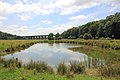 Pond and Viaduct, Dutton Park - geograph.org.uk - 4067439.jpg 4 184 × 2 789 ; 2,4 Mio
-
 Population change graph of Dutton 1881-2011.jpg 481 × 289 ; 31 kio
-
 Power Lines crossing the Weaver Navigation - geograph.org.uk - 5803651.jpg 640 × 480 ; 42 kio
-
 Preston Brook Tunnel air shaft at Dutton - geograph.org.uk - 4824717.jpg 800 × 567 ; 207 kio
-
 Pylon in a field - geograph.org.uk - 4955097.jpg 640 × 426 ; 41 kio
-
 Quiet backwater on the River Weaver - geograph.org.uk - 3579549.jpg 2 011 × 1 422 ; 929 kio
-
 Rear of a motel beside the road - geograph.org.uk - 6273915.jpg 640 × 480 ; 52 kio
-
 River Weaver - Dutton Mile Visitor Mooring - geograph.org.uk - 5822406.jpg 640 × 480 ; 122 kio
-

-
 River Weaver - wrecked ship - geograph.org.uk - 5822417.jpg 640 × 480 ; 113 kio
-
 Riverside Path - geograph.org.uk - 4065805.jpg 5 184 × 3 456 ; 4,31 Mio
-
 Rye Grass Pipes? - geograph.org.uk - 3579159.jpg 1 600 × 1 133 ; 618 kio
-
 Sign for footpath to Dutton Lodge Farm - geograph.org.uk - 5184637.jpg 1 024 × 768 ; 150 kio
-
 Sign outside Newholme Farm - geograph.org.uk - 227010.jpg 467 × 640 ; 180 kio
-
 Stile and footpath to Dutton Farm Park (geograph 4071085).jpg 5 184 × 3 456 ; 5,96 Mio
-
 Stubble field, south-east of Dutton Hall - geograph.org.uk - 5184368.jpg 1 024 × 768 ; 163 kio
-
 Thatched House Farm - geograph.org.uk - 284254.jpg 640 × 480 ; 109 kio
-
 The crossroads at Dones Green - geograph.org.uk - 4343403.jpg 1 500 × 999 ; 89 kio
-
 The Delamere Way at Dutton Park - geograph.org.uk - 4067435.jpg 5 184 × 3 456 ; 4,94 Mio
-
 The Delamere Way at Dutton Park - geograph.org.uk - 4068430.jpg 5 184 × 3 456 ; 4,06 Mio
-
 The Delamere Way at Dutton Park - geograph.org.uk - 4068431.jpg 5 184 × 3 456 ; 4,82 Mio
-
 The River Weaver - geograph.org.uk - 4065857.jpg 5 184 × 3 456 ; 4,99 Mio
-
 The River Weaver - geograph.org.uk - 4065871.jpg 5 184 × 3 456 ; 4,14 Mio
-
 The River Weaver - geograph.org.uk - 4067423.jpg 5 184 × 3 456 ; 4,31 Mio
-
 The sunken MV Chiva, River Weaver Navigation - geograph.org.uk - 5153721.jpg 1 024 × 768 ; 171 kio
-
 The track opposite Woodbank - geograph.org.uk - 4802267.jpg 4 385 × 2 918 ; 6,07 Mio
-
 The track to Brook Farm - geograph.org.uk - 4802110.jpg 4 592 × 3 056 ; 6,77 Mio
-
 The Tunnel Top public house - geograph.org.uk - 4824718.jpg 800 × 560 ; 106 kio
-
 The Tunnel Top public house at Dutton - geograph.org.uk - 4266780.jpg 1 600 × 1 200 ; 411 kio
-
 Tow Path - panoramio.jpg 1 024 × 768 ; 664 kio
-
 Towpath bridge, below Dutton Locks - geograph.org.uk - 5153705.jpg 1 024 × 614 ; 107 kio
-
 Transport Cafe, Dones Green - geograph.org.uk - 2180506.jpg 640 × 432 ; 65 kio
-
 Trees on a field boundary, south of Dale Farm - geograph.org.uk - 5184635.jpg 1 024 × 768 ; 221 kio
-
 View towards the Dutton Viaduct - geograph.org.uk - 4824628.jpg 800 × 519 ; 119 kio
-
 Vr dutton.png 591 × 443 ; 63 kio
-

-
 Weaver Junction geograph-2413897-by-Ben-Brooksbank.jpg 2 394 × 1 439 ; 504 kio
-
 Weaver Junction geograph-2599299-by-Ben-Brooksbank.jpg 2 394 × 1 292 ; 515 kio
-
 Westbrook House and Barn - geograph.org.uk - 284823.jpg 640 × 480 ; 81 kio
-
 Whitley filling station - geograph.org.uk - 5168926.jpg 1 600 × 1 200 ; 727 kio
-
 Wood Bank Farm - geograph.org.uk - 284264.jpg 640 × 384 ; 85 kio
-
 Yard behind Whitley Filling Station - geograph.org.uk - 5785829.jpg 640 × 427 ; 244 kio
-
 Petrol Station at Dones Green - geograph.org.uk - 153077.jpg 640 × 480 ; 68 kio


.jpg)


