Category:Easington, Lancashire
Jump to navigation
Jump to search

civil parish in Ribble Valley, Lancashire, UK  | |||||
| Upload media | |||||
| Instance of | |||||
|---|---|---|---|---|---|
| Location | Ribble Valley, Lancashire, North West England, England | ||||
 | |||||
Subcategories
This category has the following 4 subcategories, out of 4 total.
Media in category "Easington, Lancashire"
The following 200 files are in this category, out of 451 total.
(previous page) (next page)-
 A gap in the trees, Gisburn Forest - geograph.org.uk - 5851915.jpg 720 × 540; 114 KB
-
 A gatepost and a bench mark alongside the B6478 - geograph.org.uk - 5831268.jpg 1,200 × 1,600; 599 KB
-
 A moorland tragedy - geograph.org.uk - 4028228.jpg 800 × 600; 184 KB
-
 A name on the map - geograph.org.uk - 879210.jpg 640 × 406; 182 KB
-
 A Path in Gisburn Forest - geograph.org.uk - 3896350.jpg 4,320 × 3,240; 3.82 MB
-
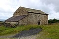 A Stone Barn in Gisburn Forest - geograph.org.uk - 5052130.jpg 1,600 × 1,067; 611 KB
-
 A Track in Gisburn Forest - geograph.org.uk - 5052303.jpg 1,600 × 1,067; 436 KB
-
 A track to nowhere on the remaining part of Stephen Moor - geograph.org.uk - 5872784.jpg 2,000 × 1,500; 1,018 KB
-
 A view from Bowland Knotts - geograph.org.uk - 5149610.jpg 1,280 × 960; 913 KB
-

-
 Access Lane leading away from Rain Gill Farm - geograph.org.uk - 3897556.jpg 4,320 × 3,240; 5.68 MB
-
 Access Lane leading towards Hammerton Mere - geograph.org.uk - 3897571.jpg 4,320 × 3,240; 3.27 MB
-
 Access road to Stocks Fishery - geograph.org.uk - 3231916.jpg 640 × 425; 267 KB
-
 Approaching Bowland Knotts - geograph.org.uk - 5127677.jpg 1,280 × 960; 930 KB
-
 Approaching bridge over Bottoms Beck - geograph.org.uk - 3115436.jpg 800 × 600; 206 KB
-
 Approaching Gisburn Forest - geograph.org.uk - 3897532.jpg 4,320 × 3,240; 3.18 MB
-
 Approaching the top - geograph.org.uk - 1077405.jpg 480 × 640; 65 KB
-
 Ash Clough - geograph.org.uk - 5052313.jpg 1,600 × 1,067; 646 KB
-
 Autumn colours on Dugdale Lane - geograph.org.uk - 5127674.jpg 1,280 × 960; 1.26 MB
-
 B6478 - geograph.org.uk - 2051408.jpg 2,560 × 1,920; 1.75 MB
-
 B6478 at Higher Stony Bank Farm - geograph.org.uk - 4247676.jpg 640 × 482; 37 KB
-
 B6478 at Meadow Top - geograph.org.uk - 5127708.jpg 1,280 × 906; 929 KB
-
 B6478 crossed by Dugdale Lane - geograph.org.uk - 4247669.jpg 640 × 481; 50 KB
-
 B6478 east of Well House in the mist - geograph.org.uk - 4247667.jpg 640 × 481; 52 KB
-
 B6478 heading north east - geograph.org.uk - 5140035.jpg 640 × 480; 65 KB
-
 B6478 heading north east - geograph.org.uk - 5140065.jpg 640 × 480; 58 KB
-
 Barn at Catlow - geograph.org.uk - 1462017.jpg 640 × 480; 88 KB
-
 Barn at Higher Laithe - geograph.org.uk - 4529753.jpg 1,024 × 767; 861 KB
-
 Barn conversion in progress, Brock Thorn, Easington - geograph.org.uk - 5869352.jpg 2,000 × 1,470; 753 KB
-
 Barn Gill - geograph.org.uk - 3539512.jpg 1,600 × 1,200; 835 KB
-
 Barn Gill near Hammerton Hall - geograph.org.uk - 4529773.jpg 1,024 × 768; 955 KB
-
 Barn Wall, Brock Thorn - geograph.org.uk - 3074200.jpg 4,000 × 3,000; 4.38 MB
-
 Barn, Bottom Laithe - geograph.org.uk - 5610183.jpg 640 × 427; 109 KB
-
 Barns at Old Ing - geograph.org.uk - 2067140.jpg 640 × 426; 277 KB
-
 Bench mark alongside the B6478 - geograph.org.uk - 5831262.jpg 1,200 × 1,600; 556 KB
-
 Bench mark on gatepost by the Hodder - geograph.org.uk - 4027088.jpg 640 × 480; 161 KB
-
 Bench mark on Walker Barn, Keasden Road - geograph.org.uk - 5833210.jpg 1,196 × 1,600; 662 KB
-
 Benchmark, Four Lane Ends - geograph.org.uk - 3227034.jpg 4,000 × 3,000; 6.61 MB
-
 Bend in the B6478 - geograph.org.uk - 5140063.jpg 640 × 480; 67 KB
-
 Bentham road below Cross of Greet - geograph.org.uk - 2916166.jpg 5,184 × 3,456; 2.65 MB
-
 Beware of the frog - geograph.org.uk - 3539490.jpg 1,600 × 1,200; 710 KB
-
 Big sky at Bowland Knotts - geograph.org.uk - 4635531.jpg 1,024 × 768; 510 KB
-
 Bike track, Gisburn - geograph.org.uk - 4225487.jpg 800 × 600; 567 KB
-
 Birch Clough Rigg - geograph.org.uk - 879219.jpg 640 × 426; 141 KB
-
 Birch Hall Farm - geograph.org.uk - 1002215.jpg 640 × 480; 96 KB
-
 Black House near Stocks Reservoir - geograph.org.uk - 4529764.jpg 1,024 × 768; 728 KB
-
 Blue remembered hill - geograph.org.uk - 5149603.jpg 1,280 × 960; 649 KB
-
 Bottoms Beck - geograph.org.uk - 2879524.jpg 768 × 1,024; 375 KB
-
 Boundary rock, Knotteranum, Slaidburn - geograph.org.uk - 6236667.jpg 2,000 × 1,500; 1,014 KB
-
 Boundary stone west of Resting Stone - geograph.org.uk - 2067197.jpg 640 × 426; 449 KB
-
 Boundary Stone with OS Cut Mark - geograph.org.uk - 6329456.jpg 1,024 × 415; 143 KB
-
 Boundary stone, Black Hill - geograph.org.uk - 5851784.jpg 960 × 720; 233 KB
-
 Boundary stone, Lawkland Fell - geograph.org.uk - 5851828.jpg 960 × 720; 210 KB
-
 Boundary Wall winding towards Ravens Castle - geograph.org.uk - 4861495.jpg 1,600 × 1,067; 507 KB
-
 Bowland Knotts - geograph.org.uk - 2500802.jpg 1,024 × 678; 230 KB
-
 Bowland Knotts - geograph.org.uk - 3061807.jpg 640 × 425; 168 KB
-
 Bowland Knotts - geograph.org.uk - 3131123.jpg 640 × 425; 130 KB
-
 Bowland Knotts - geograph.org.uk - 3544844.jpg 2,560 × 1,920; 3.21 MB
-
 Bowland Knotts - geograph.org.uk - 4051375.jpg 4,000 × 3,000; 4.64 MB
-
 Bowland Knotts - geograph.org.uk - 4218924.jpg 800 × 600; 459 KB
-
 Bowland Knotts - geograph.org.uk - 4225491.jpg 800 × 600; 466 KB
-
 Bowland Knotts - geograph.org.uk - 4225492.jpg 800 × 450; 371 KB
-
 Bowland Knotts - geograph.org.uk - 4861241.jpg 1,600 × 1,067; 333 KB
-
 Bowland Knotts - geograph.org.uk - 4910751.jpg 5,472 × 3,531; 1.99 MB
-
 Bowland Knotts - geograph.org.uk - 879172.jpg 640 × 426; 158 KB
-

-
 Bowland Memorial Forest - geograph.org.uk - 3860598.jpg 640 × 480; 63 KB
-
 Bridge over Bottoms Beck - geograph.org.uk - 6233631.jpg 1,024 × 768; 294 KB
-
 Bridge over Hasgill Beck - geograph.org.uk - 1299276.jpg 640 × 480; 165 KB
-
 Bridge over Hasgill Beck - geograph.org.uk - 3231923.jpg 640 × 425; 367 KB
-
 Bridleway leaving the moorland, Stephen Moor - geograph.org.uk - 5872779.jpg 2,000 × 1,500; 1.01 MB
-
 Bridleway over the remains of Stephen Moor - geograph.org.uk - 5872785.jpg 2,000 × 1,500; 1.04 MB
-
 Brock Thorn Farm Buildings - geograph.org.uk - 3895596.jpg 4,316 × 3,118; 3.72 MB
-
 Brook House Green - geograph.org.uk - 3897563.jpg 4,320 × 3,240; 3.22 MB
-
 Car on fell road - Bowland Fells - geograph.org.uk - 2844502.jpg 4,000 × 3,000; 1.99 MB
-
 Car Park - Cross of Greet Bridge - Bowland Fells - geograph.org.uk - 2844498.jpg 4,000 × 3,000; 1.89 MB
-
 Car park and information board off School Lane - geograph.org.uk - 2945133.jpg 1,600 × 1,198; 795 KB
-
 Carved letters, Rock Cat Knott - geograph.org.uk - 5851844.jpg 720 × 540; 210 KB
-
 Catlow - geograph.org.uk - 5869960.jpg 960 × 720; 166 KB
-
 Catlow Farm - geograph.org.uk - 1002258.jpg 640 × 480; 62 KB
-
 Catlow Farm - geograph.org.uk - 4859653.jpg 1,600 × 1,067; 341 KB
-
 Catlow Fell - Catlow Hill - Bowland Fells - geograph.org.uk - 2835032.jpg 4,000 × 3,000; 1.83 MB
-
 Catlow Fell - geograph.org.uk - 2367919.jpg 640 × 480; 42 KB
-
 Catlow Fell and conifer plantation - geograph.org.uk - 4027095.jpg 640 × 480; 74 KB
-
 Catlow Hill and headwaters of River Hodder - geograph.org.uk - 6065628.jpg 1,024 × 768; 243 KB
-

-
 Cattle at Higher Laithe - geograph.org.uk - 4529751.jpg 1,024 × 767; 687 KB
-
 Cattle Grid at Cross of Greet - geograph.org.uk - 879158.jpg 640 × 426; 148 KB
-
 Cattle grid near Coat Rakes Bridge - geograph.org.uk - 2067138.jpg 640 × 426; 309 KB
-
 Cattle Grid on Lythe Fell Road - geograph.org.uk - 4861567.jpg 1,600 × 1,067; 533 KB
-
 Cattle Grid on White Greet - Bowland Fells - geograph.org.uk - 2835117.jpg 4,000 × 3,000; 1.93 MB
-
 Cattle Grid, Crutchenber Fell Gate - geograph.org.uk - 1227943.jpg 640 × 480; 78 KB
-
 Coat Rakes Bridge - geograph.org.uk - 4861513.jpg 1,600 × 1,067; 637 KB
-
 Coat Rakes Bridge and a rivet bench mark - geograph.org.uk - 5833054.jpg 1,200 × 1,600; 758 KB
-
 Cocklet Hill - geograph.org.uk - 4218916.jpg 800 × 600; 485 KB
-
 Cocklet Hill car park - geograph.org.uk - 4218861.jpg 800 × 600; 533 KB
-
 Cocklet Hill, Gisburn Forest - geograph.org.uk - 3897577.jpg 4,320 × 3,240; 5.64 MB
-
 Cold Stone - geograph.org.uk - 1462025.jpg 640 × 480; 70 KB
-
 Cold Stone - geograph.org.uk - 4028654.jpg 800 × 600; 97 KB
-
 Cold Stone - geograph.org.uk - 4861270.jpg 640 × 427; 92 KB
-
 Cold Stone - geograph.org.uk - 5961318.jpg 1,024 × 768; 136 KB
-
 Cold Stone and Bowland Knotts - geograph.org.uk - 4027919.jpg 800 × 600; 77 KB
-
 Cold Stone gritstone crags - geograph.org.uk - 2034482.jpg 640 × 426; 319 KB
-
 Concessionary Path beside Stocks Reservoir - geograph.org.uk - 3897527.jpg 4,320 × 3,240; 5.61 MB
-

-

-
 Copy Nook - geograph.org.uk - 4861274.jpg 1,600 × 1,067; 389 KB
-
 Course of old railway - geograph.org.uk - 5610187.jpg 640 × 427; 143 KB
-
 Craggy outcrop - geograph.org.uk - 5149598.jpg 1,280 × 960; 925 KB
-
 Cross of Greet Bridge - geograph.org.uk - 3112444.jpg 1,879 × 1,408; 1.11 MB
-
 Crossing Old Moss - geograph.org.uk - 4861250.jpg 1,600 × 1,067; 608 KB
-

-
 Crutchenber Fell - geograph.org.uk - 4229798.jpg 800 × 450; 320 KB
-
 Crutchenber Fell - geograph.org.uk - 879221.jpg 640 × 426; 158 KB
-
 Crutchenber Fell Gate - geograph.org.uk - 3665166.jpg 640 × 425; 221 KB
-
 Crutchenber Fell trig point - geograph.org.uk - 3538742.jpg 1,600 × 1,200; 708 KB
-
 Crutchenberg Fell Trig Pillar - geograph.org.uk - 5961314.jpg 1,024 × 768; 235 KB
-

-
 Cycle Path, Cocklet Hill - geograph.org.uk - 2051416.jpg 2,560 × 1,920; 1.67 MB
-
 Cycle path, Cocklet Hill - geograph.org.uk - 4224551.jpg 800 × 600; 545 KB
-
 Cyclists in the Forest - geograph.org.uk - 987773.jpg 640 × 480; 93 KB
-
 Dale House - geograph.org.uk - 4912430.jpg 5,472 × 3,648; 2.04 MB
-
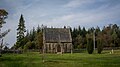
 Dalehead Church - geograph.org.uk - 4910739.jpg 5,472 × 3,115; 1.97 MB
-
 Dalehead Church - geograph.org.uk - 5555796.jpg 2,160 × 1,215; 1.72 MB
-
 Dalehead Church and Heritage Centre - geograph.org.uk - 4676188.jpg 4,066 × 2,937; 7.82 MB
-
 Dalehead Churchyard - geograph.org.uk - 879202.jpg 640 × 426; 164 KB
-
 Dalehead, Hole House Lane - geograph.org.uk - 5604918.jpg 640 × 427; 357 KB
-
 Decrepit barn, White Hill House - geograph.org.uk - 5851883.jpg 720 × 540; 135 KB
-
 Derelict "New House" - geograph.org.uk - 2945171.jpg 1,600 × 1,198; 738 KB
-
 Derelict barn and pristine cottage at Brock Thorn - geograph.org.uk - 4606025.jpg 4,383 × 2,693; 6.87 MB
-
 Descending towards Standridge - geograph.org.uk - 3942408.jpg 4,320 × 3,240; 5.84 MB
-
 Dob Dale - geograph.org.uk - 5851754.jpg 960 × 720; 165 KB
-
 Downhill on the B6478 - geograph.org.uk - 5140072.jpg 640 × 480; 106 KB
-
 Drystone wall east of Bowland Knotts - geograph.org.uk - 3563195.jpg 3,264 × 2,448; 3.02 MB
-
 Dugdale Lane in Gisburn Forest - geograph.org.uk - 5127676.jpg 2,668 × 1,998; 4.47 MB
-
 Eastern shore of Stocks Reservoir - geograph.org.uk - 5133907.jpg 640 × 428; 95 KB
-
 Edge of the forest, Crutchenber Fell - geograph.org.uk - 5851869.jpg 720 × 540; 122 KB
-
 Elliot's Laithe - geograph.org.uk - 4912426.jpg 4,811 × 2,560; 1.59 MB
-
 Empty car park on a winter afternoon - geograph.org.uk - 4268535.jpg 3,264 × 2,448; 2.51 MB
-
 Entrance to Stocks tea room - geograph.org.uk - 2945266.jpg 1,600 × 1,198; 507 KB
-

-
 Excavated foundations of St. James' Dalehead - geograph.org.uk - 4051317.jpg 4,000 × 3,000; 6.28 MB
-
-
 Far Costy Clough - geograph.org.uk - 2367922.jpg 640 × 480; 102 KB
-
 Far Costy Clough - geograph.org.uk - 4028241.jpg 640 × 480; 98 KB
-
 Far Costy Clough - geograph.org.uk - 5120443.jpg 5,184 × 2,769; 1.8 MB
-
 Farm building Stephen Moor - geograph.org.uk - 3933322.jpg 3,648 × 2,736; 4.79 MB
-
 Farm gate and cattle grid Halsteads farm - geograph.org.uk - 3933263.jpg 3,648 × 2,736; 4.53 MB
-
 Farm road at Halsteads - geograph.org.uk - 2067143.jpg 640 × 426; 300 KB
-
 Farm Track above Kearsden Holes - geograph.org.uk - 4861694.jpg 1,600 × 1,067; 555 KB
-
 Farm track from New House - geograph.org.uk - 1299282.jpg 640 × 480; 50 KB
-
 Farm track passes New House towards Low Laithe - geograph.org.uk - 2945165.jpg 1,600 × 1,198; 348 KB
-
 Felled Forest - Bowland - geograph.org.uk - 1948047.jpg 640 × 430; 91 KB
-
 Fellside wall on White Greet - geograph.org.uk - 2034465.jpg 640 × 426; 381 KB
-
 Fencing leading to Hailshowers Fell - geograph.org.uk - 5961331.jpg 1,024 × 768; 201 KB
-
 Field Barn at Shays Farm - geograph.org.uk - 987812.jpg 640 × 480; 63 KB
-
 Field of Reeds - geograph.org.uk - 3899207.jpg 4,320 × 3,240; 5.37 MB
-
 Flush bracket S5621 - geograph.org.uk - 3131115.jpg 640 × 425; 212 KB
-
 Following the boundary wall - geograph.org.uk - 4028155.jpg 640 × 480; 74 KB
-
 Footbridge over the River Hodder - geograph.org.uk - 2945185.jpg 1,600 × 1,198; 438 KB
-
 Footbridge over the River Hodder from New House - geograph.org.uk - 2945181.jpg 1,600 × 1,198; 362 KB
-
 Footpath above the upper Hodder - geograph.org.uk - 4027073.jpg 640 × 480; 80 KB
-
 Footpath leading North to Bowland Knotts - geograph.org.uk - 4859665.jpg 1,600 × 1,067; 540 KB
-
 Footpath near Catlow - geograph.org.uk - 4027105.jpg 640 × 480; 65 KB
-
 Footpath near Stocks Reservoir - geograph.org.uk - 3860098.jpg 640 × 480; 92 KB
-
 Footpath to Stocks Reservoir Bird Hide - geograph.org.uk - 5133926.jpg 640 × 428; 156 KB
-
 Footpath towards Rain Gill - geograph.org.uk - 3539504.jpg 1,600 × 1,200; 623 KB
-
 Footpath towards Ten Acre Hill - geograph.org.uk - 3539500.jpg 1,600 × 1,200; 753 KB
-
 Forest Commission Track - Bowland - geograph.org.uk - 1951470.jpg 640 × 430; 104 KB
-
 Forest road in Gisburn Forest - geograph.org.uk - 2067187.jpg 640 × 426; 282 KB
-

-
 Forest Road to Stephen Park - geograph.org.uk - 3665182.jpg 640 × 425; 331 KB
-
 Forestry clearance, Gisburn Forest - geograph.org.uk - 1394008.jpg 640 × 480; 85 KB
-
 Forestry road, Cocklet Hill - geograph.org.uk - 5851911.jpg 720 × 540; 116 KB
-
 From the small car park in Gisburn Forest - geograph.org.uk - 6233625.jpg 1,024 × 768; 266 KB
-
 Frosty Wall - geograph.org.uk - 1114353.jpg 640 × 480; 97 KB
-
 Gate and Cattle Grid on Keasden Road - geograph.org.uk - 5604912.jpg 640 × 481; 436 KB
-
 Gauge House by Bottoms Beck - geograph.org.uk - 1253997.jpg 640 × 480; 152 KB
-
 Giant boulder, Great Hill - geograph.org.uk - 5851821.jpg 960 × 720; 206 KB
-
 Gisburn Forest - geograph.org.uk - 2051425.jpg 1,920 × 2,560; 1.59 MB
-
 Gisburn Forest - geograph.org.uk - 4218866.jpg 800 × 600; 532 KB
-
 Gisburn Forest - geograph.org.uk - 4224582.jpg 800 × 600; 500 KB
-
 Gisburn Forest - geograph.org.uk - 4225845.jpg 800 × 600; 469 KB
-
 Gisburn Forest - geograph.org.uk - 6129518.jpg 4,752 × 3,168; 4.14 MB
-
 Gisburn Forest Hub - geograph.org.uk - 4914391.jpg 640 × 428; 72 KB
-
 Grassy Path near Ten Acre Hill - geograph.org.uk - 4529762.jpg 1,024 × 768; 667 KB
-
 Grazing off the B6478 - geograph.org.uk - 5140042.jpg 640 × 480; 66 KB
-
 Grazing, Lower Stony Bank - geograph.org.uk - 5140038.jpg 640 × 480; 58 KB
-
 Green Knots - geograph.org.uk - 3061784.jpg 640 × 425; 198 KB
-
 Green Pike - geograph.org.uk - 4912428.jpg 5,472 × 3,648; 1.91 MB
-
 Gritstone rocks, Knotteranum - geograph.org.uk - 3131076.jpg 425 × 640; 174 KB
-
 Hailshowers Fell - geograph.org.uk - 3544867.jpg 2,560 × 1,920; 2.79 MB
-
 Halsteads Farm - geograph.org.uk - 5052143.jpg 1,600 × 1,067; 331 KB
-
 Halsteads farm track towards Fair Hill - geograph.org.uk - 3933241.jpg 3,648 × 2,736; 4 MB
-
 Hasgill - geograph.org.uk - 1002225.jpg 640 × 480; 81 KB
-
 Hasgill Beck - geograph.org.uk - 1002229.jpg 640 × 480; 108 KB
-
 Hasgill Beck bridge - geograph.org.uk - 2945150.jpg 1,600 × 1,198; 735 KB
-
 Heading down into Copy Nook - geograph.org.uk - 4027903.jpg 640 × 480; 77 KB
-
 Heading for the road - geograph.org.uk - 4028214.jpg 800 × 600; 109 KB
-
 Heading towards the Bowland Knotts - geograph.org.uk - 4027113.jpg 640 × 480; 67 KB


