Category:East Afghan Montane Conifer Forests Ecoregion
Jump to navigation
Jump to search
Ecoregion (WWF) _-_panoramio_(4).jpg)  | |||||
| Upload media | |||||
| Instance of | |||||
|---|---|---|---|---|---|
| Location |
| ||||
| Area |
| ||||
 | |||||
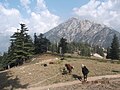
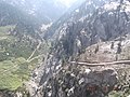
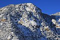
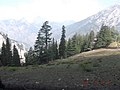
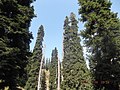
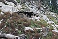
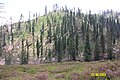
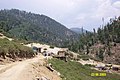
The East Afghan Montane Conifer Forests Ecoregion is a designated ecoregion by WWF and One Earth. It is classified as a Temperate Conifer Forests Biome. It is one of eight ecoregions in the Afghan-Balochistan Drylands, Mountain Meadows & Conifer Forests Bioregion.
Media in category "East Afghan Montane Conifer Forests Ecoregion"
The following 40 files are in this category, out of 40 total.
-
 Azz (2).jpg 2,592 × 1,944; 1.34 MB
-
 Cattle ranch - panoramio.jpg 3,264 × 2,448; 1.74 MB
-
 Cattles ranch - panoramio.jpg 3,264 × 2,448; 1.2 MB
-
 Crossing the Mountain in winter - panoramio.jpg 2,592 × 1,728; 1.12 MB
-
 Cypress and pinee trees - panoramio.jpg 3,264 × 2,448; 2.14 MB
-
 Dirt road from Chitraas to Hameshdesh - panoramio.jpg 3,264 × 2,448; 2.01 MB
-
 Footpath - panoramio (10).jpg 5,184 × 3,456; 8.79 MB
-
 Forest - panoramio (66).jpg 3,264 × 2,448; 1.81 MB
-
 Jaw Da Chitraas,Wama,Nuristan,Afghanistan - panoramio.jpg 5,184 × 3,456; 10.56 MB
-
 K-G Pass in 2009.jpg 2,776 × 1,716; 596 KB
-
 Kashtun da waygale Nuristan - panoramio.jpg 5,184 × 3,456; 9.91 MB
-
 Kershrah da - panoramio.jpg 5,184 × 3,456; 7.69 MB
-
 Khost-Gardez Pass.jpg 600 × 399; 46 KB
-
 Landscape in Paktia Province.jpg 4,288 × 2,848; 594 KB
-
 Mountain - panoramio (10).jpg 5,184 × 3,456; 10.06 MB
-
 Mountain top Hamesdesh - panoramio.jpg 3,264 × 2,448; 1.74 MB
-
 Payngale ( Parun ) - panoramio (2).jpg 3,264 × 2,448; 1.9 MB
-
 Payngale ( Parun ) - panoramio (3).jpg 3,264 × 2,448; 1.89 MB
-
 Payngale ( Parun ) - panoramio (4).jpg 3,264 × 2,448; 2.1 MB
-
 Payngale ( Parun ) - panoramio.jpg 3,264 × 2,448; 1.93 MB
-
 Pine And Cyprees Trees - panoramio.jpg 3,264 × 2,448; 1,019 KB
-
 Pine and Cypress Trees - panoramio.jpg 3,264 × 2,448; 2.23 MB
-
 Pine and cypress trees with goats - panoramio.jpg 3,264 × 2,448; 1.22 MB
-
 Pine cypress trees - panoramio (1).jpg 3,264 × 2,448; 1.99 MB
-
 Pine cypress trees - panoramio (2).jpg 3,264 × 2,448; 1.54 MB
-
 Pine cypress trees - panoramio.jpg 3,264 × 2,448; 1.32 MB
-
 Pine Tree with Cones in Paktika.jpg 720 × 540; 64 KB
-
 Pine trees - panoramio (3).jpg 3,264 × 2,448; 1.21 MB
-
 Pine trees - panoramio (4).jpg 3,264 × 2,448; 2.07 MB
-
 Pine trees chitraas - panoramio.jpg 3,264 × 2,448; 2.29 MB
-
 Ranch House Chitaas,Wama, Nuristan,Afghanistan - panoramio.jpg 5,184 × 3,456; 10.45 MB
-
 Stream in Nuristan province.jpg 4,288 × 2,848; 1.09 MB
-
 Unnamed Road, Afghanistan - panoramio (3).jpg 7,728 × 4,354; 11.31 MB
-
 Waygale valley - panoramio.jpg 5,184 × 3,456; 10.94 MB
-
 Zuliyal babari kass (545032497).jpg 2,448 × 1,632; 2.24 MB
-
 Zuliyal, Korengal Valley, Kunar Province, Afghanistan -3.jpg 1,024 × 683; 490 KB
-
 Zuliyal, Kunar, Afghanistan 2.jpg 1,024 × 683; 500 KB
-
 Zuliyal, Kunar, Afghanistan 3.jpg 1,024 × 683; 425 KB
-
 د سپینۀ د کلي یو برخه.jpg 4,160 × 1,872; 2.07 MB
-
 سپینۀ کلی.jpg 4,160 × 2,340; 3.07 MB
.jpg)


.jpg)
.jpg)


.jpg)

_-_panoramio_(2).jpg)
_-_panoramio_(3).jpg)
_-_panoramio.jpg)


.jpg)
.jpg)


.jpg)
.jpg)


.jpg)

.jpg)


