Category:East Lound
Jump to navigation
Jump to search
East Lound is a hamlet in the civil parish of Haxey in North Lincolnshire, England.
village in Lincolnshire  | |||||
| Upload media | |||||
| Instance of | |||||
|---|---|---|---|---|---|
| Location | Haxey, North Lincolnshire, Lincolnshire, Yorkshire and the Humber, England | ||||
 | |||||
Media in category "East Lound"
The following 16 files are in this category, out of 16 total.
-
 Airstrip at East Lound - geograph.org.uk - 1990716.jpg 1,024 × 768; 180 KB
-
 Brackenhill Road, East Lound - geograph.org.uk - 2313204.jpg 1,280 × 954; 517 KB
-
 Carr Lane approaching East Lound - geograph.org.uk - 4681296.jpg 3,072 × 1,728; 1.67 MB
-
 Carr Lane at East Lound - geograph.org.uk - 1250291.jpg 640 × 480; 93 KB
-
 Carr Lane, East Lound - geograph.org.uk - 170931.jpg 640 × 480; 122 KB
-
 Carr Lane, East Lound - geograph.org.uk - 1990995.jpg 1,024 × 768; 239 KB
-
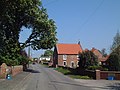 East Lound - geograph.org.uk - 170927.jpg 640 × 480; 97 KB
-
 Entering East Lound - geograph.org.uk - 4372546.jpg 640 × 480; 53 KB
-
 Fields to east of East Lound - geograph.org.uk - 4681291.jpg 3,072 × 1,728; 2.21 MB
-
 Footpath to East Lound. - geograph.org.uk - 4952193.jpg 640 × 317; 46 KB
-
 Grazing, East Lound - geograph.org.uk - 4372542.jpg 640 × 480; 72 KB
-
 Haxey Electricity Sub-Station - geograph.org.uk - 1250292.jpg 640 × 480; 61 KB
-
 House in East Lound - geograph.org.uk - 4372545.jpg 640 × 480; 53 KB
-
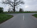 Road Junction on Station Road - geograph.org.uk - 1250295.jpg 640 × 480; 65 KB
-
 The village of East Lound. - geograph.org.uk - 4019714.jpg 640 × 480; 118 KB
-
 View towards East Lound - geograph.org.uk - 2701301.jpg 1,024 × 768; 219 KB


