Category:East Tilbury
Jump to navigation
Jump to search
English: East Tilbury is a village in the unitary authority of Thurrock borough, England and one of the traditional (Church of England) parishes in Thurrock.
village in the Essex, England  | |||||
| Upload media | |||||
| Instance of | |||||
|---|---|---|---|---|---|
| Location |
| ||||
| Located in or next to body of water | |||||
 | |||||
Subcategories
This category has the following 2 subcategories, out of 2 total.
C
E
- East Tilbury railway station (14 F)
Media in category "East Tilbury"
The following 95 files are in this category, out of 95 total.
-
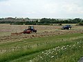
 21st Century Harvest Home - geograph.org.uk - 37902.jpg 482 × 640; 73 KB
-
 A 'giant' pillbox, Tilbury - geograph.org.uk - 548690.jpg 640 × 480; 124 KB
-
 Baling the hay - geograph.org.uk - 2499614.jpg 640 × 480; 93 KB
-
 Baling the hay - geograph.org.uk - 6085408.jpg 1,024 × 768; 289 KB
-
 Borrow dyke, East Tilbury - geograph.org.uk - 6082503.jpg 1,024 × 768; 352 KB
-
 Chicane on sea wall path - geograph.org.uk - 6083137.jpg 1,024 × 768; 278 KB
-
 Chicane on sea wall path - geograph.org.uk - 6085398.jpg 1,024 × 768; 277 KB
-
 City of London ^ Shornemead Fort - geograph.org.uk - 2408599.jpg 640 × 428; 62 KB
-
 Coalhouse Fort - geograph.org.uk - 2091559.jpg 800 × 531; 46 KB
-
 Coalhouse Fort - geograph.org.uk - 2580160.jpg 3,008 × 2,000; 2.63 MB
-
 Coalhouse Fort - geograph.org.uk - 2823526.jpg 640 × 426; 81 KB
-
 Coalhouse Fort - geograph.org.uk - 6082867.jpg 1,024 × 684; 179 KB
-
 Coalhouse Fort area map.png 730 × 869; 346 KB
-
 Coalhouse Fort, East Tilbury - geograph.org.uk - 2729256.jpg 640 × 427; 120 KB
-
 Coalhouse Fort, East Tilbury - geograph.org.uk - 2729260.jpg 640 × 427; 103 KB
-
 Coalhouse Fort, East Tilbury - geograph.org.uk - 2729263.jpg 640 × 427; 127 KB
-
 Coalhouse Fort, East Tilbury - geograph.org.uk - 2729265.jpg 640 × 452; 96 KB
-
 Coalhouse Fort, Essex - geograph.org.uk - 4194642.jpg 1,238 × 825; 655 KB
-
 Coalhouse Fort, WWII Minefield Control Tower - geograph.org.uk - 3183037.jpg 4,288 × 3,216; 5.93 MB
-
 Coalhouse Point - geograph.org.uk - 2091576.jpg 800 × 531; 45 KB
-
 Coalhouse Point - geograph.org.uk - 2823530.jpg 640 × 426; 55 KB
-
 Coalhouse Point and River Thames - geograph.org.uk - 3182999.jpg 4,288 × 3,216; 5.55 MB
-
 Coalhouse Point, East Tilbury - geograph.org.uk - 6082517.jpg 1,024 × 768; 298 KB
-
 Coalhouse QF Battery Information Board - geograph.org.uk - 3183050.jpg 4,288 × 3,216; 5.2 MB
-
 Colourful field, East Tilbury - geograph.org.uk - 6082497.jpg 1,024 × 768; 340 KB
-
 Cutting Walkers Legs, East Tilbury - geograph.org.uk - 3183123.jpg 4,288 × 3,216; 5.13 MB
-

-
 Drainage dyke near Coalhouse Fort - geograph.org.uk - 3182972.jpg 4,288 × 3,216; 6.52 MB
-
 Earth and concrete sea wall, East Tilbury - geograph.org.uk - 3183085.jpg 4,288 × 3,216; 5.1 MB
-
 East Tilbury - geograph.org.uk - 913547.jpg 480 × 640; 91 KB
-
 East Tilbury Defences, Information Board - geograph.org.uk - 3183031.jpg 4,288 × 3,216; 4.83 MB
-
 East Tilbury Marshes - geograph.org.uk - 2580151.jpg 3,008 × 2,000; 2.74 MB
-

-
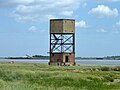
 East Tilbury Radar Tower - geograph.org.uk - 3543104.jpg 1,280 × 960; 715 KB
-
 East Tilbury, Coalhouse Point - geograph.org.uk - 218465.jpg 640 × 480; 108 KB
-
East Tilbury.ogg 1.3 s; 14 KB
-
 Enjoying the surrounds of Coalhouse Fort - geograph.org.uk - 2499616.jpg 640 × 480; 111 KB
-
 Fence Post Driver, East Tilbury - geograph.org.uk - 3183113.jpg 4,288 × 3,216; 5.61 MB
-
 Footpath - geograph.org.uk - 37905.jpg 482 × 640; 135 KB
-
 Footpath from Coalhouse Fort - geograph.org.uk - 2823521.jpg 640 × 426; 67 KB
-
 Footpath to Sea Wall, nesar East Tilbury - geograph.org.uk - 3183077.jpg 4,288 × 3,216; 5.36 MB
-
 Hole in the fence - geograph.org.uk - 6082481.jpg 1,024 × 768; 321 KB
-
 Industry and Defence - geograph.org.uk - 2091551.jpg 800 × 531; 59 KB
-
 Minefield control tower, Coalhouse Point - geograph.org.uk - 6082619.jpg 1,024 × 768; 237 KB
-
 Mucking Flats Buoy 7 - geograph.org.uk - 2091535.jpg 800 × 531; 65 KB
-
 Old wharf, Coalhouse Point - geograph.org.uk - 6082603.jpg 1,024 × 768; 252 KB
-
 Path and Moat, Coalhouse Fort - geograph.org.uk - 3183014.jpg 4,288 × 3,216; 6.31 MB
-
 Path beside Coalhouse Fort moat - geograph.org.uk - 3183055.jpg 4,288 × 3,216; 7.31 MB
-
 Path to Coalhouse Fort - geograph.org.uk - 3182937.jpg 4,288 × 3,216; 7.16 MB
-
 Path to Coalhouse Fort - geograph.org.uk - 3183046.jpg 4,288 × 3,216; 6.27 MB
-
 Path to East Tilbury - geograph.org.uk - 2824302.jpg 640 × 426; 116 KB
-
 Path towards Tilbury Power Station - geograph.org.uk - 3182965.jpg 4,103 × 2,953; 5.41 MB
-
 Pointless barrier on path, East Tilbury - geograph.org.uk - 6082487.jpg 1,024 × 768; 294 KB
-
 Princess Margaret Road, East Tilbury - geograph.org.uk - 2824307.jpg 640 × 426; 85 KB
-
 Prohibited Anchorage - geograph.org.uk - 2408563.jpg 640 × 428; 51 KB
-
 Radar Tower - geograph.org.uk - 2580171.jpg 3,008 × 2,000; 2.06 MB
-
 Railway Line to East Tilbury - geograph.org.uk - 3188079.jpg 4,288 × 3,216; 6.98 MB
-
 Railway to East Tilbury - geograph.org.uk - 3188172.jpg 4,213 × 3,114; 7.76 MB
-
 River Thames and jetty - geograph.org.uk - 218699.jpg 640 × 480; 108 KB
-
 River Thames from Coalhouse Fort - geograph.org.uk - 2729270.jpg 640 × 427; 73 KB
-
 River Thames, Mucking No 7 Buoy - geograph.org.uk - 6255711.jpg 800 × 600; 586 KB
-

-
 Sea wall duck ramp - geograph.org.uk - 6085670.jpg 1,024 × 768; 280 KB
-
 Sea wall pampas grass - geograph.org.uk - 6085663.jpg 1,024 × 768; 318 KB
-
 Sea Wall Path to Mucking Marshes (2) - geograph.org.uk - 3183142.jpg 4,288 × 3,216; 6.52 MB
-
 Sea Wall Path to Mucking Marshes - geograph.org.uk - 3183133.jpg 4,288 × 3,216; 6.4 MB
-

-
 St Catherine, East Tilbury - East end - geograph.org.uk - 4046589.jpg 900 × 620; 163 KB
-
 St Catherine, East Tilbury - Font - geograph.org.uk - 4046576.jpg 900 × 728; 209 KB
-
 St Catherine, East Tilbury - geograph.org.uk - 2729276.jpg 640 × 427; 108 KB
-
 St Catherine, East Tilbury - geograph.org.uk - 2729280.jpg 567 × 480; 83 KB
-
 St Catherine, East Tilbury - geograph.org.uk - 4046575.jpg 900 × 493; 156 KB
-
 St Catherine, East Tilbury - Royal Arms - geograph.org.uk - 4046585.jpg 900 × 756; 252 KB
-
 St Catherine, East Tilbury - Royal Arms - geograph.org.uk - 4046588.jpg 900 × 723; 244 KB
-

-

-

-
 Thames foreshore near Coalhouse Point - geograph.org.uk - 2499800.jpg 640 × 480; 120 KB
-
 Thames Shore near Coalhouse Point - geograph.org.uk - 6255675.jpg 800 × 533; 505 KB
-
 The Old Rectory, East Tilbury - geograph.org.uk - 3183069.jpg 4,175 × 3,029; 5.63 MB
-
 The Ship Public House, East Tilbury - geograph.org.uk - 3183074.jpg 4,288 × 3,216; 5.12 MB
-
 The Thames near Coalhouse Fort - geograph.org.uk - 3542321.jpg 1,280 × 960; 486 KB
-
 Thomas Bata.jpg 683 × 1,024; 128 KB
-
 Tilbury Beacon - geograph.org.uk - 2408611.jpg 428 × 640; 61 KB
-
 Tilbury Marshes, Essex - geograph.org.uk - 4195270.jpg 1,238 × 929; 673 KB
-
 Tilbury Radar Tower, Coalhouse Point - geograph.org.uk - 5494249.jpg 1,600 × 1,067; 374 KB
-
 Tower at Coalhouse Point - geograph.org.uk - 6255672.jpg 800 × 533; 500 KB
-
 Tower on Coalhouse Point - geograph.org.uk - 2091488.jpg 1,254 × 733; 299 KB
-
 Track near Bowaters Farm (geograph 3188133).jpg 4,288 × 3,216; 5.69 MB
-
 View towards aggregates works, Cliffe - geograph.org.uk - 6082730.jpg 1,024 × 768; 253 KB
-
 Wet Ditch at Coalhouse Fort - geograph.org.uk - 3542309.jpg 1,280 × 960; 418 KB
-
 Defunct Jetty Near Mucking Tip - geograph.org.uk - 131053.jpg 640 × 290; 44 KB
-
 Keeping Back the Tide - geograph.org.uk - 37914.jpg 482 × 640; 59 KB
-
 Mucking Tip - geograph.org.uk - 131032.jpg 640 × 480; 68 KB
-
 Seawall Near East Tilbury - geograph.org.uk - 131044.jpg 640 × 480; 44 KB


_-_geograph.org.uk_-_3183142.jpg)


.jpg)


