Category:East Amwell Township, New Jersey
Jump to navigation
Jump to search
township in Hunterdon County, New Jersey   | |||||
| Upload media | |||||
| Instance of | |||||
|---|---|---|---|---|---|
| Location | Hunterdon County, New Jersey | ||||
| Inception |
| ||||
| Population |
| ||||
| Area |
| ||||
| Elevation above sea level |
| ||||
| official website | |||||
 | |||||
Subcategories
This category has the following 12 subcategories, out of 12 total.
Media in category "East Amwell Township, New Jersey"
The following 27 files are in this category, out of 27 total.
-

-
-
-

-

-

-

-

-
 60 switching cars.JPG 3,072 × 1,728; 2 MB
-
 Amwell Militia monument, Raritan Township, NJ.jpg 1,750 × 2,334; 1.68 MB
-
 Black River & Western 60.JPG 3,072 × 1,728; 2.1 MB
-
 Census Bureau map of East Amwell Township, New Jersey.png 575 × 425; 55 KB
-
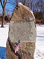
 Cornet Francis Geary monument, NJ.jpg 3,071 × 2,047; 2.27 MB
-
 East Amwell (Township); Wertsville (Village) NYPL1602735.tiff 5,474 × 4,484; 70.23 MB
-
 East amwell twp 019 nj.png 568 × 585; 48 KB
-
 Furmans Corners, NJ.jpg 2,272 × 1,704; 1.37 MB
-
 HIGHFIELDS, EAST AMWELL TOWNSHIP, HUNTERDON COUNTY (cropped).jpg 2,506 × 1,391; 523 KB
-
 HIGHFIELDS, EAST AMWELL TOWNSHIP, HUNTERDON COUNTY.jpg 2,784 × 1,848; 763 KB
-
 John Hart's cave marker.jpg 246 × 777; 79 KB
-
 Neshanic River, East Amwell, NJ - panoramio (2).jpg 1,344 × 2,240; 1.23 MB
-
 Neshanic River, East Amwell, NJ - panoramio (3).jpg 1,344 × 2,240; 1.47 MB
-
 Neshanic River, East Amwell, NJ - panoramio (4).jpg 2,240 × 1,344; 1.89 MB
-
 Neshanic River, East Amwell, NJ - panoramio (5).jpg 1,344 × 2,240; 1.15 MB
-
 Neshanic River, East Amwell, NJ - panoramio.jpg 2,240 × 1,344; 1.74 MB
-
 TabbysPlaceLobby1.jpg 385 × 269; 163 KB
-
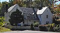
 William Chamberlain House.JPG 3,648 × 2,736; 5.87 MB
-
 Wm. Chamberlain House.JPG 3,648 × 2,736; 3.97 MB
_in_East_Amwell_Township,_Hunterdon_County,_New_Jersey.jpg)


.jpg)

.jpg)
.jpg)
.jpg)
.jpg)


