Category:Ebnit
Zur Navigation springen
Zur Suche springen
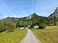
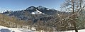
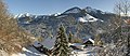
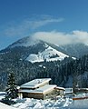
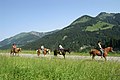
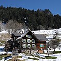
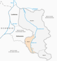
Deutsch: Ebnit ist ein Bergdorf im Gemeindegebiet der Stadt Dornbirn in Vorarlberg (Österreich). Ebnit ist ein Luftkurort und zählt wie beispielsweise auch Lech, Damüls oder Mittelberg zu den Vorarlberger Walserdörfern.
Ort in Vorarlberg, Österreich   | |||||
| Medium hochladen | |||||
| Isch e | |||||
|---|---|---|---|---|---|
| Ort | Doarobiro, Bezirk Doarobiro, Vorarlbearg, Öschtriich | ||||
| Gebirgszug | |||||
| Yywohnerzahl |
| ||||
| Flechi |
| ||||
| Hechi iber em Meeresspiegel |
| ||||
 | |||||
Unterkategorie
S wäre 22 vu insgsamt 22 Unterkategorie in däre Kategori aazeigt:
A
- Alpe Schöner Mann (3 D)
B
- Beständerhaus Ebnit (27 D)
- Buslinie Dornbirn–Ebnit (28 D)
E
- Ebniterache (6 D)
G
- Gasthaus Alpenrose (Ebnit) (5 D)
- Gasthaus Hoher Freschen (2 D)
H
- Hoher Gang (6 D)
J
- Jausenstation s'Marend (24 D)
K
- Kilbi 2023 (Brücken-Kilbi) (87 D)
- Knopfweg (8 D)
- Kohlhaldenbrücke (24 D)
- Kolping Feriendorf (Ebnit) (4 D)
N
P
R
S
- Schanerloch (21 D)
- Schanerlochbrücke (27 D)
- Skilift Heumöser (5 D)
V
- Valorsertal (12 D)
Medie in dr Kategori „Ebnit“
S wäre 61 vu insgsamt 61 Dateie in däre Kategori aazeigt:
-
De-Ebnit.ogg 1,7 s; 17 KB
-
 Coprinus comatus, Schopftintling 4.JPG 2.223 × 3.211; 3,89 MB
-
 Dornbirn-Ebnit vom Unterdorf zur Hohen Klara-01ASD.jpg 4.624 × 3.468; 6,83 MB
-
 Dornbirn-Ebnit von Heumoeserkoepfle zu Hohe Klara-Brotaschrofa-01ASD.jpg 4.624 × 3.468; 8,35 MB
-
 Dornbirn-Ebnit von Heumoeserkoepfle zu Hohe Klara-Brotaschrofa-02ASD.jpg 4.624 × 3.468; 6,76 MB
-
 Dornbirn-Ebnit von Ilgenwaldalpe zu Hohe Klara-Brotaschrofa-01ASD.jpg 4.624 × 3.468; 5,63 MB
-
 Dornbirn-Ebnit von Ilgenwaldalpe zu Hohe Klara-Brotaschrofa-02ASD.jpg 4.624 × 3.468; 4,42 MB
-
 Dornbirn-Ebnit von Ilgenwaldalpe zu Hohe Klara-Brotaschrofa-03ASD.jpg 3.264 × 2.448; 2,76 MB
-
 Dornbirn-Ebnit-Bocksberg-01MND.jpg 5.472 × 3.648; 9,63 MB
-
 Dornbirn-Ebnit-Bruderbach-flussabwaerts-03ASD.jpg 3.468 × 4.624; 13,71 MB
-
 Dornbirn-Ebnit-Bruderbach-flussaufwaerts-01ASD.jpg 3.468 × 4.624; 12,61 MB
-
 Dornbirn-Ebnit-Bruderbach-flussaufwaerts-02ASD.jpg 3.468 × 4.624; 12,68 MB
-
 Dornbirn-Ebnit-Church--autumn-01MND.jpg 5.472 × 3.648; 13,35 MB
-
 Dornbirn-Ebnit-Church--Sattelspitze-Alpkopf-Hoher Freschen-01MND.jpg 4.000 × 3.000; 4,69 MB
-
 Dornbirn-Ebnit-Church--Sattelspitze-Alpkopf-Hoher Freschen-02MND.jpg 5.472 × 3.648; 7,88 MB
-
 Dornbirn-Ebnit-Church--summer-01MND.jpg 2.357 × 3.432; 2,54 MB
-
 Dornbirn-Ebnit-Church-winter-01MND.jpg 5.472 × 3.648; 10,04 MB
-
 Dornbirn-Ebnit-Dorfbrunnen-04.JPG 2.576 × 4.592; 1,9 MB
-
 Dornbirn-Ebnit-Heumoeserlift-01ASD.jpg 4.624 × 3.468; 6,43 MB
-
 Dornbirn-Ebnit-Hohe Klara-01MND.jpg 5.472 × 3.648; 10,67 MB
-
 Dornbirn-Ebnit-Hohe Klara-02MND.jpg 5.472 × 3.648; 9,88 MB
-
 Dornbirn-Ebnit-Häuschen-02.JPG 4.592 × 2.576; 7,5 MB
-
 Dornbirn-Ebnit-Lindenbachalpe-Heumoeser-von Heumoeserkoepfle-01ASD.jpg 4.624 × 3.468; 6,55 MB
-
 Dornbirn-Ebnit-Restaurant Heumoeser-01ASD.jpg 4.624 × 3.468; 6,93 MB
-
 Dornbirn-Ebnit-Saegebach-01ASD.jpg 3.468 × 4.624; 12,6 MB
-
 Dornbirn-Ebnit-Saegebach-Loeschteich-01ESD.jpg 3.456 × 4.608; 11,92 MB
-
 Dornbirn-Ebnit-Schoenblickweg-03.JPG 4.592 × 2.576; 6,5 MB
-
 Dornbirn-Ebnit-Waysidecross plot Saega-01ASD.jpg 3.468 × 4.624; 13,29 MB
-
 Dornbirn-Ebnit-Waysidecross plot Saega-99ASD.jpg 3.468 × 4.624; 8,7 MB
-

-
 Dornbirn-Hohe Klara-Broataschrofa-from Heumoeser-01ASD.jpg 4.624 × 3.468; 8,88 MB
-
 Dornbirn-Hohe Klara-First-01ASD.jpg 3.056 × 4.592; 6,45 MB
-
 Dornbirn-Hohe Klara-First-02ASD.jpg 3.056 × 4.592; 6,73 MB
-
 Dornbirn-sMarendkaertle Nr 1806-Vorderseite-01ASD.jpg 2.572 × 2.500; 837 KB
-
 Ebnit Pano1.jpg 6.146 × 2.280; 13,09 MB
-
 Ebnit Pano2.jpg 5.767 × 2.494; 13,13 MB
-
 Ebnit Pano3.jpg 5.882 × 2.696; 12,85 MB
-
 Ebnit0205.JPG 2.280 × 1.160; 643 KB
-
 Ebnit02051.JPG 1.213 × 1.498; 379 KB
-
 Ebnit06061.JPG 3.008 × 2.000; 3,21 MB
-
 Enit Nr 8.JPG 2.674 × 2.694; 4,88 MB
-
 Feuerwehrhaus Ebnit.JPG 2.846 × 3.794; 3,61 MB
-
 Frühlings Enzian Gentiana verna 03.JPG 3.147 × 2.638; 4,65 MB
-
 Frühlings Enzian Gentiana verna 05.JPG 2.848 × 2.848; 3,86 MB
-
 Frühlings Enzian Gentiana verna 09.JPG 4.272 × 2.848; 7,97 MB
-
 Hinterbergalpe Böhringer.JPG 2.090 × 2.786; 3,34 MB
-
 HinterbergalpeFirst.JPG 4.272 × 2.848; 2,23 MB
-
 Hoher Freschen von Norden mit Graten.jpg 4.320 × 2.880; 1,61 MB
-
 Hoher Freschen von Norden.jpg 4.320 × 2.880; 1,92 MB
-
 HoherFreschen3.jpg 3.888 × 2.592; 2,36 MB
-
 Karte Katastralgemeinde Ebnit I.png 960 × 1.025; 166 KB
-
 Karte Katastralgemeinde Ebnit II.png 960 × 1.025; 165 KB
-
 Morgendlicher Sonnenblick - panoramio.jpg 4.928 × 3.264; 6,5 MB
-
 Red Holstein Rind 1.JPG 2.248 × 3.247; 3,93 MB
-
 Red Holstein Rind 2.JPG 2.783 × 3.409; 4,32 MB
-
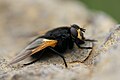
 Rinderfliege, Mesembrina meridiana 1.JPG 3.579 × 2.478; 4,81 MB
-
 Rinderfliege, Mesembrina meridiana 2.JPG 4.272 × 2.848; 6,53 MB
-
 Rinderfliege, Mesembrina meridiana 3.JPG 2.641 × 1.829; 2,49 MB
-
 Siegelmarke Gemeinde Vorstehung - Ebnit W0261098.jpg 270 × 267; 19 KB
-
 Waldeidechse, Zootoca vivipara 1.JPG 3.207 × 2.221; 4,44 MB
-
 Waldeidechse, Zootoca vivipara 2.JPG 3.237 × 2.241; 3,79 MB


