Category:Edenbridge, Kent
Vai alla navigazione
Vai alla ricerca
town in Kent, England, UK  | |||||
| Carica un file multimediale | |||||
| Istanza di | |||||
|---|---|---|---|---|---|
| Luogo | Sevenoaks, Kent, Sud Est dell'Inghilterra, Inghilterra | ||||
| Popolazione |
| ||||
| Considerato essere uguale a | Edenbridge (pagina Wikimedia duplicata, parrocchia civile dell'Inghilterra) | ||||
| sito web ufficiale | |||||
 | |||||
Sottocategorie
Questa categoria contiene le 7 sottocategorie indicate di seguito, su un totale di 7.
File nella categoria "Edenbridge, Kent"
Questa categoria contiene 200 file, indicati di seguito, su un totale di 638.
(pagina precedente) (pagina successiva)-
 A dead tree - geograph.org.uk - 4009650.jpg 640 × 430; 63 KB
-
 A Southern train seen from a foot crossing - geograph.org.uk - 5335188.jpg 4 000 × 3 000; 4,93 MB
-
 A wooded pond - geograph.org.uk - 5419748.jpg 640 × 426; 31 KB
-
 Access road to Batchelor's Farm - geograph.org.uk - 1755525.jpg 3 072 × 2 304; 1,65 MB
-
 Access road to Swan Lane Farm - geograph.org.uk - 5335836.jpg 4 000 × 3 000; 5,03 MB
-
 Access road to Swan Lane Farm - geograph.org.uk - 5335841.jpg 4 000 × 3 000; 4,99 MB
-
 Acorns Horticultural Centre - geograph.org.uk - 1868093.jpg 3 072 × 2 304; 1,4 MB
-

-
-
 An unusual railway crossing - geograph.org.uk - 5336412.jpg 4 000 × 3 000; 4,41 MB
-
 Another heavy shower - geograph.org.uk - 4201265.jpg 4 000 × 3 000; 4,05 MB
-
 Approach to Swan Lane Farm - geograph.org.uk - 5335833.jpg 4 000 × 3 000; 4,95 MB
-
 Arthurs Shaw - geograph.org.uk - 4009638.jpg 640 × 430; 145 KB
-
 At the gates of Cemetery One - geograph.org.uk - 2458168.jpg 640 × 480; 114 KB
-
 B2026, Edenbridge - geograph.org.uk - 5419752.jpg 640 × 326; 55 KB
-
 B2026, Edenbridge - geograph.org.uk - 6441577.jpg 1 024 × 681; 127 KB
-
 Barn, Greybury Farm (geograph 6723735).jpg 1 024 × 684; 177 KB
-
 Barn, Hamsell Mead Farm - geograph.org.uk - 5419757.jpg 587 × 640; 57 KB
-
 Barn, Skeynes Park - geograph.org.uk - 3988954.jpg 640 × 430; 53 KB
-
 Bellview - geograph.org.uk - 4009682.jpg 640 × 442; 83 KB
-
 Bend on a footpath and an archway - geograph.org.uk - 1864447.jpg 3 072 × 2 304; 3,06 MB
-
 Bend on Hever Rd - geograph.org.uk - 1714291.jpg 640 × 427; 90 KB
-
 Birdbox in Broxham Wood - geograph.org.uk - 1754611.jpg 2 304 × 3 072; 2,05 MB
-
 Bluebell walk in Mowhurst Wood - geograph.org.uk - 1864275.jpg 2 304 × 3 072; 2,74 MB
-
 Bluebells in Broxham Wood - geograph.org.uk - 5366536.jpg 4 000 × 3 000; 4,89 MB
-
 Bluebells in Broxham Wood - geograph.org.uk - 5366538.jpg 4 000 × 3 000; 4,88 MB
-
 Bluebells in Broxham Wood - geograph.org.uk - 5369406.jpg 4 000 × 3 000; 4,77 MB
-
 Bluebells in Broxham Wood - geograph.org.uk - 5369416.jpg 4 000 × 3 000; 4,89 MB
-
 Bluebells in Broxham Wood - geograph.org.uk - 5369420.jpg 4 000 × 3 000; 4,82 MB
-
 Bridge at Edenbridge, Kent - geograph.org.uk - 1385633.jpg 640 × 480; 97 KB
-
 Bridge from Edenbridge to an allotment. - geograph.org.uk - 1864380.jpg 3 072 × 2 304; 2,18 MB
-
 Bridge on Lingfield Road, Edenbridge - geograph.org.uk - 1096403.jpg 640 × 480; 60 KB
-
 Bridge over Station Road, Edenbridge - geograph.org.uk - 2911741.jpg 1 600 × 1 200; 555 KB
-
 Bridge over the River Eden, High Street, Edenbridge (NHLE Code 1336373) (September 2012).JPG 2 500 × 1 900; 1,37 MB
-
 Bridge to Surrey - geograph.org.uk - 3988992.jpg 640 × 430; 134 KB
-
 Bridges, High St, Edenbridge - geograph.org.uk - 1713795.jpg 640 × 427; 66 KB
-
 Bridleway bridge over River Eden - geograph.org.uk - 1869601.jpg 3 072 × 2 304; 2,99 MB
-
 Broadlands, Honeypot Lane - geograph.org.uk - 4056175.jpg 640 × 430; 114 KB
-
 By the Roman Road - geograph.org.uk - 4147891.jpg 640 × 430; 78 KB
-
 Car Dealer, Edenbridge, Kent - geograph.org.uk - 1124338.jpg 640 × 480; 68 KB
-
 Car Park off Station Rd - geograph.org.uk - 1713174.jpg 640 × 427; 51 KB
-

-
 Cauk Wood - geograph.org.uk - 5098809.jpg 640 × 426; 56 KB
-
 Cauk Wood - geograph.org.uk - 5135625.jpg 640 × 426; 33 KB
-
 Cauk Wood - geograph.org.uk - 6514073.jpg 1 024 × 684; 113 KB
-
 Chiswell Barn, Shernden Lane - geograph.org.uk - 2458285.jpg 640 × 480; 151 KB
-
 Christmas Mill Millpond - geograph.org.uk - 1869448.jpg 3 072 × 2 304; 2,02 MB
-
 Churchfield, Edenbridge - geograph.org.uk - 1713899.jpg 640 × 427; 59 KB
-
 Clatfields Farm access road - geograph.org.uk - 1869435.jpg 3 072 × 2 304; 2,75 MB
-
 Close up of pillbox - geograph.org.uk - 1714037.jpg 550 × 640; 49 KB
-
 Close up of pillbox - geograph.org.uk - 1714052.jpg 640 × 378; 47 KB
-
 Clump of trees - geograph.org.uk - 5335112.jpg 4 000 × 3 000; 4,94 MB
-
 Clump of trees on the way to Edenbridge - geograph.org.uk - 5335106.jpg 4 000 × 3 000; 4,87 MB
-
 Clump of trees on the way to Edenbridge - geograph.org.uk - 5335110.jpg 4 000 × 3 000; 4,72 MB
-
 Cobhambury Wood - geograph.org.uk - 1708948.jpg 640 × 427; 55 KB
-
 Colour in Jules Wood - geograph.org.uk - 2434402.jpg 640 × 480; 186 KB
-
 Commerce Way, Edenbridge - geograph.org.uk - 5356190.jpg 3 264 × 2 448; 1,97 MB
-
 Corner of Devil's Den Moat - geograph.org.uk - 1867877.jpg 3 072 × 2 304; 3,13 MB
-
 Corner of the green, Marsh Green - geograph.org.uk - 5665431.jpg 640 × 427; 102 KB
-
 Cottages in Lingfield Road - geograph.org.uk - 5329957.jpg 4 000 × 3 000; 4,71 MB
-
 Countryside by Eden Valley Walk - geograph.org.uk - 4156601.jpg 640 × 430; 71 KB
-
 Countryside near Oast Farm - geograph.org.uk - 4156582.jpg 640 × 430; 72 KB
-
 Countryside near Oast Farm - geograph.org.uk - 4156613.jpg 640 × 430; 76 KB
-
 Countryside west of Edenbridge - geograph.org.uk - 2265394.jpg 640 × 430; 102 KB
-
 Cows^ - geograph.org.uk - 4191298.jpg 1 600 × 1 200; 538 KB
-
 Croft Lane - geograph.org.uk - 1713792.jpg 640 × 427; 58 KB
-
 Crop Field near Home Field - geograph.org.uk - 1860814.jpg 1 024 × 768; 217 KB
-
 Crop Field off Hever Road - geograph.org.uk - 1947250.jpg 1 024 × 768; 245 KB
-
 Crossing over the railway near Lockhurst Farm - geograph.org.uk - 5375506.jpg 4 000 × 3 000; 4,82 MB
-
 Crossing the railway near Edenbridge - geograph.org.uk - 5375442.jpg 4 000 × 3 000; 4,78 MB
-
 Crossing the railway near Edenbridge - geograph.org.uk - 5375470.jpg 4 000 × 3 000; 4,8 MB
-
 Crouch House Rd - geograph.org.uk - 3979304.jpg 640 × 430; 112 KB
-
 Crouch House Rd - geograph.org.uk - 3979319.jpg 640 × 430; 109 KB
-
 Crouch House Road, Edenbridge - geograph.org.uk - 2092652.jpg 3 072 × 2 304; 2,66 MB
-
 Crouch House Road, Edenbridge - geograph.org.uk - 2092655.jpg 3 072 × 2 304; 2,65 MB
-
 Crouch House Road, Edenbridge - geograph.org.uk - 5356182.jpg 3 097 × 2 323; 1,59 MB
-
 Crown Road, Marlpit Hill - geograph.org.uk - 5355577.jpg 3 264 × 2 448; 3,17 MB
-
 Crown Road, Marlpit Hill - geograph.org.uk - 5357914.jpg 3 264 × 2 448; 1,82 MB
-
 Daffodils and hawthorn on Little Browns Lane - geograph.org.uk - 5336429.jpg 4 000 × 3 000; 4,81 MB
-
 Deer Gate near Broxham Wood - geograph.org.uk - 1754606.jpg 3 072 × 2 304; 3,03 MB
-
 Delaware Cottages, Hever Rd - geograph.org.uk - 1714299.jpg 640 × 427; 83 KB
-
 Diverted footpath on the way to Clatfields - geograph.org.uk - 4202419.jpg 4 000 × 3 000; 4,32 MB
-
-

-
 Eden Valley Walk - geograph.org.uk - 4009622.jpg 640 × 430; 73 KB
-
 Eden Valley Walk passing under the Uckfield Line - geograph.org.uk - 5449879.jpg 4 000 × 3 000; 4,83 MB
-
 Eden Valley Walk passing under the Uckfield Line - geograph.org.uk - 5449885.jpg 4 000 × 3 000; 4,77 MB
-
 Eden Valley Walk past Devil's Den - geograph.org.uk - 1867961.jpg 3 072 × 2 304; 3,11 MB
-
 Eden Valley Walk, footbridge and Pillbox - geograph.org.uk - 1867972.jpg 3 072 × 2 304; 2,6 MB
-
 Edenbridge 1.JPG 1 280 × 960; 468 KB
-
 Edenbridge 4.JPG 1 280 × 960; 476 KB
-
 Edenbridge 5.JPG 1 280 × 960; 468 KB
-
 Edenbridge 6.JPG 1 280 × 960; 486 KB
-
 Edenbridge Allotments - geograph.org.uk - 1713962.jpg 640 × 427; 98 KB
-
 Edenbridge Allotments - geograph.org.uk - 1713982.jpg 640 × 427; 80 KB
-
 Edenbridge from the air - geograph.org.uk - 2337455.jpg 480 × 640; 149 KB
-
 Edenbridge Golf Course (abandoned) - geograph.org.uk - 3988949.jpg 640 × 430; 77 KB
-
 Edenbridge High Street bridge over the River Eden - geograph.org.uk - 1868035.jpg 3 072 × 2 304; 2,2 MB
-
 Edenbridge Millennium Wood - geograph.org.uk - 1864277.jpg 3 072 × 2 304; 2,79 MB
-
 Edenbridge Sewage Works - geograph.org.uk - 2265312.jpg 640 × 430; 109 KB
-
 Edenbridge Sewage Works - geograph.org.uk - 3546663.jpg 640 × 430; 55 KB
-
 Edenbridge Sewage Works - geograph.org.uk - 4061068.jpg 640 × 358; 45 KB
-
 Edenbridge Sewage Works - geograph.org.uk - 5098810.jpg 640 × 426; 64 KB
-
 Edenbridge Sewage Works - geograph.org.uk - 5135626.jpg 640 × 426; 46 KB
-
 Edenbridge Sewage Works - geograph.org.uk - 5419750.jpg 640 × 426; 42 KB
-
 Edenbridge Sewage Works - geograph.org.uk - 5664970.jpg 640 × 334; 35 KB
-
 Edenbridge Sewage Works - geograph.org.uk - 6441572.jpg 1 024 × 681; 129 KB
-
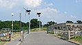
 Edenbridge Station - geograph.org.uk - 5340038.jpg 640 × 426; 74 KB
-
 Edenbridge Station - geograph.org.uk - 5659981.jpg 640 × 426; 75 KB
-
 Edenbridge Station - geograph.org.uk - 5664969.jpg 640 × 426; 52 KB
-
 Edenbridge Town Railway Station - geograph.org.uk - 5355609.jpg 3 264 × 2 448; 1,77 MB
-
 Edenbridge Village Sign - geograph.org.uk - 1868040.jpg 2 304 × 3 072; 1,76 MB
-
 Edenbridge, Kent in 2008.jpg 640 × 430; 54 KB
-
 Enclosed footpath - geograph.org.uk - 4013945.jpg 640 × 430; 91 KB
-
 Entering Edenbridge, Crouch House Rd - geograph.org.uk - 3979350.jpg 640 × 430; 87 KB
-
 Entering Kent, Marsh Green Rd - geograph.org.uk - 4013942.jpg 640 × 430; 88 KB
-
 Entering Marsh Green, Marsh Green Rd - geograph.org.uk - 4013933.jpg 640 × 430; 86 KB
-
 Enterprise Way, Edenbridge - geograph.org.uk - 1713169.jpg 640 × 427; 74 KB
-
 Fairmead Road, Marlpit Hill - geograph.org.uk - 5355556.jpg 3 264 × 2 448; 3,81 MB
-
 Farm buildings, Skeynes Park - geograph.org.uk - 3979491.jpg 640 × 430; 54 KB
-
 Farmland and woodland near Hilders - geograph.org.uk - 3972242.jpg 640 × 430; 76 KB
-
 Farmland by railway line - geograph.org.uk - 6485675.jpg 1 024 × 684; 101 KB
-
 Farmland by the railway - geograph.org.uk - 2929383.jpg 640 × 430; 57 KB
-
 Farmland by the railway - geograph.org.uk - 4792664.jpg 640 × 426; 54 KB
-
 Farmland by the railway line - geograph.org.uk - 3369190.jpg 640 × 430; 56 KB
-
 Farmland by the railway line - geograph.org.uk - 3945659.jpg 640 × 430; 54 KB
-
 Farmland near Cauk Wood - geograph.org.uk - 4061070.jpg 640 × 430; 33 KB
-
 Farmland near Troy Town - geograph.org.uk - 4951192.jpg 640 × 426; 51 KB
-
 Farmland south of Hilders Lane - geograph.org.uk - 4056211.jpg 640 × 430; 83 KB
-
 Farmland, Hamsell Mead Farm - geograph.org.uk - 3546668.jpg 640 × 430; 39 KB
-
 Farmland, Skeynes Park - geograph.org.uk - 3979487.jpg 640 × 430; 62 KB
-
 Field - geograph.org.uk - 4790023.jpg 640 × 426; 51 KB
-
 Field - geograph.org.uk - 4790025.jpg 640 × 426; 51 KB
-
 Field by the Roman Road - geograph.org.uk - 4147887.jpg 640 × 430; 66 KB
-
 Field by the Roman Road - geograph.org.uk - 4147889.jpg 640 × 430; 60 KB
-
 Field by the Roman Road - geograph.org.uk - 4147895.jpg 640 × 430; 82 KB
-
 Field near Marlpit Hill - geograph.org.uk - 5340040.jpg 640 × 426; 75 KB
-
 Field next to Swan Lane Farm - geograph.org.uk - 5335828.jpg 4 000 × 3 000; 4,76 MB
-
 Field north of Marsh Green - geograph.org.uk - 4009632.jpg 640 × 430; 56 KB
-
 Field north of Marsh Green - geograph.org.uk - 4009645.jpg 640 × 430; 64 KB
-
 Field north of the railway line - geograph.org.uk - 3945666.jpg 640 × 430; 68 KB
-
 Field of wheat - geograph.org.uk - 4147910.jpg 640 × 430; 82 KB
-
 Field south of Hilders - geograph.org.uk - 3972247.jpg 640 × 430; 80 KB
-
 Field west of Edenbridge - geograph.org.uk - 3369204.jpg 640 × 430; 52 KB
-
 Field, Marlpit Hill - geograph.org.uk - 4951183.jpg 640 × 426; 51 KB
-
 Fields behind Round House Farm - geograph.org.uk - 2497430.jpg 640 × 480; 128 KB
-
 Fircroft Way - geograph.org.uk - 1713183.jpg 640 × 427; 54 KB
-
 Flower-filled meadow next to the Eden Valley Walk - geograph.org.uk - 5449871.jpg 4 000 × 3 000; 4,58 MB
-
 Flowering hawthorn by a pond - geograph.org.uk - 5375514.jpg 4 000 × 3 000; 4,78 MB
-
 Footbridge near Clatfields - geograph.org.uk - 1869431.jpg 3 072 × 2 304; 3,18 MB
-
 Footbridge near Hever Road - geograph.org.uk - 1869519.jpg 3 072 × 2 304; 2,37 MB
-
 Footbridge near Old Barn Farm - geograph.org.uk - 1869506.jpg 3 072 × 2 304; 2,87 MB
-
 Footbridge on footpath SR593 - geograph.org.uk - 2493653.jpg 640 × 480; 191 KB
-
 Footbridge on footpath SR594 - geograph.org.uk - 2493631.jpg 640 × 480; 149 KB
-
 Footbridge over Kent Brook - geograph.org.uk - 5327366.jpg 4 000 × 3 000; 4,81 MB
-
 Footbridge over the Kent Brook - geograph.org.uk - 1867989.jpg 3 072 × 2 304; 2,68 MB
-
 Footbridge towards Church Street - geograph.org.uk - 1868049.jpg 3 072 × 2 304; 2,34 MB
-
 Footbridge, Edenbridge Station - geograph.org.uk - 4061057.jpg 640 × 430; 70 KB
-
 Footbridge, Lydens Farm - geograph.org.uk - 4156575.jpg 640 × 430; 104 KB
-
 Footpath alongside the railway line - geograph.org.uk - 5375512.jpg 4 000 × 3 000; 4,69 MB
-
 Footpath leading to a railway foot crossing - geograph.org.uk - 5335183.jpg 4 000 × 3 000; 4,8 MB
-
 Footpath near Delaware Farm - geograph.org.uk - 5334185.jpg 4 000 × 3 000; 4,87 MB
-
 Footpath north-east of Edenbridge - geograph.org.uk - 5363455.jpg 4 000 × 3 000; 4,85 MB
-
 Footpath sign along Hilders Lane - geograph.org.uk - 5336335.jpg 4 000 × 3 000; 4,81 MB
-
 Footpath steps in a railway cutting - geograph.org.uk - 6485671.jpg 1 024 × 684; 257 KB
-
 Footpath to Appledore - geograph.org.uk - 5366030.jpg 4 000 × 3 000; 4,58 MB
-
 Footpath to Medhurst Row - geograph.org.uk - 5334175.jpg 4 000 × 3 000; 4,63 MB
-
 Footpath towards Edenbridge - geograph.org.uk - 5335126.jpg 4 000 × 3 000; 4,69 MB
-
 Footpath, Edenbridge Millennium Wood - geograph.org.uk - 5357917.jpg 3 264 × 2 448; 2,93 MB
-
 Forge Croft, Edenbridge - geograph.org.uk - 1713901.jpg 640 × 427; 62 KB
-
 Forge Croft, Edenbridge - geograph.org.uk - 1713905.jpg 640 × 427; 60 KB
-
 Former pillbox next to Eden Valley Walk - geograph.org.uk - 5326067.jpg 4 000 × 3 000; 4,82 MB
-
 Four Elms Rd, Edenbridge - geograph.org.uk - 1713245.jpg 640 × 427; 70 KB
-
 Four Elms Road, Edenbridge - geograph.org.uk - 2092659.jpg 3 072 × 2 304; 2,3 MB
-
 Four Elms Road, Edenbridge - geograph.org.uk - 2092663.jpg 3 072 × 2 304; 2,41 MB
-
 Four Elms Road, Mowshurst - geograph.org.uk - 5355583.jpg 3 264 × 2 448; 2,3 MB
-
 Four tall trees - geograph.org.uk - 4009649.jpg 640 × 430; 74 KB
-
 Frantfield, Edenbridge - geograph.org.uk - 5355625.jpg 3 264 × 2 448; 2,21 MB
-
 Frantfields, Edenbridge - geograph.org.uk - 5355620.jpg 3 264 × 2 448; 1,93 MB
-
 Garden Centre at Edenbridge, Kent - geograph.org.uk - 1389429.jpg 640 × 360; 50 KB
-
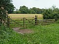 Gate at footpath junction - geograph.org.uk - 2493598.jpg 640 × 480; 141 KB
-
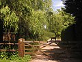
 Gate into Troy Town Wood - geograph.org.uk - 2500450.jpg 3 072 × 2 304; 3,57 MB
-
 Gate near Greybury Farm - geograph.org.uk - 1868274.jpg 3 072 × 2 304; 1,45 MB
-
 Gate piers, Plas Bryn - geograph.org.uk - 4142699.jpg 640 × 398; 102 KB
-
 Gate piers, Plas Bryn - geograph.org.uk - 4142703.jpg 640 × 430; 122 KB
-
 Gate to Round House Farm - geograph.org.uk - 1942972.jpg 3 072 × 2 304; 2,5 MB
-
 Glads Wood - geograph.org.uk - 4009643.jpg 640 × 430; 88 KB
-

-
 Grassy farmland, Marlpit Hill - geograph.org.uk - 3962498.jpg 640 × 430; 65 KB
-
 Grassy meadow - geograph.org.uk - 4147907.jpg 640 × 430; 71 KB
-
 Grassy meadow - geograph.org.uk - 4147913.jpg 640 × 430; 80 KB
-
 Grassy pasture - geograph.org.uk - 3979460.jpg 640 × 430; 64 KB
-
 Great Western Railway Notice - geograph.org.uk - 1942974.jpg 3 072 × 2 304; 2,1 MB
-
 Green alongside Skeynes Road - geograph.org.uk - 5338230.jpg 4 000 × 3 000; 4,88 MB
-
 Green on abandoned golf course - geograph.org.uk - 2395550.jpg 640 × 473; 140 KB
-
 Green on Skeynes Road - geograph.org.uk - 5338450.jpg 3 862 × 2 896; 3,08 MB
-
 Greybury Furzes - geograph.org.uk - 1860864.jpg 3 166 × 4 749; 7,23 MB
-
 Guildables Wood - geograph.org.uk - 1947218.jpg 1 024 × 768; 184 KB
-
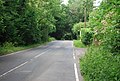 Hartfield Rd - geograph.org.uk - 4142697.jpg 640 × 430; 99 KB
-
 Hartfield Rd - geograph.org.uk - 4147630.jpg 640 × 430; 123 KB


.jpg)


_(September_2012).JPG)


_-_geograph.org.uk_-_3988949.jpg)


