Category:Edenbridge, Kent
Jump to navigation
Jump to search
town in Kent, England, UK  | |||||
| Upload media | |||||
| Instance of | |||||
|---|---|---|---|---|---|
| Location | Sevenoaks, Kent, South East England, England | ||||
| Population |
| ||||
| Said to be the same as | Edenbridge (Wikimedia duplicated page, civil parish) | ||||
| official website | |||||
 | |||||
Subcategories
This category has the following 7 subcategories, out of 7 total.
Media in category "Edenbridge, Kent"
The following 200 files are in this category, out of 696 total.
(previous page) (next page)-
 'Zebra' in a field in Kent - geograph.org.uk - 6607301.jpg 4,000 × 3,000; 4.45 MB
-
 A dead tree - geograph.org.uk - 4009650.jpg 640 × 430; 63 KB
-
 A footpath at dusk - geograph.org.uk - 6604650.jpg 4,000 × 3,000; 4.36 MB
-
 A Southern train seen from a foot crossing - geograph.org.uk - 5335188.jpg 4,000 × 3,000; 4.93 MB
-
 A wooded pond - geograph.org.uk - 5419748.jpg 640 × 426; 31 KB
-
 Access road to Batchelor's Farm - geograph.org.uk - 1755525.jpg 3,072 × 2,304; 1.65 MB
-
 Access road to Swan Lane Farm - geograph.org.uk - 5335836.jpg 4,000 × 3,000; 5.03 MB
-
 Access road to Swan Lane Farm - geograph.org.uk - 5335841.jpg 4,000 × 3,000; 4.99 MB
-
 Acorns Horticultural Centre - geograph.org.uk - 1868093.jpg 3,072 × 2,304; 1.4 MB
-

-
-
 An unusual railway crossing - geograph.org.uk - 5336412.jpg 4,000 × 3,000; 4.41 MB
-
 Another heavy shower - geograph.org.uk - 4201265.jpg 4,000 × 3,000; 4.05 MB
-
 Approach to Swan Lane Farm - geograph.org.uk - 5335833.jpg 4,000 × 3,000; 4.95 MB
-
 Arable field - geograph.org.uk - 6723760.jpg 1,024 × 684; 206 KB
-
 Arthurs Shaw - geograph.org.uk - 4009638.jpg 640 × 430; 145 KB
-
 At the gates of Cemetery One - geograph.org.uk - 2458168.jpg 640 × 480; 114 KB
-
 B2026, Edenbridge - geograph.org.uk - 5419752.jpg 640 × 326; 55 KB
-
 B2026, Edenbridge - geograph.org.uk - 6441577.jpg 1,024 × 681; 127 KB
-
 Barn skeletons, New Barns farm - geograph.org.uk - 6723765.jpg 1,024 × 684; 186 KB
-
 Barn, Greybury Farm (geograph 6723735).jpg 1,024 × 684; 177 KB
-
 Barn, Hamsell Mead Farm - geograph.org.uk - 5419757.jpg 587 × 640; 57 KB
-
 Barn, Skeynes Park - geograph.org.uk - 3988954.jpg 640 × 430; 53 KB
-
 Bellview - geograph.org.uk - 4009682.jpg 640 × 442; 83 KB
-
 Bend on a footpath and an archway - geograph.org.uk - 1864447.jpg 3,072 × 2,304; 3.06 MB
-
 Bend on Hever Rd - geograph.org.uk - 1714291.jpg 640 × 427; 90 KB
-
 Birches Wood - geograph.org.uk - 6723751.jpg 1,024 × 684; 289 KB
-
 Birdbox in Broxham Wood - geograph.org.uk - 1754611.jpg 2,304 × 3,072; 2.05 MB
-
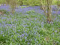
 Bluebell walk in Mowhurst Wood - geograph.org.uk - 1864275.jpg 2,304 × 3,072; 2.74 MB
-
 Bluebells in Broxham Wood - geograph.org.uk - 5366536.jpg 4,000 × 3,000; 4.89 MB
-
 Bluebells in Broxham Wood - geograph.org.uk - 5366538.jpg 4,000 × 3,000; 4.88 MB
-
 Bluebells in Broxham Wood - geograph.org.uk - 5369406.jpg 4,000 × 3,000; 4.77 MB
-
 Bluebells in Broxham Wood - geograph.org.uk - 5369416.jpg 4,000 × 3,000; 4.89 MB
-
 Bluebells in Broxham Wood - geograph.org.uk - 5369420.jpg 4,000 × 3,000; 4.82 MB
-
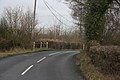
 Bridge at Edenbridge, Kent - geograph.org.uk - 1385633.jpg 640 × 480; 97 KB
-
 Bridge from Edenbridge to an allotment. - geograph.org.uk - 1864380.jpg 3,072 × 2,304; 2.18 MB
-
 Bridge on Lingfield Road, Edenbridge - geograph.org.uk - 1096403.jpg 640 × 480; 60 KB
-
 Bridge over Station Road, Edenbridge - geograph.org.uk - 2911741.jpg 1,600 × 1,200; 555 KB
-
 Bridge over the River Eden, High Street, Edenbridge (NHLE Code 1336373) (September 2012).JPG 2,500 × 1,900; 1.37 MB
-
 Bridge to Surrey - geograph.org.uk - 3988992.jpg 640 × 430; 134 KB
-
 Bridges, High St, Edenbridge - geograph.org.uk - 1713795.jpg 640 × 427; 66 KB
-
 Bridleway - geograph.org.uk - 6723660.jpg 1,024 × 684; 297 KB
-
 Bridleway - geograph.org.uk - 6723691.jpg 1,024 × 684; 255 KB
-
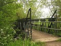 Bridleway bridge over River Eden - geograph.org.uk - 1869601.jpg 3,072 × 2,304; 2.99 MB
-
 Bridleway by Smoky Wood - geograph.org.uk - 6717556.jpg 1,024 × 684; 283 KB
-
 Bridleway junction - geograph.org.uk - 6723661.jpg 1,024 × 684; 296 KB
-
 Bridleway junction - geograph.org.uk - 6723757.jpg 1,024 × 684; 272 KB
-
 Bridleway to Greybury - geograph.org.uk - 6723663.jpg 1,024 × 684; 310 KB
-
 Bridleway to Greybury - geograph.org.uk - 6723682.jpg 1,024 × 684; 250 KB
-
 Bridleway to Greybury - geograph.org.uk - 6723683.jpg 1,024 × 684; 258 KB
-
 Bridleway to Greybury - geograph.org.uk - 6723684.jpg 684 × 1,024; 275 KB
-
 Bridleway, Greybury Woods - geograph.org.uk - 6723687.jpg 1,024 × 684; 267 KB
-
 Bridleway, Greybury Woods - geograph.org.uk - 6723689.jpg 684 × 1,024; 279 KB
-
 Broadlands, Honeypot Lane - geograph.org.uk - 4056175.jpg 640 × 430; 114 KB
-
 By the Roman Road - geograph.org.uk - 4147891.jpg 640 × 430; 78 KB
-
 Car Dealer, Edenbridge, Kent - geograph.org.uk - 1124338.jpg 640 × 480; 68 KB
-
 Car Park off Station Rd - geograph.org.uk - 1713174.jpg 640 × 427; 51 KB
-

-
 Cauk Wood - geograph.org.uk - 5098809.jpg 640 × 426; 56 KB
-
 Cauk Wood - geograph.org.uk - 5135625.jpg 640 × 426; 33 KB
-
 Cauk Wood - geograph.org.uk - 6514073.jpg 1,024 × 684; 113 KB
-
 Chiswell Barn, Shernden Lane - geograph.org.uk - 2458285.jpg 640 × 480; 151 KB
-
 Christmas Mill Millpond - geograph.org.uk - 1869448.jpg 3,072 × 2,304; 2.02 MB
-
 Churchfield, Edenbridge - geograph.org.uk - 1713899.jpg 640 × 427; 59 KB
-
 Clatfields Farm access road - geograph.org.uk - 1869435.jpg 3,072 × 2,304; 2.75 MB
-
 Close up of pillbox - geograph.org.uk - 1714037.jpg 550 × 640; 49 KB
-
 Close up of pillbox - geograph.org.uk - 1714052.jpg 640 × 378; 47 KB
-
 Clump of trees - geograph.org.uk - 5335112.jpg 4,000 × 3,000; 4.94 MB
-
 Clump of trees on the way to Edenbridge - geograph.org.uk - 5335106.jpg 4,000 × 3,000; 4.87 MB
-
 Clump of trees on the way to Edenbridge - geograph.org.uk - 5335110.jpg 4,000 × 3,000; 4.72 MB
-
 Cobhambury Wood - geograph.org.uk - 1708948.jpg 640 × 427; 55 KB
-
 Colour in Jules Wood - geograph.org.uk - 2434402.jpg 640 × 480; 186 KB
-
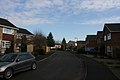
 Commerce Way, Edenbridge - geograph.org.uk - 5356190.jpg 3,264 × 2,448; 1.97 MB
-
 Conifers, Jules Wood - geograph.org.uk - 6717533.jpg 1,024 × 684; 327 KB
-
 Conifers, Jules Wood - geograph.org.uk - 6717540.jpg 1,024 × 684; 343 KB
-
 Corner of Devil's Den Moat - geograph.org.uk - 1867877.jpg 3,072 × 2,304; 3.13 MB
-
 Corner of the green, Marsh Green - geograph.org.uk - 5665431.jpg 640 × 427; 102 KB
-
 Cottages in Lingfield Road - geograph.org.uk - 5329957.jpg 4,000 × 3,000; 4.71 MB
-
 Countryside by Eden Valley Walk - geograph.org.uk - 4156601.jpg 640 × 430; 71 KB
-
 Countryside near Oast Farm - geograph.org.uk - 4156582.jpg 640 × 430; 72 KB
-
 Countryside near Oast Farm - geograph.org.uk - 4156613.jpg 640 × 430; 76 KB
-
 Countryside west of Edenbridge - geograph.org.uk - 2265394.jpg 640 × 430; 102 KB
-
 Cows^ - geograph.org.uk - 4191298.jpg 1,600 × 1,200; 538 KB
-
 Croft Lane - geograph.org.uk - 1713792.jpg 640 × 427; 58 KB
-
 Crop Field near Home Field - geograph.org.uk - 1860814.jpg 1,024 × 768; 217 KB
-
 Crop Field off Hever Road - geograph.org.uk - 1947250.jpg 1,024 × 768; 245 KB
-
 Crossing over the railway near Lockhurst Farm - geograph.org.uk - 5375506.jpg 4,000 × 3,000; 4.82 MB
-
 Crossing the railway near Edenbridge - geograph.org.uk - 5375442.jpg 4,000 × 3,000; 4.78 MB
-
 Crossing the railway near Edenbridge - geograph.org.uk - 5375470.jpg 4,000 × 3,000; 4.8 MB
-
 Crouch House Rd - geograph.org.uk - 3979304.jpg 640 × 430; 112 KB
-
 Crouch House Rd - geograph.org.uk - 3979319.jpg 640 × 430; 109 KB
-
 Crouch House Road, Edenbridge - geograph.org.uk - 2092652.jpg 3,072 × 2,304; 2.66 MB
-
 Crouch House Road, Edenbridge - geograph.org.uk - 2092655.jpg 3,072 × 2,304; 2.65 MB
-
 Crouch House Road, Edenbridge - geograph.org.uk - 5356182.jpg 3,097 × 2,323; 1.59 MB
-
 Crown Road, Marlpit Hill - geograph.org.uk - 5355577.jpg 3,264 × 2,448; 3.17 MB
-
 Crown Road, Marlpit Hill - geograph.org.uk - 5357914.jpg 3,264 × 2,448; 1.82 MB
-
 Daffodils and hawthorn on Little Browns Lane - geograph.org.uk - 5336429.jpg 4,000 × 3,000; 4.81 MB
-
 Deer Gate near Broxham Wood - geograph.org.uk - 1754606.jpg 3,072 × 2,304; 3.03 MB
-
 Delaware Cottages, Hever Rd - geograph.org.uk - 1714299.jpg 640 × 427; 83 KB
-
 Diverted footpath on the way to Clatfields - geograph.org.uk - 4202419.jpg 4,000 × 3,000; 4.32 MB
-
-

-
 Dry Hill Fort - geograph.org.uk - 6717524.jpg 1,024 × 684; 302 KB
-
 Dry Hill Fort - geograph.org.uk - 6717527.jpg 1,024 × 684; 262 KB
-
 Eden Valley Walk - geograph.org.uk - 4009622.jpg 640 × 430; 73 KB
-
 Eden Valley Walk passing under the Uckfield Line - geograph.org.uk - 5449879.jpg 4,000 × 3,000; 4.83 MB
-
 Eden Valley Walk passing under the Uckfield Line - geograph.org.uk - 5449885.jpg 4,000 × 3,000; 4.77 MB
-
 Eden Valley Walk past Devil's Den - geograph.org.uk - 1867961.jpg 3,072 × 2,304; 3.11 MB
-
 Eden Valley Walk, footbridge and Pillbox - geograph.org.uk - 1867972.jpg 3,072 × 2,304; 2.6 MB
-
 Edenbridge 1.JPG 1,280 × 960; 468 KB
-
 Edenbridge 4.JPG 1,280 × 960; 476 KB
-
 Edenbridge 5.JPG 1,280 × 960; 468 KB
-
 Edenbridge 6.JPG 1,280 × 960; 486 KB
-
 Edenbridge Allotments - geograph.org.uk - 1713962.jpg 640 × 427; 98 KB
-
 Edenbridge Allotments - geograph.org.uk - 1713982.jpg 640 × 427; 80 KB
-
 Edenbridge from the air - geograph.org.uk - 2337455.jpg 480 × 640; 149 KB
-
 Edenbridge Golf Course (abandoned) - geograph.org.uk - 3988949.jpg 640 × 430; 77 KB
-
 Edenbridge High Street bridge over the River Eden - geograph.org.uk - 1868035.jpg 3,072 × 2,304; 2.2 MB
-
 Edenbridge Millennium Wood - geograph.org.uk - 1864277.jpg 3,072 × 2,304; 2.79 MB
-
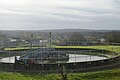
 Edenbridge Sewage Works - geograph.org.uk - 2265312.jpg 640 × 430; 109 KB
-
 Edenbridge Sewage Works - geograph.org.uk - 3546663.jpg 640 × 430; 55 KB
-
 Edenbridge Sewage Works - geograph.org.uk - 4061068.jpg 640 × 358; 45 KB
-
 Edenbridge Sewage Works - geograph.org.uk - 5098810.jpg 640 × 426; 64 KB
-
 Edenbridge Sewage Works - geograph.org.uk - 5135626.jpg 640 × 426; 46 KB
-
 Edenbridge Sewage Works - geograph.org.uk - 5419750.jpg 640 × 426; 42 KB
-
 Edenbridge Sewage Works - geograph.org.uk - 5664970.jpg 640 × 334; 35 KB
-
 Edenbridge Sewage Works - geograph.org.uk - 6441572.jpg 1,024 × 681; 129 KB
-
 Edenbridge Station - geograph.org.uk - 5340038.jpg 640 × 426; 74 KB
-
 Edenbridge Station - geograph.org.uk - 5659981.jpg 640 × 426; 75 KB
-
 Edenbridge Station - geograph.org.uk - 5664969.jpg 640 × 426; 52 KB
-
 Edenbridge Town Railway Station - geograph.org.uk - 5355609.jpg 3,264 × 2,448; 1.77 MB
-
 Edenbridge Village Sign - geograph.org.uk - 1868040.jpg 2,304 × 3,072; 1.76 MB
-
 Edenbridge, Kent in 2008.jpg 640 × 430; 54 KB
-
 Enclosed footpath - geograph.org.uk - 4013945.jpg 640 × 430; 91 KB
-
 Entering Edenbridge, Crouch House Rd - geograph.org.uk - 3979350.jpg 640 × 430; 87 KB
-
 Entering Kent, Marsh Green Rd - geograph.org.uk - 4013942.jpg 640 × 430; 88 KB
-
 Entering Marsh Green, Marsh Green Rd - geograph.org.uk - 4013933.jpg 640 × 430; 86 KB
-
 Enterprise Way, Edenbridge - geograph.org.uk - 1713169.jpg 640 × 427; 74 KB
-
 Fairmead Road, Marlpit Hill - geograph.org.uk - 5355556.jpg 3,264 × 2,448; 3.81 MB
-
 Farm buildings, Skeynes Park - geograph.org.uk - 3979491.jpg 640 × 430; 54 KB
-
 Farmland - geograph.org.uk - 6723745.jpg 1,024 × 684; 134 KB
-
 Farmland and woodland near Hilders - geograph.org.uk - 3972242.jpg 640 × 430; 76 KB
-
 Farmland by railway line - geograph.org.uk - 6485675.jpg 1,024 × 684; 101 KB
-
 Farmland by the railway - geograph.org.uk - 2929383.jpg 640 × 430; 57 KB
-
 Farmland by the railway - geograph.org.uk - 4792664.jpg 640 × 426; 54 KB
-
 Farmland by the railway line - geograph.org.uk - 3369190.jpg 640 × 430; 56 KB
-
 Farmland by the railway line - geograph.org.uk - 3945659.jpg 640 × 430; 54 KB
-
 Farmland near Cauk Wood - geograph.org.uk - 4061070.jpg 640 × 430; 33 KB
-
 Farmland near Troy Town - geograph.org.uk - 4951192.jpg 640 × 426; 51 KB
-
 Farmland south of Hilders Lane - geograph.org.uk - 4056211.jpg 640 × 430; 83 KB
-
 Farmland, Greybury Farm - geograph.org.uk - 6723739.jpg 1,024 × 684; 137 KB
-
 Farmland, Hamsell Mead Farm - geograph.org.uk - 3546668.jpg 640 × 430; 39 KB
-
 Farmland, Skeynes Park - geograph.org.uk - 3979487.jpg 640 × 430; 62 KB
-
 Field - geograph.org.uk - 4790023.jpg 640 × 426; 51 KB
-
 Field - geograph.org.uk - 4790025.jpg 640 × 426; 51 KB
-
 Field by the Roman Road - geograph.org.uk - 4147887.jpg 640 × 430; 66 KB
-
 Field by the Roman Road - geograph.org.uk - 4147889.jpg 640 × 430; 60 KB
-
 Field by the Roman Road - geograph.org.uk - 4147895.jpg 640 × 430; 82 KB
-
 Field entrance near Shernden Oast Farm - geograph.org.uk - 6606640.jpg 3,829 × 2,871; 2.11 MB
-
 Field near Marlpit Hill - geograph.org.uk - 5340040.jpg 640 × 426; 75 KB
-
 Field next to Swan Lane Farm - geograph.org.uk - 5335828.jpg 4,000 × 3,000; 4.76 MB
-
 Field north of Marsh Green - geograph.org.uk - 4009632.jpg 640 × 430; 56 KB
-
 Field north of Marsh Green - geograph.org.uk - 4009645.jpg 640 × 430; 64 KB
-
 Field north of the railway line - geograph.org.uk - 3945666.jpg 640 × 430; 68 KB
-
 Field of wheat - geograph.org.uk - 4147910.jpg 640 × 430; 82 KB
-
 Field of Wheat - geograph.org.uk - 6723754.jpg 1,024 × 685; 149 KB
-
 Field south of Hilders - geograph.org.uk - 3972247.jpg 640 × 430; 80 KB
-
 Field west of Edenbridge - geograph.org.uk - 3369204.jpg 640 × 430; 52 KB
-
 Field, Marlpit Hill - geograph.org.uk - 4951183.jpg 640 × 426; 51 KB
-
 Fields behind Round House Farm - geograph.org.uk - 2497430.jpg 640 × 480; 128 KB
-
 Fircroft Way - geograph.org.uk - 1713183.jpg 640 × 427; 54 KB
-
 Flower-filled meadow next to the Eden Valley Walk - geograph.org.uk - 5449871.jpg 4,000 × 3,000; 4.58 MB
-
 Flowering hawthorn by a pond - geograph.org.uk - 5375514.jpg 4,000 × 3,000; 4.78 MB
-
 Footbridge near Clatfields - geograph.org.uk - 1869431.jpg 3,072 × 2,304; 3.18 MB
-
 Footbridge near Hever Road - geograph.org.uk - 1869519.jpg 3,072 × 2,304; 2.37 MB
-
 Footbridge near Old Barn Farm - geograph.org.uk - 1869506.jpg 3,072 × 2,304; 2.87 MB
-
 Footbridge on footpath SR593 - geograph.org.uk - 2493653.jpg 640 × 480; 191 KB
-
 Footbridge on footpath SR594 - geograph.org.uk - 2493631.jpg 640 × 480; 149 KB
-
 Footbridge over Kent Brook - geograph.org.uk - 5327366.jpg 4,000 × 3,000; 4.81 MB
-
 Footbridge over the Kent Brook - geograph.org.uk - 1867989.jpg 3,072 × 2,304; 2.68 MB
-
 Footbridge towards Church Street - geograph.org.uk - 1868049.jpg 3,072 × 2,304; 2.34 MB
-
 Footbridge, Edenbridge Station - geograph.org.uk - 4061057.jpg 640 × 430; 70 KB
-
 Footbridge, Lydens Farm - geograph.org.uk - 4156575.jpg 640 × 430; 104 KB
-
 Footpath alongside the railway line - geograph.org.uk - 5375512.jpg 4,000 × 3,000; 4.69 MB
-
 Footpath leading to a railway foot crossing - geograph.org.uk - 5335183.jpg 4,000 × 3,000; 4.8 MB
-
 Footpath near Delaware Farm - geograph.org.uk - 5334185.jpg 4,000 × 3,000; 4.87 MB
-
 Footpath near Howlets Farm - geograph.org.uk - 6606642.jpg 4,000 × 3,000; 4.6 MB
-
 Footpath north-east of Edenbridge - geograph.org.uk - 5363455.jpg 4,000 × 3,000; 4.85 MB
-
 Footpath sign along Hilders Lane - geograph.org.uk - 5336335.jpg 4,000 × 3,000; 4.81 MB
-
 Footpath steps in a railway cutting - geograph.org.uk - 6485671.jpg 1,024 × 684; 257 KB
-
 Footpath to Appledore - geograph.org.uk - 5366030.jpg 4,000 × 3,000; 4.58 MB
-
 Footpath to Medhurst Row - geograph.org.uk - 5334175.jpg 4,000 × 3,000; 4.63 MB
-
 Footpath towards Edenbridge - geograph.org.uk - 5335126.jpg 4,000 × 3,000; 4.69 MB
-
 Footpath, Edenbridge Millennium Wood - geograph.org.uk - 5357917.jpg 3,264 × 2,448; 2.93 MB
-
 Forge Croft, Edenbridge - geograph.org.uk - 1713901.jpg 640 × 427; 62 KB
-
 Forge Croft, Edenbridge - geograph.org.uk - 1713905.jpg 640 × 427; 60 KB
-
 Former pillbox next to Eden Valley Walk - geograph.org.uk - 5326067.jpg 4,000 × 3,000; 4.82 MB
-
 Four Elms Rd, Edenbridge - geograph.org.uk - 1713245.jpg 640 × 427; 70 KB
-
 Four Elms Road, Edenbridge - geograph.org.uk - 2092659.jpg 3,072 × 2,304; 2.3 MB
-
 Four Elms Road, Edenbridge - geograph.org.uk - 2092663.jpg 3,072 × 2,304; 2.41 MB


.jpg)


_(September_2012).JPG)


_-_geograph.org.uk_-_3988949.jpg)


