Category:Ellerby, East Riding of Yorkshire
Jump to navigation
Jump to search
civil parish in the East Riding of Yorkshire, England   | |||||
| Upload media | |||||
| Instance of | |||||
|---|---|---|---|---|---|
| Location | East Riding of Yorkshire, Yorkshire and the Humber, England | ||||
 | |||||
Subcategories
This category has the following 4 subcategories, out of 4 total.
Media in category "Ellerby, East Riding of Yorkshire"
The following 170 files are in this category, out of 170 total.
-
 1906 Cottages, Ellerby - geograph.org.uk - 775467.jpg 640 × 476; 133 KB
-
 A footpath heading to New Ellerby - geograph.org.uk - 2745626.jpg 800 × 642; 152 KB
-
 A lay-by on the A165 - geograph.org.uk - 2151696.jpg 800 × 600; 290 KB
-
 A lay-by on the A165 - geograph.org.uk - 2151701.jpg 800 × 600; 345 KB
-

-
 A sea of yellow - geograph.org.uk - 6135101.jpg 1,024 × 768; 317 KB
-
 A Terragator near New Ellerby - geograph.org.uk - 4882890.jpg 1,200 × 799; 446 KB
-
 A Terragator near New Ellerby - geograph.org.uk - 4882896.jpg 1,200 × 799; 437 KB
-
 A Terragator near New Ellerby - geograph.org.uk - 4882903.jpg 1,200 × 799; 356 KB
-

-
 A165 North - geograph.org.uk - 652277.jpg 640 × 480; 112 KB
-
 A165 South - geograph.org.uk - 652286.jpg 640 × 480; 96 KB
-
 A165 towards Hull - geograph.org.uk - 1528067.jpg 640 × 480; 81 KB
-
 Avenue to Dowthorpe Hall - geograph.org.uk - 963263.jpg 640 × 564; 218 KB
-
 Blue Bell Old Ellerby on a wet day - geograph.org.uk - 3975699.jpg 3,264 × 2,448; 1.3 MB
-
 Blue Bell, Old Ellerby - geograph.org.uk - 2272365.jpg 640 × 480; 59 KB
-
 Church of St James, Old Ellerby - geograph.org.uk - 6369317.jpg 800 × 517; 108 KB
-

-

-
 Crab Tree Lane - geograph.org.uk - 3848860.jpg 4,000 × 3,000; 3.19 MB
-
 Crab Tree Lane passing through Old Ellerby - geograph.org.uk - 4987036.jpg 3,833 × 2,857; 3.37 MB
-
 Crab Tree Lane towards Old Ellerby - geograph.org.uk - 6368239.jpg 800 × 600; 125 KB
-
 Crab Tree Lane, Old Ellerby - geograph.org.uk - 6366189.jpg 4,392 × 3,274; 3.02 MB
-

-
 Deep ploughed field by Roehill Wood - geograph.org.uk - 5503925.jpg 1,024 × 768; 168 KB
-

-

-
 Elizabeth II postbox on Langthorpe Road, New Ellerby - geograph.org.uk - 6362823.jpg 1,745 × 3,451; 1.12 MB
-
 Elizabeth II postbox on Marton Road, Ellerby - geograph.org.uk - 6361805.jpg 1,899 × 3,472; 1.54 MB
-
 Ellerby Gatehouse - geograph.org.uk - 2099243.jpg 800 × 600; 271 KB
-
 Ellerby Gatehouse - geograph.org.uk - 3848330.jpg 4,000 × 3,000; 3.41 MB
-
 Ellerby Grange - geograph.org.uk - 2100016.jpg 800 × 600; 277 KB
-
 Ellerby Grange Farm - geograph.org.uk - 2100017.jpg 800 × 600; 228 KB
-
 Ellerby Grange Farm - geograph.org.uk - 6369318.jpg 800 × 516; 83 KB
-
 Ellerby Roll of Honour - geograph.org.uk - 5260457.jpg 1,200 × 799; 335 KB
-
 Ellerby, East Riding of Yorkshire UK parish locator map.svg 1,425 × 1,107; 1.68 MB
-
 Ellerby, Yorkshire - geograph.org.uk - 3348947.jpg 3,230 × 2,404; 4.2 MB
-
 Ellerby, Yorkshire - geograph.org.uk - 3348954.jpg 3,264 × 2,448; 3.64 MB
-
 Ellerby, Yorkshire - geograph.org.uk - 3348974.jpg 3,264 × 2,448; 3.3 MB
-
 Ellerby, Yorkshire - geograph.org.uk - 3375666.jpg 3,200 × 2,360; 4.42 MB
-
 Ellerby, Yorkshire - geograph.org.uk - 3375672.jpg 2,448 × 3,264; 4.67 MB
-
 Ellerby, Yorkshire - geograph.org.uk - 3400259.jpg 3,262 × 2,446; 3.59 MB
-
 Ellerby, Yorkshire - geograph.org.uk - 3400292.jpg 3,264 × 2,448; 4.3 MB
-
 Ellerby, Yorkshire - geograph.org.uk - 3400302.jpg 3,264 × 2,448; 3.09 MB
-
 Ellerby, Yorkshire - geograph.org.uk - 3400309.jpg 3,264 × 2,446; 3.56 MB
-
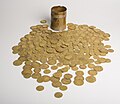 EllerbyHoard.jpg 500 × 433; 44 KB
-
 Entering Old Ellerby - geograph.org.uk - 6368241.jpg 640 × 396; 74 KB
-
 Entrance to Woodhall Park - geograph.org.uk - 4673892.jpg 1,024 × 768; 280 KB
-
 Farm buildings at Ellerby Grange - geograph.org.uk - 6135092.jpg 1,024 × 768; 235 KB
-
 Farm driveway, near Burton Constable - geograph.org.uk - 5048446.jpg 640 × 480; 500 KB
-
 Field edge near Swine - geograph.org.uk - 963296.jpg 499 × 640; 214 KB
-
 Fields east of Old Ellerby - geograph.org.uk - 4673890.jpg 1,024 × 715; 135 KB
-
 Fields near New Ellerby - geograph.org.uk - 2700608.jpg 500 × 640; 193 KB
-
 Flytip and miscanthus, near Ellerby - geograph.org.uk - 5048448.jpg 519 × 640; 505 KB
-
 Font in St James Church - geograph.org.uk - 5260220.jpg 799 × 1,200; 219 KB
-
 Footpath and recently planted trees, Old Ellerby - geograph.org.uk - 4673887.jpg 1,024 × 768; 201 KB
-
 Footpath to Langthorpe Hall - geograph.org.uk - 4673886.jpg 1,024 × 768; 190 KB
-
 Former cattle dock, Skirlaugh Station - geograph.org.uk - 4673883.jpg 1,024 × 768; 342 KB
-
 Gas Plant on Crab Tree Lane - geograph.org.uk - 3848857.jpg 4,000 × 3,000; 2.64 MB
-
 Gas pumping station - geograph.org.uk - 1209851.jpg 640 × 500; 444 KB
-
 Granville Terrace, New Ellerby - geograph.org.uk - 5260445.jpg 1,200 × 799; 373 KB
-
 Grass field off Swine Lane near Skirlaugh - geograph.org.uk - 5688579.jpg 1,024 × 768; 164 KB
-
 Green Lane - Oubrough to Swine - geograph.org.uk - 1209826.jpg 640 × 427; 328 KB
-
 Green Lane off the A165 - geograph.org.uk - 1528111.jpg 640 × 480; 111 KB
-
 Green Lane, Oubrough - geograph.org.uk - 775434.jpg 640 × 487; 129 KB
-
 Hornsea Rail Trail - geograph.org.uk - 1528072.jpg 640 × 480; 152 KB
-
 Hornsea Rail Trail - geograph.org.uk - 6135087.jpg 1,024 × 768; 277 KB
-
 Hornsea Rail Trail - geograph.org.uk - 6135098.jpg 1,024 × 768; 397 KB
-
 Hornsea Rail Trail - geograph.org.uk - 6135104.jpg 1,024 × 768; 348 KB
-
 Hornsea Rail Trail - geograph.org.uk - 6249615.jpg 1,024 × 768; 353 KB
-
 Hornsea Rail Trail going SE from New Ellerby - geograph.org.uk - 3975721.jpg 3,264 × 2,448; 2.27 MB
-
 Hornsea Rail Trail toward A165 - geograph.org.uk - 3848620.jpg 4,000 × 3,000; 4.98 MB
-
 Hornsea Rail Trail towards Ellerby - geograph.org.uk - 2099256.jpg 800 × 600; 333 KB
-
 Hornsea Rail Trail ^10 - geograph.org.uk - 5024174.jpg 640 × 480; 141 KB
-
 Hornsea Rail Trail ^11 - geograph.org.uk - 5024175.jpg 640 × 480; 169 KB
-
 Hornsea Rail Trail ^12 - geograph.org.uk - 5024176.jpg 640 × 480; 162 KB
-
 Hornsea Rail Trail ^13 - geograph.org.uk - 5024177.jpg 640 × 480; 134 KB
-
 Hornsea Rail Trail ^14 - geograph.org.uk - 5024178.jpg 640 × 480; 90 KB
-
 Hornsea Rail Trail ^9 - geograph.org.uk - 5024173.jpg 640 × 480; 161 KB
-
 Hornsea Rail Trail, near Ellerby - geograph.org.uk - 4439217.jpg 467 × 640; 200 KB
-
 Houses on Lambwath Lane, New Ellerby - geograph.org.uk - 6362825.jpg 5,184 × 3,888; 3.51 MB
-
 Houses on Lambwath Lane, New Ellerby - geograph.org.uk - 6364100.jpg 800 × 519; 73 KB
-
 Houses on Marton Road, Ellerby - geograph.org.uk - 6361807.jpg 640 × 480; 69 KB
-
 Houses on The Green, Old Ellerby - geograph.org.uk - 6369310.jpg 800 × 567; 134 KB
-

-
 Jackey Lane, near Old Ellerby - geograph.org.uk - 4439259.jpg 640 × 509; 179 KB
-

-

-
 Langthorpe Road, New Ellerby - geograph.org.uk - 6362824.jpg 4,534 × 3,485; 2.42 MB
-
 Langthorpe Road, New Ellerby - geograph.org.uk - 6362827.jpg 5,184 × 3,888; 2.79 MB
-

-
 Looking west from Four Lane Ends - geograph.org.uk - 3260991.jpg 4,323 × 2,594; 2.94 MB
-
 Maize field - geograph.org.uk - 2005198.jpg 640 × 480; 104 KB
-
 Marker post at Roe Hill - geograph.org.uk - 4885391.jpg 1,200 × 799; 557 KB
-
 Marton Road after a heavy shower - geograph.org.uk - 5668583.jpg 1,024 × 768; 129 KB
-
 Marton Road from Jackey Lane - geograph.org.uk - 2100415.jpg 640 × 480; 65 KB
-
 Marton Road, Ellerby - geograph.org.uk - 6361809.jpg 4,757 × 2,911; 2.02 MB
-
 Marton Road, Ellerby - geograph.org.uk - 6361811.jpg 5,184 × 3,888; 3.47 MB
-
 Minor road meets A165 - geograph.org.uk - 1209839.jpg 640 × 354; 245 KB
-
 New Ellerby from the Hornsea Rail Trail - geograph.org.uk - 2099264.jpg 800 × 600; 213 KB
-
 New Ellerby Methodist Church - geograph.org.uk - 5048310.jpg 640 × 640; 457 KB
-
 New Ellerby Methodist Church - geograph.org.uk - 5260633.jpg 1,200 × 799; 207 KB
-
 New Ellerby Methodist Church - geograph.org.uk - 5260637.jpg 1,200 × 799; 224 KB
-
 New England - geograph.org.uk - 32528.jpg 640 × 480; 97 KB
-
 New England field edge - geograph.org.uk - 963266.jpg 640 × 480; 203 KB
-
 New plantation near Ellerby Grange - geograph.org.uk - 4676626.jpg 1,024 × 768; 168 KB
-
 Old Ellerby village entrance sign - geograph.org.uk - 2272361.jpg 640 × 480; 74 KB
-
 Old Ellerby, Yorkshire - geograph.org.uk - 3400233.jpg 3,182 × 2,404; 2.07 MB
-
 Old Ellerby, Yorkshire - geograph.org.uk - 3400275.jpg 3,260 × 2,444; 3.36 MB
-
 Order your Christmas turkey here - geograph.org.uk - 2151715.jpg 800 × 600; 361 KB
-
 Oubrough Lane - geograph.org.uk - 775432.jpg 443 × 640; 134 KB
-
 Oubrough Lane Water Tower - geograph.org.uk - 775433.jpg 640 × 458; 96 KB
-
 Over field to Lodge Farm - geograph.org.uk - 3975654.jpg 3,264 × 2,448; 1.52 MB
-
 Over field to Woodcock Wood - geograph.org.uk - 4987058.jpg 4,608 × 3,456; 4.99 MB
-
 Parish boundary - geograph.org.uk - 4673912.jpg 1,024 × 768; 177 KB
-
 Path leading to Fox Covert - geograph.org.uk - 4885405.jpg 1,200 × 799; 380 KB
-
 Path leading to Fox Covert - geograph.org.uk - 4885412.jpg 1,200 × 799; 460 KB
-
 Path leading to Fox Covert - geograph.org.uk - 4885422.jpg 1,200 × 799; 294 KB
-
 Path leading to Old Ellerby - geograph.org.uk - 4885755.jpg 1,200 × 799; 306 KB
-
 Path leading to Old Ellerby - geograph.org.uk - 4885762.jpg 1,200 × 799; 323 KB
-
 Path leading to Old Ellerby - geograph.org.uk - 4885794.jpg 1,200 × 799; 293 KB
-
 Ramer's Plantation, Woodhall Park - geograph.org.uk - 551290.jpg 640 × 480; 120 KB
-
 Roehill Farm (ruin) - geograph.org.uk - 3975619.jpg 3,264 × 2,448; 1.66 MB
-
 Roehill Farm - geograph.org.uk - 721576.jpg 640 × 454; 92 KB
-
 Roehill Farm - geograph.org.uk - 721579.jpg 640 × 445; 109 KB
-
 Ruins of Roehill Farm - geograph.org.uk - 4885396.jpg 1,200 × 799; 443 KB
-
 Sign for the Blue Bell, Old Ellerby - geograph.org.uk - 6368244.jpg 620 × 800; 83 KB
-

-
 Site of Ellerby Station - geograph.org.uk - 4693115.jpg 1,024 × 768; 290 KB
-
 Skirlaugh Road, Ellerby - geograph.org.uk - 551343.jpg 640 × 288; 42 KB
-
 Skirlaugh Road, Old Ellerby - geograph.org.uk - 4439230.jpg 640 × 479; 154 KB
-
 Skirlaugh Station - geograph.org.uk - 2165859.jpg 640 × 427; 163 KB
-
 Solar panels at Ellerby Grange, E Yorks - geograph.org.uk - 4439221.jpg 640 × 480; 176 KB
-
 St James Church - geograph.org.uk - 5260208.jpg 1,200 × 799; 327 KB
-
 St James Church - geograph.org.uk - 5260211.jpg 1,200 × 799; 220 KB
-
 St James Church - geograph.org.uk - 5260268.jpg 1,200 × 799; 213 KB
-
 St James Church First World War Memorial Plaque - geograph.org.uk - 5260216.jpg 1,200 × 781; 361 KB
-
 St James Church, Old Ellerby - geograph.org.uk - 5048450.jpg 640 × 467; 410 KB
-
 Stag View Nurseries, Old Ellerby - geograph.org.uk - 6368240.jpg 800 × 484; 74 KB
-

-
 Sunset from Four Lane Ends - geograph.org.uk - 3260992.jpg 4,606 × 2,764; 2.83 MB
-
 The Blue Bell Old Ellerby - geograph.org.uk - 4987031.jpg 4,608 × 3,456; 4.65 MB
-
 The Blue Bell, Old Ellerby - geograph.org.uk - 5048451.jpg 640 × 458; 311 KB
-
 The Blue Bell, Old Ellerby - geograph.org.uk - 6368243.jpg 800 × 568; 76 KB
-
 The Footpath up Roe Hill to Old Ellerby - geograph.org.uk - 1833417.jpg 3,200 × 2,400; 3.24 MB
-
 The former Skirlaugh Station - geograph.org.uk - 6369335.jpg 800 × 600; 209 KB
-
 The Gardeners Country Inn, Oubrough - geograph.org.uk - 775435.jpg 640 × 443; 122 KB
-
 The Green, Old Ellerby - geograph.org.uk - 2100393.jpg 800 × 600; 309 KB
-
 The Hornsea Rail Trail - geograph.org.uk - 2421280.jpg 2,736 × 3,648; 4.36 MB
-
 The Hornsea Rail Trail - geograph.org.uk - 4676622.jpg 1,024 × 768; 234 KB
-
 The Hornsea Rail Trail towards the A165 - geograph.org.uk - 2099232.jpg 800 × 600; 345 KB
-
 The Hull to Hornsea rail trail - geograph.org.uk - 2745472.jpg 800 × 600; 139 KB
-
 The Old Hull to Hornsea Railway Track at New Ellerby - geograph.org.uk - 2169569.jpg 3,648 × 2,736; 3.46 MB
-
 The path comes out at Crab Tree Lane - geograph.org.uk - 2100384.jpg 800 × 600; 334 KB
-
 The Path to Roehill - geograph.org.uk - 5389957.jpg 4,608 × 3,456; 7.57 MB
-
 The Railway Inn, New Ellerby - geograph.org.uk - 6364105.jpg 800 × 522; 73 KB
-
 The ruined farm at Roe Hill with Old Wood beyond - geograph.org.uk - 3975637.jpg 3,264 × 2,448; 2.14 MB
-
 The ruins of Roehill Farm - geograph.org.uk - 5503920.jpg 1,024 × 768; 249 KB
-
 The Trail crosses the A165 Oubrough Lane - geograph.org.uk - 2099237.jpg 800 × 600; 358 KB
-
 Track through Bog Wood and field to Wood Hall - geograph.org.uk - 3975688.jpg 3,264 × 2,448; 2.85 MB
-
 Track to Dowthorpe Hall - geograph.org.uk - 1528069.jpg 640 × 480; 81 KB
-
 Track to Wood Hall - geograph.org.uk - 2005195.jpg 640 × 480; 83 KB
-
 Tram lining on field footpath toward Old Ellerby - geograph.org.uk - 4987050.jpg 4,606 × 3,454; 4.77 MB
-
 Trans Pennine Trail near Dowthorpe Hall - geograph.org.uk - 6369331.jpg 800 × 600; 159 KB
-
 View towards a drain - geograph.org.uk - 4673884.jpg 1,024 × 768; 225 KB
-
 Walking north towards New Ellerby - geograph.org.uk - 2747300.jpg 800 × 600; 115 KB
-
 Wheat and Lodge, near Wood Hall - geograph.org.uk - 5048452.jpg 640 × 500; 517 KB
-
 Woodhall Farm near Old Ellerby - geograph.org.uk - 4885749.jpg 1,200 × 799; 266 KB
-
 Woodhall Park - geograph.org.uk - 3848868.jpg 4,000 × 3,000; 2.99 MB
-
 Woodhall Woods - geograph.org.uk - 426837.jpg 640 × 433; 77 KB


_-_geograph.org.uk_-_3975619.jpg)


