Category:Elmore County, Idaho
Sari la navigare
Sari la căutare
Counties of Idaho: Ada · Adams · Bannock · Bear Lake · Benewah · Bingham · Blaine · Boise · Bonner · Bonneville · Boundary · Butte · Camas · Canyon · Caribou · Cassia · Clark · Clearwater · Custer · Elmore · Franklin · Fremont · Gem · Gooding · Idaho · Jefferson · Jerome · Kootenai · Latah · Lemhi · Lewis · Lincoln · Madison · Minidoka · Nez Perce · Oneida · Owyhee · Payette · Power · Shoshone · Teton · Twin Falls · Valley · Washington
comitat din Statele Unite ale Americii   | |||||
| Încarcă multimedia | |||||
| Este un/o | |||||
|---|---|---|---|---|---|
| Locul actual | Idaho, SUA | ||||
| Capitală | |||||
| Înființare |
| ||||
| Populație |
| ||||
| Suprafață |
| ||||
| Diferit(ă) de | |||||
| site oficial | |||||
 | |||||
English: Media related to Elmore County, Idaho, a county in southwestern Idaho, United States.
Subcategorii
Această categorie conține următoarele 13 subcategorii, dintr-un total de 13.
Fișiere media din categoria „Elmore County, Idaho”
Următoarele 48 fișiere se află în această categorie, dintr-un total de 48.
-
 Algae in snowfed creek on Bennett Mountain, Idaho 2.jpg 768x1.024; 97 KB
-
 Algae in snowfed creek on Bennett Mountain, Idaho.jpg 1.024x768; 106 KB
-
 AtlantaBirdsEye.JPG 1.536x2.048; 666 KB
-
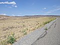
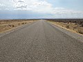
 Bennett Mountain Road transect (lower elevations, burned sites) (9662645095).jpg 4.608x3.456; 4,67 MB
-
 Bennett Mountain Road transect (lower elevations, unburned sites) (9662661327).jpg 4.608x3.456; 4,79 MB
-

-

-
-

-
 Bennett Mountain Road transect 12 (lower elevations, burned sites) (9665897642).jpg 4.608x3.456; 4,65 MB
-
 Bennett Mountain Road transect 12 (lower elevations, burned sites) (9665899408).jpg 4.608x3.456; 4,63 MB
-

-
 Bennett Mountain Road transect 3 (upper elevations) (9662376765).jpg 4.608x3.456; 4,61 MB
-
 Bennett Mountain Road transect 4a (lower elevations, burned sites) (9662634921).jpg 4.608x3.456; 4,53 MB
-
 Bennett Mountain Road transect 4a (lower elevations, burned sites) (9665868520).jpg 4.608x3.456; 4,51 MB
-
 Bennett Mountain Road transect 5a (lower elevations, burned sites) (9662639649).jpg 4.608x3.456; 4,52 MB
-

-

-
-
-
-
 Bennett Mountain Road transect 7a (lower elevations, burned sites) (9665881774).jpg 4.608x3.456; 4,67 MB
-
 Bennett Mountain Road transect 7a (lower elevations, burned sites) (9665882860).jpg 4.608x3.456; 4,46 MB
-

-

-
 Bennett Mountain Road transect 8 (lower elevations, unburned sites) (9662651655).jpg 4.608x3.456; 4,66 MB
-
-
-

-

-
 Crater Rings Idaho.jpg 300x197; 20 KB
-
 Crater Rings Panorama, Elmore County Idaho.jpg 2.445x720; 1,47 MB
-
 Huston-Bursaw 000118 153516 492991 4578 (36169334242).jpg 1.920x1.080; 1,03 MB
-
 I-84 Mountain Home.jpg 4.608x2.565; 1,93 MB
-
 IDAHO-M-0001 Boise Basin.jpg 2.002x1.463; 556 KB
-
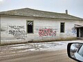 MayfieldIdahoGraffiti.jpg 4.160x3.120; 4,15 MB
-
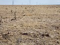
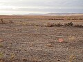 Mountain Home burned sagebrush steppe (9723130571).jpg 4.608x3.456; 4,52 MB
-
 Mountain Home burned sagebrush steppe (9723131593).jpg 4.608x3.456; 4,48 MB
-
 Mountain Home burned sagebrush steppe (9723132553).jpg 4.608x3.456; 4,4 MB
-
 Mountain Home burned sagebrush steppe (9726360274).jpg 4.608x3.456; 4,7 MB
-
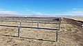
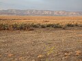
 Mountain Home sagebrush steppe with intact soil crusts (9723787599).jpg 4.608x3.456; 4,65 MB
-
 Mountain Home sagebrush steppe with intact soil crusts (9727013488).jpg 4.608x3.456; 4,6 MB
-
 Mountain Home sagebrush steppe with intact soil crusts (9727014592).jpg 4.608x3.456; 4,76 MB
-
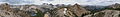 Sawtooth Panorama 1.JPG 11.889x1.683; 15,45 MB
-
 Sky view at Rest Area I-84 Idaho - panoramio.jpg 2.304x1.728; 2 MB
-
 Soil survey of Elmore County area, Idaho - parts of Elmore, Owyhee, and Ada Counties (IA soilsurveyofelmo00noeh).pdf 1.802 × 2.191, 756 de pagini; 90,63 MB
-
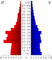 USA Elmore County, Idaho age pyramid.svg 520x600; 9 KB
-
 낙원계곡 Paradise Valley I-84 Idaho - panoramio.jpg 2.304x1.728; 1,78 MB


.jpg)


.jpg)
.jpg)
.jpg)
.jpg)
.jpg)
.jpg)
.jpg)


_(9662645095).jpg)
_(9662661327).jpg)
_(9662658137).jpg)
_(9665891564).jpg)
_(9662664323).jpg)
_(9665894780).jpg)
_(9665897642).jpg)
_(9665899408).jpg)
_(9662669043).jpg)
_(9662376765).jpg)
_(9662634921).jpg)
_(9665868520).jpg)
_(9662639649).jpg)
_(9665869724).jpg)
_(9665870846).jpg)
_%26_6b_(right)_(lower_elevations,_burned_sites)_(9662641073).jpg)
_(9665874688).jpg)
_(9665875782).jpg)
_(9665881774).jpg)
_(9665882860).jpg)
_(9665878916).jpg)
_(9665880398).jpg)
_(9662651655).jpg)
_and_9b_(right)_(lower_elevations,_burned_sites)_(9665886556).jpg)
_(9662655449).jpg)
_(9662652987).jpg)
_(9665888956).jpg)