Category:Elton on the Hill
Jump to navigation
Jump to search
English: Elton on the Hill is a small village and civil parish in the Vale of Belvoir, about being the nearest village on the southern side. Elton has a population of about 75 and is in the Rushcliffe district.. It has two pubs and one church but no other public buildings. The Medieval church is named St. Michael and All Angels' Church and the nearest station to the village is the Elton and Orston railway station. The village straddles the A52.
village in Nottinghamshire, England, United Kingdom  | |||||
| Upload media | |||||
| Instance of | |||||
|---|---|---|---|---|---|
| Location | Rushcliffe, Nottinghamshire, East Midlands, England | ||||
 | |||||
Subcategories
This category has the following 2 subcategories, out of 2 total.
E
Media in category "Elton on the Hill"
The following 36 files are in this category, out of 36 total.
-
 A Norwich to Liverpool train east of Aslockton - geograph.org.uk - 4953183.jpg 1,024 × 768; 142 KB
-
 A52 at Elton - geograph.org.uk - 256832.jpg 640 × 427; 94 KB
-
 A52 Entering Elton on the Hill - geograph.org.uk - 4225928.jpg 640 × 480; 270 KB
-
 A52 towards Grantham - geograph.org.uk - 2889429.jpg 640 × 480; 68 KB
-
 A52 towards Nottingham - geograph.org.uk - 2888344.jpg 640 × 480; 64 KB
-
 A52 Westbound - geograph.org.uk - 4226001.jpg 640 × 480; 243 KB
-
 Bench mark, Elton on the Hill church - geograph.org.uk - 3925827.jpg 1,280 × 960; 390 KB
-
 Bon Moor - geograph.org.uk - 4312924.jpg 640 × 430; 44 KB
-
 Bridge NOG1-23 - geograph.org.uk - 4951977.jpg 1,024 × 768; 222 KB
-
 Bridleway to Orston - geograph.org.uk - 4953185.jpg 1,024 × 768; 220 KB
-
 Bridleway to Orston - geograph.org.uk - 4953189.jpg 1,024 × 768; 256 KB
-
 Bridleway to Orston - geograph.org.uk - 4953191.jpg 1,024 × 768; 220 KB
-
 Chipsholm on the A52 - geograph.org.uk - 2889428.jpg 640 × 384; 47 KB
-
 Colman Hill - geograph.org.uk - 4950165.jpg 1,024 × 768; 202 KB
-
 County boundary - geograph.org.uk - 6105983.jpg 1,024 × 768; 306 KB
-
 Crossroads near Elton-on-the-Hill - geograph.org.uk - 3925809.jpg 1,280 × 960; 319 KB
-
 Farmland near Elton on the Hill - geograph.org.uk - 4159677.jpg 494 × 640; 154 KB
-
 Footpath alongside The Grimmer - geograph.org.uk - 6105989.jpg 1,024 × 768; 241 KB
-
 Former lodge, Elton on the Hill - geograph.org.uk - 4158505.jpg 566 × 640; 186 KB
-
 Gates, Elton on the Hill - geograph.org.uk - 4158490.jpg 640 × 631; 301 KB
-
 Light mist in the Vale - geograph.org.uk - 5194266.jpg 1,280 × 795; 220 KB
-
 Little India - geograph.org.uk - 3113347.jpg 640 × 427; 83 KB
-
 Manor Arms Elton.JPG 3,072 × 2,048; 2.61 MB
-
 Minor road towards Belvoir - geograph.org.uk - 2888352.jpg 640 × 480; 67 KB
-
 Moor Lane - geograph.org.uk - 4953193.jpg 1,024 × 768; 363 KB
-
 Pond by the railway - geograph.org.uk - 4950170.jpg 1,024 × 768; 245 KB
-
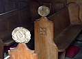 Poppy Head pew ends, Elton-on-the-Hill - geograph.org.uk - 3925854.jpg 1,280 × 927; 165 KB
-
 Sign of The Manor Arms - geograph.org.uk - 3131827.jpg 640 × 427; 106 KB
-
 Sutton crossroads - geograph.org.uk - 1045528.jpg 640 × 427; 75 KB
-
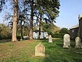 The churchyard, Elton on the Hill - geograph.org.uk - 6105014.jpg 1,024 × 768; 317 KB
-

-
 The path from nowhere - geograph.org.uk - 6105026.jpg 1,024 × 768; 313 KB
-
 The Vale of Belvoir Hotel - geograph.org.uk - 2888348.jpg 640 × 480; 71 KB
-
 Westbound A52 - geograph.org.uk - 4225997.jpg 640 × 480; 252 KB
-
 Westbound A52 leaving Elton on the Hill - geograph.org.uk - 4225930.jpg 640 × 480; 297 KB
-
 Farmland near Elton - geograph.org.uk - 256835.jpg 640 × 427; 67 KB


