Category:Englefield Green
Englefield Green is an elevated village in northern Surrey, England. It is home to Royal Holloway, the University of London, the south eastern corner of Windsor Great Park, borders the town of Egham and more tightly-clustered village of Virginia Water. Its nearest main commercial hubs are Staines upon Thames (2.5 miles (4 km)) and Windsor (4 miles (6 km)). The village grew from a hamlet in Egham in the 19th century, when much of it was sold off from the Great Park in the Crown Estate, and is mostly residential. Domestic gardens occupy a high proportion of land relative to national and regional averages and the village is not bisected by trunk transport infrastructure however is connected to the M25 motorway by the Egham by-pass of the A30 road and is centred 1 mile (1.6 km) from Egham railway station.
village britannique  | |||||
| Téléverser des médias | |||||
| Nature de l’élément | |||||
|---|---|---|---|---|---|
| Lieu | Borough de Runnymede, Surrey, Angleterre du Sud-Est, Angleterre | ||||
| Superficie |
| ||||
| site officiel | |||||
 | |||||
Sous-catégories
Cette catégorie comprend 9 sous-catégories, dont les 9 ci-dessous.
Média dans la catégorie « Englefield Green »
Cette catégorie comprend 50 fichiers, dont les 50 ci-dessous.
-
 Bishopsgate Evangelical Church in Kings Lane - geograph.org.uk - 1361799.jpg 480 × 640 ; 101 kio
-
 Bishopsgate road approaching the park gate. - geograph.org.uk - 1543959.jpg 640 × 480 ; 76 kio
-
 Bishopsgate Windsor Great Park - geograph.org.uk - 555553.jpg 640 × 425 ; 108 kio
-
 Castle Hill, Englefield Green.jpg 400 × 326 ; 107 kio
-
 Cattle grazing south of Kings Lane - geograph.org.uk - 1362244.jpg 640 × 444 ; 51 kio
-
 Comely Bank, Englefield Green, Surrey, the garden porch.png 1 004 × 691 ; 1,02 Mio
-
 Comely Bank, Englefield Green, Surrey, the verandah.png 1 000 × 695 ; 1,02 Mio
-
 Comely Bank, Englefield Green, Surrey.jpg 1 156 × 543 ; 180 kio
-
 Cumberland Gate, Windsor Great Park - geograph.org.uk - 122283.jpg 640 × 480 ; 213 kio
-
 Egham, UK - panoramio.jpg 4 000 × 3 000 ; 3,73 Mio
-
 Englefield Green cemetary - panoramio.jpg 1 374 × 282 ; 56 kio
-
 Englefield Green High Street - panoramio.jpg 1 389 × 268 ; 64 kio
-
 Entering Cooper's Hill Woods - geograph.org.uk - 1501484.jpg 640 × 480 ; 141 kio
-

-
-
-
 Glasshouse just off South Road - geograph.org.uk - 1362488.jpg 640 × 480 ; 82 kio
-
 Holly Tree Englefield Green - panoramio.jpg 600 × 450 ; 39 kio
-
 Horses on the hill, Englefield Green, Surrey - geograph.org.uk - 1533606.jpg 640 × 419 ; 91 kio
-
 Impressive house at the end of Laurel Avenue - geograph.org.uk - 1361642.jpg 640 × 480 ; 93 kio
-
 Jumbo jet soaring over Kings Lane Allotments - geograph.org.uk - 1356243.jpg 640 × 480 ; 87 kio
-
 Kings Lane Allotments - geograph.org.uk - 1356226.jpg 640 × 480 ; 91 kio
-
 Kings Lane open space - geograph.org.uk - 555492.jpg 640 × 425 ; 80 kio
-
 Lieutenant Colonel Poulett Somerset.jpg 800 × 941 ; 297 kio
-
 Looking westwards along Barley Mow Road - geograph.org.uk - 1357688.jpg 640 × 480 ; 96 kio
-
 Looking westwards along Kings Lane - geograph.org.uk - 1356281.jpg 480 × 640 ; 84 kio
-

-
 One-way system behind Englefield Green - geograph.org.uk - 1357611.jpg 640 × 480 ; 78 kio
-
 Park Close, Englefield Green, Ordnance Survey map 1935.jpg 3 925 × 3 750 ; 2,38 Mio
-
 Queen Elizabeth House in Torin Court - geograph.org.uk - 1360596.jpg 640 × 480 ; 53 kio
-
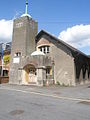
 Redundant church tower next to Saville Place - geograph.org.uk - 1359161.jpg 480 × 640 ; 70 kio
-
 Rental Notice Heath Lodge 1844.jpg 800 × 298 ; 146 kio
-
 Runnymede Meadows - panoramio.jpg 3 648 × 2 736 ; 5,43 Mio
-
 Savill Court Englefield Green.jpg 1 200 × 753 ; 258 kio
-
 Sign in Kings Lane - geograph.org.uk - 1356246.jpg 480 × 640 ; 131 kio
-

-

-
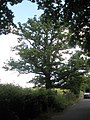 Splendid tree in Kings Lane - geograph.org.uk - 1362248.jpg 480 × 640 ; 107 kio
-
 St Cuthbert's RC Primary School - geograph.org.uk - 1362360.jpg 640 × 480 ; 74 kio
-
 St. Andrew, Englefield Green - geograph.org.uk - 932044.jpg 458 × 640 ; 73 kio
-
 Stables in Prospect Lane - geograph.org.uk - 1361720.jpg 640 × 480 ; 105 kio
-

-

-

-
 The Fox and Hounds, Bishopsgate - geograph.org.uk - 376861.jpg 640 × 480 ; 82 kio
-
 The Sun public house - geograph.org.uk - 555530.jpg 640 × 425 ; 88 kio
-
 The Sun, Wick Lane - geograph.org.uk - 1361770.jpg 640 × 480 ; 62 kio
-

-
 Winter Feed, Englefield Green, Surrey. - geograph.org.uk - 1533559.jpg 640 × 409 ; 111 kio
-
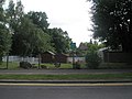
 Englefield Green Village Centre - geograph.org.uk - 1359156.jpg 480 × 640 ; 67 kio


_-_geograph.org.uk_-_1360373.jpg)
_-_geograph.org.uk_-_1360374.jpg)


