Category:Egham
Jump to navigation
Jump to search
town in the borough of Runnymede in Surrey, England  Y Stryd Fawr, Egham | |||||
| Upload media | |||||
| Instance of | |||||
|---|---|---|---|---|---|
| Location | Runnymede, Surrey, South East England, England | ||||
| Inception |
| ||||
| Area |
| ||||
| official website | |||||
 | |||||
Subcategories
This category has the following 18 subcategories, out of 18 total.
E
G
- Great Fosters (4 F)
M
P
R
- Rusham Park (27 F)
S
- Shops and restaurants in Egham (16 F)
- St John's Church, Egham (4 F)
- Streets in Egham (26 F)
T
- Thorpe Green, Surrey (2 F)
- Tower Garage, Egham (5 F)
- Truss's Island (3 F)
Media in category "Egham"
The following 129 files are in this category, out of 129 total.
-

-
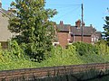 Across the tracks - geograph.org.uk - 3141586.jpg 1,984 × 1,487; 2.94 MB
-
 Approaching Egham station - geograph.org.uk - 3141476.jpg 2,048 × 1,536; 2.69 MB
-

-
 Baja, Egham (former Railway pub) - geograph.org.uk - 4498411.jpg 1,024 × 768; 132 KB
-
 Boshers Garden - geograph.org.uk - 3141508.jpg 2,048 × 1,536; 2.74 MB
-

-
 Cafe Pizzeria, Egham - geograph.org.uk - 1499893.jpg 640 × 480; 91 KB
-
 Car park behind Tesco - geograph.org.uk - 2609730.jpg 640 × 480; 62 KB
-
 Church of St John the Baptist, Egham - geograph.org.uk - 4498434.jpg 852 × 768; 113 KB
-
 Clarence Street, Egham - geograph.org.uk - 5321400.jpg 3,648 × 2,736; 2.27 MB
-
 Corner of playing field at Egham - geograph.org.uk - 4038643.jpg 640 × 427; 71 KB
-
 Cycle lane alongside the Egham bypass - geograph.org.uk - 4498562.jpg 1,024 × 768; 101 KB
-
 Egham - Queen Street - geograph.org.uk - 5245422.jpg 4,608 × 3,456; 6.41 MB
-
 Egham - Queen Street - geograph.org.uk - 5245426.jpg 4,608 × 3,456; 6.34 MB
-
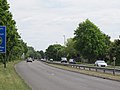
 Egham Bypass - geograph.org.uk - 3045949.jpg 1,905 × 1,429; 1.77 MB
-
 Egham bypass - geograph.org.uk - 4498565.jpg 1,024 × 768; 130 KB
-
 Egham fire station - geograph.org.uk - 280007.jpg 640 × 426; 186 KB
-
 Egham Gateway West View 1.jpg 1,920 × 1,080; 454 KB
-
 Egham High Street - geograph.org.uk - 3595276.jpg 1,024 × 704; 591 KB
-
 Egham High Street - geograph.org.uk - 3595314.jpg 1,024 × 768; 771 KB
-
 Egham High Street - geograph.org.uk - 4316272.jpg 2,560 × 1,920; 1.35 MB
-
 Egham Hill - geograph.org.uk - 6210908.jpg 1,906 × 1,260; 1.48 MB
-
 Egham Hill - panoramio.jpg 1,384 × 321; 91 KB
-
 Egham Literary Institute - geograph.org.uk - 4498426.jpg 1,024 × 768; 168 KB
-
 Egham Literary Institute - geograph.org.uk - 5386525.jpg 1,574 × 1,600; 654 KB
-
 Egham M25 aerial 2011.jpg 4,288 × 2,848; 5.31 MB
-
 Egham Maltings - geograph.org.uk - 5386443.jpg 3,549 × 2,736; 1.78 MB
-
 Egham Museum - geograph.org.uk - 3595297.jpg 1,024 × 729; 733 KB
-
 Egham Museum - geograph.org.uk - 4042074.jpg 640 × 425; 146 KB
-
 Egham station, abandoned steps to old footbridge - geograph.org.uk - 4497800.jpg 1,024 × 768; 171 KB
-
 Egham station, cycle parking (down side) - geograph.org.uk - 4497806.jpg 1,024 × 768; 194 KB
-
 Egham station, cycle parking (up side) - geograph.org.uk - 4497809.jpg 1,024 × 768; 167 KB
-
 Egham United Church - geograph.org.uk - 4498437.jpg 768 × 1,024; 123 KB
-
 Egham War Memorial, St John's Church, Egham, Surrey 01.jpg 1,573 × 2,621; 1.33 MB
-
 Egham War Memorial, St John's Church, Egham, Surrey 02.jpg 1,824 × 2,432; 1.68 MB
-
 Egham Youth Centre - geograph.org.uk - 4526007.jpg 1,024 × 768; 150 KB
-
 Entrance to Egham Waitrose - geograph.org.uk - 4498443.jpg 1,024 × 768; 117 KB
-
 Ferrari dealership in Egham - geograph.org.uk - 5871327.jpg 4,032 × 3,024; 3.85 MB
-

-
 Footpath to Coopers Hill - geograph.org.uk - 4498574.jpg 1,024 × 768; 180 KB
-
 Footpaths on Runnymede - geograph.org.uk - 4498569.jpg 1,024 × 768; 186 KB
-
 Foresters Arms, North Street - geograph.org.uk - 5321389.jpg 1,600 × 965; 373 KB
-
 Former Egham Post Office - geograph.org.uk - 3038659.jpg 1,691 × 1,685; 547 KB
-
 Fuel Station Forecourt - Egham - geograph.org.uk - 3716509.jpg 3,579 × 3,456; 2.39 MB
-
 How are the mighty fallen - geograph.org.uk - 3141619.jpg 2,048 × 1,536; 3.12 MB
-
 Hummer Road, Egham - geograph.org.uk - 4498469.jpg 1,024 × 768; 132 KB
-
 Hummer Road, Egham - geograph.org.uk - 4502362.jpg 2,560 × 1,920; 2.11 MB
-
 Intel, Egham - geograph.org.uk - 4526018.jpg 1,024 × 768; 108 KB
-
 Kingjohn-Egham-DavidParfitt.JPG 369 × 480; 47 KB
-
 Langham Place Cottages, Egham - geograph.org.uk - 4525996.jpg 1,024 × 768; 123 KB
-
 Langham Place, Egham - geograph.org.uk - 3045952.jpg 2,048 × 1,536; 2.19 MB
-
 Level crossing at Egham Station - geograph.org.uk - 4076645.jpg 4,320 × 3,240; 3.97 MB
-
 Limes Road Mews, Egham - geograph.org.uk - 4526005.jpg 1,024 × 768; 111 KB
-
 Loch Fyne Restaurant, Egham - geograph.org.uk - 4430533.jpg 1,600 × 1,000; 195 KB
-

-
 Looking along Queen's Road from twitten - geograph.org.uk - 4360485.jpg 800 × 533; 104 KB
-

-
 Looking into Stoneylands Court - geograph.org.uk - 4360497.jpg 800 × 533; 113 KB
-
 Looking into twitten from Queen's Road - geograph.org.uk - 4360480.jpg 800 × 533; 109 KB
-

-
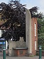
 Magna Carta Fountain (1994) Neil Lawson Baker, High Street, Egham, Surrey.jpg 1,813 × 2,418; 1.15 MB
-
 Magna Carta memorial, Egham - geograph.org.uk - 4498460.jpg 768 × 1,024; 189 KB
-
 Magna Carta Monument, Egham - geograph.org.uk - 4042069.jpg 425 × 640; 162 KB
-
 Magna Carta mosaic, Egham (1) - geograph.org.uk - 4498454.jpg 1,024 × 768; 173 KB
-
 Magna Carta mosaic, Egham (2) - geograph.org.uk - 4498452.jpg 1,024 × 768; 201 KB
-
 Magna Carta mosaic, Egham (3) - geograph.org.uk - 4498450.jpg 1,024 × 768; 193 KB
-
 Malt Hill, Egham - geograph.org.uk - 5322301.jpg 1,600 × 959; 464 KB
-
 Marchamont House - geograph.org.uk - 1499938.jpg 640 × 480; 84 KB
-
 Mini roundabout on High Street, Egham - geograph.org.uk - 1728469.jpg 1,280 × 960; 238 KB
-
 Motel and Restaurant - geograph.org.uk - 42233.jpg 640 × 431; 160 KB
-
 New Student Accommodation at Royal Holloway University - geograph.org.uk - 4507334.jpg 4,608 × 2,862; 4.72 MB
-
 North Street, Egham - geograph.org.uk - 3141489.jpg 2,048 × 1,536; 2.52 MB
-
 Nursery in former chapel, Hummer Road, Egham - geograph.org.uk - 4498539.jpg 1,024 × 768; 142 KB
-
 Office block on High Street, Egham - geograph.org.uk - 4315261.jpg 2,560 × 1,920; 2 MB
-
 Offices in Egham - geograph.org.uk - 4956288.jpg 640 × 426; 51 KB
-
 Old church and offices on Egham Hill - geograph.org.uk - 6210902.jpg 1,864 × 1,192; 1.25 MB
-
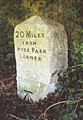 Old Milestone (geograph 6114459).jpg 965 × 1,393; 161 KB
-
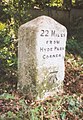 Old Milestone (geograph 6115303).jpg 965 × 1,393; 192 KB
-
 Old Milestone (geograph 6115376).jpg 1,007 × 1,490; 268 KB
-
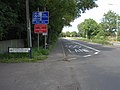
 Old Milestone (south face) by the A30, Egham Hill, Egham (geograph 6614374).jpg 1,000 × 1,532; 320 KB
-

-
 Old Strode's School buildings.png 603 × 401; 611 KB
-
 Olympic Lane, Egham Bypass - geograph.org.uk - 3045944.jpg 1,990 × 1,492; 2 MB
-
 PH on North Street - geograph.org.uk - 4360470.jpg 800 × 533; 111 KB
-
 Pre-Worboys sign on Hummer Road, Egham - geograph.org.uk - 4502372.jpg 2,560 × 1,920; 1.88 MB
-
 Railway Footbridge - geograph.org.uk - 5321398.jpg 1,600 × 1,097; 437 KB
-
 Railway footbridge, Egham - geograph.org.uk - 3141492.jpg 2,048 × 1,536; 2.55 MB
-
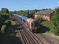
 Railway, Egham - geograph.org.uk - 3141485.jpg 2,048 × 1,536; 2.44 MB
-
 Rhul (216871227).jpeg 2,048 × 790; 490 KB
-
 Ripley Springs - geograph.org.uk - 3141605.jpg 2,048 × 1,536; 2.5 MB
-
 Ripley Springs - geograph.org.uk - 3141616.jpg 1,991 × 1,492; 2.18 MB
-
 Runnemede Road - geograph.org.uk - 5386555.jpg 2,970 × 2,368; 1.19 MB
-
 Runnymede Hotel.jpg 2,521 × 1,614; 2.7 MB
-
 Runnymede Meadows - panoramio.jpg 3,648 × 2,736; 5.43 MB
-
 Runnymede roundabout - geograph.org.uk - 2855355.jpg 1,600 × 1,200; 541 KB
-
 Rusham Farm - geograph.org.uk - 3141594.jpg 2,048 × 1,536; 2.37 MB
-
 Rusham Park Avenue - geograph.org.uk - 3141501.jpg 2,048 × 1,536; 2.12 MB
-
 Shell filling station, Egham High Street - geograph.org.uk - 4526004.jpg 1,024 × 768; 86 KB
-
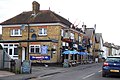
 Shops on Egham High Street - geograph.org.uk - 4526000.jpg 1,024 × 768; 145 KB
-
 Spring Rise, Egham - geograph.org.uk - 5322305.jpg 1,600 × 1,093; 534 KB
-
 St John, Egham, church path - geograph.org.uk - 6010159.jpg 640 × 480; 93 KB
-
 Station Villas, Egham - geograph.org.uk - 4497932.jpg 1,024 × 768; 116 KB
-
 Stoneylands Road - geograph.org.uk - 4360489.jpg 800 × 533; 110 KB
-
 Strode's College stained glass window.jpg 609 × 765; 273 KB
-
 Strode's College, Egham - geograph.org.uk - 1501614.jpg 640 × 480; 97 KB
-
 Strodes College - geograph.org.uk - 4526012.jpg 1,024 × 768; 198 KB
-
 The back of Tesco, from the car park - geograph.org.uk - 2609722.jpg 640 × 480; 56 KB
-
 The Burger King, Egham - geograph.org.uk - 2979470.jpg 800 × 600; 95 KB
-
 The Crown Inn, Egham - geograph.org.uk - 4526015.jpg 1,024 × 768; 116 KB
-
 The Future Building - geograph.org.uk - 1392553.jpg 640 × 427; 67 KB
-
 The Future Building - geograph.org.uk - 1392566.jpg 427 × 640; 64 KB
-
 The Future Building - geograph.org.uk - 1392577.jpg 640 × 427; 78 KB
-
 The gardens at Great Fosters, Egham (1497512710).jpg 1,840 × 1,232; 970 KB
-
 The Old Bakery, Egham - geograph.org.uk - 1499855.jpg 640 × 480; 103 KB
-
 The Old Bank, Egham - geograph.org.uk - 4498394.jpg 1,024 × 768; 118 KB
-
 The Red Lion - geograph.org.uk - 1499865.jpg 640 × 480; 89 KB
-
 The Red Lion, Egham - geograph.org.uk - 3595283.jpg 1,024 × 723; 738 KB
-
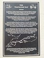 The Trafalgar Way, Loch Fyne, Egham - geograph.org.uk - 4430477.jpg 1,861 × 2,413; 1.35 MB
-
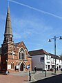 The United Church of Egham - geograph.org.uk - 5386484.jpg 2,622 × 3,491; 1.23 MB
-
 The White Lion, Egham - geograph.org.uk - 4076611.jpg 4,184 × 3,050; 4.02 MB
-
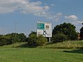 There's the sign, where's the road - geograph.org.uk - 3075326.jpg 1,943 × 1,457; 1.65 MB
-
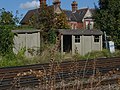 Trackworkers' shelters - geograph.org.uk - 3141580.jpg 2,048 × 1,536; 3.15 MB
-
 Twitten to Manor Way from footpath - geograph.org.uk - 4360460.jpg 800 × 533; 125 KB
-

-
 Unusual roadsign, Hummer Road, Egham - geograph.org.uk - 4498551.jpg 1,024 × 768; 132 KB
-

-
 Whitehall Lane, Egham - geograph.org.uk - 4279162.jpg 1,920 × 2,560; 1.64 MB
-

_David_Parfitt,_High_Street,_Egham,_Surrey.jpg)


_-_geograph.org.uk_-_4498411.jpg)

_RMG_PW4931.jpg)


_-_geograph.org.uk_-_4497806.jpg)
_-_geograph.org.uk_-_4497809.jpg)


_Neil_Lawson_Baker,_High_Street,_Egham,_Surrey.jpg)


_-_geograph.org.uk_-_4498454.jpg)
_-_geograph.org.uk_-_4498452.jpg)
_-_geograph.org.uk_-_4498450.jpg)


.jpg)
.jpg)
.jpg)
_by_the_A30,_Egham_Hill,_Egham_(geograph_6614374).jpg)


.jpg)


_-_geograph.org.uk_-_4498552.jpg)


.jpeg)