Category:Epping Upland
Jump to navigation
Jump to search
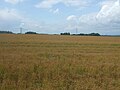
Epping Upland is a village in the Epping Forest district of Essex, England, and sits in the TL4404 grid reference square. It is also the centre for its civil parish of Epping Upland, which includes the village of Epping Green, the hamlet of Rye Hill, and historically included the north-western part of the town of Epping.

a civil parish and village in Essex, England  | |||||
| Upload media | |||||
| Instance of | |||||
|---|---|---|---|---|---|
| Location | Epping Forest, Essex, East of England, England | ||||
 | |||||
Subcategories
This category has the following 6 subcategories, out of 6 total.
A
- All Saints Church, Epping Upland (16 F)
C
E
- Epping Green, Essex (10 F)
J
- Jacks Hatch (3 F)
P
- Parvills Farm, Epping Forest (2 F)
Media in category "Epping Upland"
The following 200 files are in this category, out of 337 total.
(previous page) (next page)-
 2 Signs - geograph.org.uk - 2649273.jpg 3,648 × 2,736; 2.74 MB
-
 A lone stile - geograph.org.uk - 403797.jpg 640 × 480; 257 KB
-
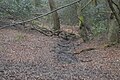 A Small woodland stream - geograph.org.uk - 5908790.jpg 1,024 × 681; 276 KB
-
 Above the M25 on Bell Common - geograph.org.uk - 5532954.jpg 5,184 × 3,456; 5.26 MB
-
 All Saints Church, Epping Upland - geograph.org.uk - 2649264.jpg 3,238 × 2,001; 2.06 MB
-
 All Saints church, Epping Upland - geograph.org.uk - 4037641.jpg 4,320 × 3,240; 4.99 MB
-
 All Saints Church, Epping Upland, Essex - geograph.org.uk - 2031191.jpg 640 × 465; 127 KB
-
 An Essex farmyard - geograph.org.uk - 2649388.jpg 1,024 × 633; 438 KB
-
 Approaching Copy Wood - geograph.org.uk - 5414501.jpg 640 × 424; 91 KB
-
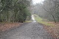
 B181 towards Epping Upland - geograph.org.uk - 5491028.jpg 640 × 480; 80 KB
-
 Ballhill Wood - geograph.org.uk - 4618797.jpg 640 × 480; 198 KB
-
 Barn on Upland Road, Thornwood Common - geograph.org.uk - 5730405.jpg 1,990 × 1,454; 1.19 MB
-
 Bean Field ^ Orange Wood - geograph.org.uk - 5414749.jpg 640 × 424; 82 KB
-
 Blue Path to Wintry Park - geograph.org.uk - 5052826.jpg 424 × 640; 57 KB
-
 Branch in the meadow - geograph.org.uk - 4068594.jpg 4,000 × 3,000; 4.68 MB
-
 Bridge over a stream on Upland Road - geograph.org.uk - 4470701.jpg 4,000 × 3,000; 4.21 MB
-
 Bridleway along the Green - geograph.org.uk - 2649370.jpg 1,024 × 633; 603 KB
-
 Bury Lane (B182) - geograph.org.uk - 5491015.jpg 640 × 480; 106 KB
-
 Bury Lane (B182) - geograph.org.uk - 5491022.jpg 640 × 480; 63 KB
-

-
 Cantering through the Green - geograph.org.uk - 2649400.jpg 640 × 395; 184 KB
-
 Car park, Epping Forest - geograph.org.uk - 5908802.jpg 1,024 × 681; 235 KB
-
 Cellar, Copped Hall, Essex - geograph.org.uk - 4846370.jpg 1,400 × 933; 1.43 MB
-
 Cellar, Copped Hall, Essex - geograph.org.uk - 4846496.jpg 1,400 × 933; 1.45 MB
-
 Cellar, Copped Hall, Essex - geograph.org.uk - 4846497.jpg 1,400 × 933; 1.11 MB
-
 Centenary Walk approaches Theydon Road - geograph.org.uk - 5908804.jpg 1,024 × 681; 210 KB
-
 Centenary Walk goes left - geograph.org.uk - 5908774.jpg 1,024 × 681; 250 KB
-
 Centenary Walk near Bell Common - geograph.org.uk - 6088637.jpg 4,835 × 3,350; 4.37 MB
-
 Centenary Walk near Epping Thicks - geograph.org.uk - 110286.jpg 480 × 640; 131 KB
-
 Centenary Walk, Epping Forest - geograph.org.uk - 5908753.jpg 1,024 × 681; 226 KB
-
 Centenary Walk, Epping Forest - geograph.org.uk - 5908762.jpg 1,024 × 681; 256 KB
-
 Centenary Walk, Epping Forest - geograph.org.uk - 5908768.jpg 1,024 × 681; 273 KB
-
 Centenary Walk, Epping Forest - geograph.org.uk - 5908770.jpg 1,024 × 681; 267 KB
-
 Centenary Walk, Epping Forest - geograph.org.uk - 5908771.jpg 1,024 × 681; 240 KB
-
 Centenary Walk, Epping Forest - geograph.org.uk - 5908772.jpg 1,024 × 681; 244 KB
-
 Centenary Walk, Epping Forest - geograph.org.uk - 5908781.jpg 1,024 × 681; 233 KB
-
 Centenary Walk, Epping Forest - geograph.org.uk - 5908789.jpg 1,024 × 681; 203 KB
-
 Centenary Walk, Epping Forest - geograph.org.uk - 5908794.jpg 1,024 × 681; 263 KB
-
 Centenary Walk, Epping Forest - geograph.org.uk - 5908798.jpg 1,024 × 681; 268 KB
-
 Centenary Walk, Epping Forest - geograph.org.uk - 5908799.jpg 1,024 × 681; 260 KB
-
 Centenary Way in Epping Forest - geograph.org.uk - 5531753.jpg 5,184 × 3,456; 6.79 MB
-
 Cereal Crop beside the B181 - geograph.org.uk - 5491024.jpg 640 × 480; 64 KB
-
 Cereal crop near Bury Farm - geograph.org.uk - 5491027.jpg 640 × 480; 86 KB
-
 Cereal crop near Shingle Hall - geograph.org.uk - 5491041.jpg 640 × 480; 87 KB
-
 Cereal crop off Upland Road - geograph.org.uk - 5491047.jpg 640 × 480; 71 KB
-
 Clock of All Saints church, Epping Upland - geograph.org.uk - 3895711.jpg 1,024 × 768; 325 KB
-
 Close mowing, Epping Upland - geograph.org.uk - 3895716.jpg 1,024 × 768; 160 KB
-

-
 Cobbins Bridge - geograph.org.uk - 3895702.jpg 1,024 × 768; 458 KB
-

-
 Copped Hall - geograph.org.uk - 3561902.jpg 1,600 × 1,200; 442 KB
-
 Copped Hall - geograph.org.uk - 4929660.jpg 640 × 428; 116 KB
-
 Copped Hall at Night - geograph.org.uk - 5612069.jpg 6,720 × 4,480; 5.63 MB
-
 Copped Hall Garden, Essex - geograph.org.uk - 4846511.jpg 1,400 × 933; 940 KB
-
 Copped Hall Park, near Epping - geograph.org.uk - 2526515.jpg 640 × 480; 127 KB
-
 Copped Hall Reflection, Essex - geograph.org.uk - 4465730.jpg 550 × 825; 643 KB
-
 Copped Hall Reflection, Essex - geograph.org.uk - 4465732.jpg 550 × 825; 572 KB
-
 Copped Hall, Essex - geograph.org.uk - 3975022.jpg 1,024 × 683; 885 KB
-
 Copped Hall, Essex - geograph.org.uk - 3975165.jpg 1,024 × 683; 839 KB
-
 Copped Hall, Essex - geograph.org.uk - 3975174.jpg 1,024 × 683; 1.09 MB
-
 Copped Hall, Essex - geograph.org.uk - 3975177.jpg 683 × 1,024; 806 KB
-
 Copped Hall, Essex - geograph.org.uk - 3975179.jpg 683 × 1,024; 972 KB
-
 Copped Hall, Essex - geograph.org.uk - 4465711.jpg 1,238 × 825; 937 KB
-
 Copped Hall, Essex - geograph.org.uk - 4465718.jpg 1,238 × 825; 1.37 MB
-
 Copped Hall, Essex - geograph.org.uk - 4465725.jpg 1,238 × 825; 927 KB
-
 Copped Hall, Essex - geograph.org.uk - 4846359.jpg 1,400 × 933; 967 KB
-
 Copped Hall, Essex - geograph.org.uk - 4846509.jpg 1,400 × 891; 1.03 MB
-
 Copped Hall, Essex - geograph.org.uk - 4846513.jpg 1,400 × 933; 883 KB
-
 Copped Hall, Essex - geograph.org.uk - 4846514.jpg 1,400 × 933; 928 KB
-
 Country lane near Epping - geograph.org.uk - 2526296.jpg 640 × 480; 142 KB
-
 Country lane near Epping - geograph.org.uk - 2526302.jpg 480 × 640; 132 KB
-
 Countryside, Copped Hall, Essex - geograph.org.uk - 4465724.jpg 1,238 × 825; 925 KB
-
 Courtyard off Magpies, Epping Green - geograph.org.uk - 3884678.jpg 640 × 480; 146 KB
-
 Cricket over the M25 - geograph.org.uk - 2551466.jpg 3,648 × 2,280; 1.53 MB
-
 Crop field beside Cobbin's Brook - geograph.org.uk - 5491040.jpg 640 × 480; 84 KB
-
 Crop field near Cobbin's Brook - geograph.org.uk - 5491034.jpg 640 × 480; 58 KB
-
 Crop field off Bury Lane (B182) - geograph.org.uk - 5491021.jpg 640 × 480; 78 KB
-
 Crops near Copped Hall - geograph.org.uk - 4069264.jpg 3,720 × 2,516; 2.47 MB
-
 Crossing of Cobbin's Brook - geograph.org.uk - 4930835.jpg 640 × 480; 178 KB
-
 Daffodils outside All Saints church - geograph.org.uk - 3895708.jpg 1,024 × 768; 400 KB
-
 Derelict bunker near Epping - geograph.org.uk - 2526315.jpg 640 × 480; 141 KB
-
 Directly above the M25 Epping Tunnel - geograph.org.uk - 258218.jpg 640 × 427; 80 KB
-
 Driveway to Orchard Farm - geograph.org.uk - 4470282.jpg 4,000 × 3,000; 4.38 MB
-
 Driveway, Copped Hall, Essex - geograph.org.uk - 4465727.jpg 1,238 × 825; 990 KB
-
 Early autumn colours - geograph.org.uk - 2639847.jpg 3,648 × 2,255; 2.78 MB
-
 Elizabeth II postbox on Upland Road, Epping Upland - geograph.org.uk - 5490180.jpg 2,136 × 2,848; 1.42 MB
-
 Entering Bell Common Tunnel, M25 - geograph.org.uk - 3004461.jpg 800 × 600; 100 KB
-
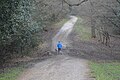
 Entering Epping Upland - geograph.org.uk - 5491031.jpg 640 × 480; 88 KB
-
 Entrance to Bell Common tunnel on M25 - geograph.org.uk - 4046971.jpg 1,024 × 682; 67 KB
-
 Entrance to Epping Long Green - geograph.org.uk - 2639857.jpg 3,648 × 2,255; 2.77 MB
-
 Epping cemetery - geograph.org.uk - 3895682.jpg 1,024 × 768; 307 KB
-
 Epping Chapel at Epping Green - geograph.org.uk - 6220222.jpg 4,608 × 3,456; 4.31 MB
-
 Epping Forest - geograph.org.uk - 5038087.jpg 4,000 × 2,666; 7.98 MB
-
 Epping Forest - geograph.org.uk - 5038097.jpg 4,000 × 2,666; 7.26 MB
-
 Epping Forest - geograph.org.uk - 5038829.jpg 4,000 × 2,666; 7.12 MB
-
 Epping Forest - geograph.org.uk - 5038834.jpg 4,000 × 2,666; 7.38 MB
-
 Epping Forest - geograph.org.uk - 5038850.jpg 4,000 × 2,666; 7.37 MB
-
 Epping Forest - geograph.org.uk - 5908764.jpg 1,024 × 681; 248 KB
-
 Epping Forest - geograph.org.uk - 5908766.jpg 1,024 × 681; 285 KB
-
 Epping Forest - geograph.org.uk - 5908782.jpg 1,024 × 681; 286 KB
-
 Epping Forest - geograph.org.uk - 5908787.jpg 1,024 × 681; 277 KB
-
 Epping Forest - panoramio.jpg 4,619 × 3,079; 4.05 MB
-
 Epping Forest by B1393 - geograph.org.uk - 3894383.jpg 640 × 428; 152 KB
-
 Epping Long Green - geograph.org.uk - 5414460.jpg 640 × 424; 104 KB
-
 Epping Long Green Junction - geograph.org.uk - 5414495.jpg 640 × 424; 78 KB
-
 Epping Long Green Near The Old Farm - geograph.org.uk - 5414488.jpg 640 × 424; 72 KB
-
 Epping Road (B181) - geograph.org.uk - 3884647.jpg 640 × 480; 112 KB
-
 Epping Road, Epping Green - geograph.org.uk - 5730406.jpg 1,980 × 1,440; 1.21 MB
-
 Epping Upland - B181 road to Epping Green.jpg 4,116 × 2,310; 5.64 MB
-
 Epping Upland - B181 road towards Epping.jpg 5,472 × 3,084; 12.22 MB
-
 Epping Upland - geograph.org.uk - 109418.jpg 640 × 480; 82 KB
-
 Epping Upland - Upland Road looking east towards Takeleys.jpg 4,608 × 2,124; 5.2 MB
-
 Epping Upland - Upland Road looking west towards the perimeter wall of Walton Lodge.jpg 4,608 × 2,718; 5.8 MB
-
 Epping Upland church - geograph.org.uk - 3884631.jpg 640 × 428; 174 KB
-
 Facade, Copped Hall, Essex - geograph.org.uk - 3975704.jpg 1,024 × 683; 722 KB
-
 Fallen Branch, Copped Hall, Essex - geograph.org.uk - 4465721.jpg 1,238 × 825; 1.26 MB
-
 Fallen tree blocks ride - geograph.org.uk - 3841188.jpg 3,648 × 2,736; 4.96 MB
-
 Farm track by Upland Road - geograph.org.uk - 5507975.jpg 1,990 × 1,454; 1.19 MB
-
 Farm tracks off Upland Road - geograph.org.uk - 3884589.jpg 640 × 480; 159 KB
-
 Farm tracks off Upland Road, Thornwood Common - geograph.org.uk - 5730404.jpg 2,048 × 1,536; 1.64 MB
-
 Farmland - geograph.org.uk - 400559.jpg 640 × 480; 98 KB
-
 Farmland - geograph.org.uk - 400574.jpg 640 × 480; 98 KB
-
 Farmland - geograph.org.uk - 400604.jpg 640 × 480; 132 KB
-
 Farmland near Copped Hall, Essex - geograph.org.uk - 3976039.jpg 1,024 × 683; 810 KB
-
 Farmland near Copped Hall, Essex - geograph.org.uk - 3976040.jpg 1,024 × 683; 954 KB
-
 Farmland, Copped Hall, Essex - geograph.org.uk - 3975730.jpg 1,024 × 683; 833 KB
-
 Farmland, Copped Hall, Essex - geograph.org.uk - 3975735.jpg 1,024 × 683; 727 KB
-
 Farmland, Pinch Timber - geograph.org.uk - 5491043.jpg 640 × 480; 66 KB
-
 Field by Bury Lane, Epping - geograph.org.uk - 5732995.jpg 2,048 × 1,536; 1.54 MB
-
 Field by Bury Lane, Epping - geograph.org.uk - 5733002.jpg 2,048 × 1,536; 1.62 MB
-
 Field by Bury Lane, Epping - geograph.org.uk - 5733007.jpg 2,048 × 1,536; 1.45 MB
-
 Field by Upland Road, Thornwood Common - geograph.org.uk - 5731077.jpg 2,048 × 1,536; 1.57 MB
-
 Field edge next to Lindsey Street - geograph.org.uk - 4470736.jpg 4,000 × 3,000; 4.08 MB
-
 Field edge off Lindsey Street - geograph.org.uk - 4470752.jpg 4,000 × 3,000; 4.06 MB
-
 Field entrance on Rye Hill Road - geograph.org.uk - 5505583.jpg 1,990 × 1,454; 829 KB
-
 Field near to Chambers Manor Farm - geograph.org.uk - 6103184.jpg 4,608 × 3,456; 5.95 MB
-
 Field north of Cobbins Bridge - geograph.org.uk - 3895706.jpg 1,024 × 768; 195 KB
-
 Field path at Cobbin's Brook - geograph.org.uk - 6220237.jpg 4,608 × 3,456; 6.42 MB
-
 Fields near Copped Hall - geograph.org.uk - 4069255.jpg 4,000 × 3,000; 2.84 MB
-
 Fly tipping by Cobbins Bridge - geograph.org.uk - 3895703.jpg 1,024 × 768; 502 KB
-
 Folly, Copped Hall, Essex - geograph.org.uk - 4846502.jpg 1,400 × 933; 1.17 MB
-
 Folly, Copped Hall, Essex - geograph.org.uk - 4846503.jpg 1,400 × 933; 1.13 MB
-
 Footpath across Farmland near Copped Hall, Essex - geograph.org.uk - 3976038.jpg 1,024 × 683; 827 KB
-
 Footpath at Upland Road - geograph.org.uk - 4470131.jpg 4,000 × 3,000; 4.42 MB
-
 Footpath gate near Epping - geograph.org.uk - 2526502.jpg 640 × 480; 110 KB
-
 Footpath junction at Epping Long Green - geograph.org.uk - 6103174.jpg 4,608 × 3,456; 5.68 MB
-
 Footpath though Epping Forest, in Epping Upland, Essex.jpg 640 × 480; 137 KB
-
 Footpath to Thornwood Common - geograph.org.uk - 4470126.jpg 4,000 × 3,000; 4.21 MB
-
 Footpath to Wintry Park Farm - geograph.org.uk - 5052832.jpg 424 × 640; 87 KB
-
 Forest Way off Rye Hill Road - geograph.org.uk - 5505581.jpg 2,048 × 1,536; 1.51 MB
-
 Frosty near Ambresbury Banks, Epping Forest - geograph.org.uk - 6031333.jpg 3,648 × 2,736; 6.09 MB
-
 Garden, Copped Hall, Essex - geograph.org.uk - 3975181.jpg 683 × 1,024; 842 KB
-
 Garden, Copped Hall, Essex - geograph.org.uk - 3975183.jpg 1,024 × 683; 882 KB
-
 Garden, Copped Hall, Essex - geograph.org.uk - 4465856.jpg 550 × 825; 636 KB
-
 Gated field with rooks - geograph.org.uk - 3894467.jpg 640 × 480; 88 KB
-

-
 Gibbons Bush Green - geograph.org.uk - 2649276.jpg 3,648 × 2,736; 4.42 MB
-
 Gooseberry Hall - geograph.org.uk - 2552258.jpg 2,266 × 1,696; 1.98 MB
-
 Grazing, Epping Upland - geograph.org.uk - 5491029.jpg 640 × 480; 54 KB
-
 Green Lane Approaching Epping Green - geograph.org.uk - 5414467.jpg 424 × 640; 96 KB
-
 Green narrows to become a bridleway - geograph.org.uk - 2640419.jpg 3,648 × 2,736; 3.84 MB
-
 Green Ride - geograph.org.uk - 5908791.jpg 1,024 × 681; 238 KB
-
 Green Ride - geograph.org.uk - 5908792.jpg 1,024 × 681; 249 KB
-
 Griffin's Wood seen from the M25 - geograph.org.uk - 2968003.jpg 640 × 481; 48 KB
-
 Hawthorn thicket, Crabs Green - geograph.org.uk - 2628013.jpg 3,648 × 2,266; 2.64 MB
-
 Hay Meaddow by thee Green Lane - geograph.org.uk - 5414478.jpg 640 × 424; 56 KB
-
 Heading North through Epping Thicks - geograph.org.uk - 5532943.jpg 5,184 × 3,456; 5.94 MB
-
 High Road (B1393) - geograph.org.uk - 5490979.jpg 640 × 480; 93 KB
-
 High Road, Epping - geograph.org.uk - 5509991.jpg 2,048 × 1,536; 1.49 MB
-
 Holm Oak, Copped Hall, Essex - geograph.org.uk - 4465710.jpg 1,238 × 825; 998 KB
-
 Honey Fungus - geograph.org.uk - 2629905.jpg 3,648 × 2,736; 4.52 MB
-
 Horses at Parvills Farm - geograph.org.uk - 5037620.jpg 4,608 × 3,456; 4.98 MB
-
 Horses in a field near to Epping Green - geograph.org.uk - 6103178.jpg 4,608 × 3,456; 3.72 MB
-
 House on Rye Hill Road - geograph.org.uk - 5505285.jpg 1,837 × 1,360; 1.04 MB
-
 House on Rye Hill Road - geograph.org.uk - 5505587.jpg 2,014 × 1,490; 1.18 MB
-
 House on Upland Road, Epping Upland - geograph.org.uk - 5490187.jpg 2,835 × 1,843; 1.18 MB
-
 House on Upland Road, Epping Upland - geograph.org.uk - 5731124.jpg 2,048 × 1,536; 1.49 MB
-
 House, Parvills Farm - geograph.org.uk - 4930787.jpg 640 × 480; 116 KB
-
 Houses on Highfield Green - geograph.org.uk - 5490994.jpg 640 × 480; 60 KB
-
 Houses on Upland Road - geograph.org.uk - 5491051.jpg 640 × 489; 69 KB
-
 Kitchen, Copped Hall, Essex - geograph.org.uk - 4846499.jpg 1,400 × 933; 1.35 MB
-
 Kitchen, Copped Hall, Essex - geograph.org.uk - 4846501.jpg 1,366 × 1,050; 1.14 MB
-
 Lane to Parvills Farm - geograph.org.uk - 5414756.jpg 424 × 640; 111 KB
-
 Log Pile by Epping Long Green - geograph.org.uk - 5414514.jpg 640 × 424; 104 KB
-
 Logpile ^ Ballhill Wood - geograph.org.uk - 5414742.jpg 640 × 424; 82 KB
-
 Long Green boundary with farm land - geograph.org.uk - 2649275.jpg 3,648 × 2,736; 4.41 MB
-
 Long Green view - geograph.org.uk - 2640447.jpg 3,648 × 2,255; 2.87 MB
-
 M25 approaching Warren Wood - geograph.org.uk - 3246260.jpg 640 × 430; 40 KB
-
 M25 Beside The Warren - geograph.org.uk - 3356965.jpg 1,600 × 1,056; 878 KB
-
 M25 enters Bell Common Tunnel - geograph.org.uk - 3537450.jpg 3,648 × 2,736; 1.18 MB
-
 M25 enters Bell Common Tunnel - geograph.org.uk - 3828956.jpg 640 × 430; 34 KB
-
 M25 motorway near Epping - geograph.org.uk - 2526523.jpg 640 × 480; 67 KB
-
 Marshland at Thornwood Common - geograph.org.uk - 3895728.jpg 1,024 × 768; 487 KB
-
 Minor road crossing Cobbin's Brook - geograph.org.uk - 5491038.jpg 640 × 480; 94 KB
-
 Minor road towards Shingle Hall - geograph.org.uk - 5491036.jpg 640 × 480; 58 KB
-
 Minor road, Pinch Timber - geograph.org.uk - 5491046.jpg 640 × 480; 74 KB
-
 Muddy bridleway - geograph.org.uk - 3894632.jpg 1,024 × 768; 595 KB
-
 Narrow bridge on Upland Road - geograph.org.uk - 3884607.jpg 640 × 480; 192 KB
-
 Near Pinch Timber Farm - geograph.org.uk - 4037647.jpg 4,320 × 3,240; 4.98 MB
-
 Non-conformist chapel, Epping Green - geograph.org.uk - 4124134.jpg 4,320 × 3,240; 4.45 MB


_-_geograph.org.uk_-_5491015.jpg)
_-_geograph.org.uk_-_5491022.jpg)
_towards_Epping_Upland_-_geograph.org.uk_-_5491019.jpg)


_-_geograph.org.uk_-_5491021.jpg)


_-_geograph.org.uk_-_3884647.jpg)


_-_geograph.org.uk_-_5490979.jpg)


