Category:Eretz Israel
Vai alla navigazione
Vai alla ricerca

Eretz Israel (ארץ ישראל) is a biblical term, which in Hebrew means "Land of People of Israel". In time of British Mandate this was one of the official names of the territory. The name refers to the old place which was connected to the People of Israel. In contemporary sense, this term is geographically synonimous with Palestine, where both the state of Israel and the Palestinian territories (or the State of Palestine since 1988) are located.
nome ebraico tradizionale per un'area storica nel Vicino Oriente   | |||||
| Carica un file multimediale | |||||
| Istanza di |
| ||||
|---|---|---|---|---|---|
| Parte di |
| ||||
| Aspetto di | |||||
| Prende il nome da | |||||
| Luogo | Levante meridionale, Mezzaluna Fertile | ||||
| Situato sul mare / lago / fiume | |||||
| Consiste di | |||||
| Distinto da | |||||
| Considerato essere uguale a | Palestina, Terra santa | ||||
 | |||||
Sottocategorie
Questa categoria contiene le 14 sottocategorie indicate di seguito, su un totale di 14.
A
B
F
H
I
J
K
M
S
Z
File nella categoria "Eretz Israel"
Questa categoria contiene 43 file, indicati di seguito, su un totale di 43.
-
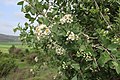 'Uzrar - Crataegus aronia.jpg 5 472 × 3 648; 6,39 MB
-
 Almond in blossom.jpg 5 472 × 3 648; 11,52 MB
-
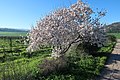 Almond tree in blossom (Israel).jpg 5 472 × 3 648; 11,82 MB
-
 Anemone (Red and white).jpg 5 472 × 3 648; 5,16 MB
-
 Arabenorth.JPG 2 048 × 1 536; 432 KB
-
 Beit Netofa valley & Hoshaya and Shikhin.JPG 4 720 × 1 080; 1,18 MB
-
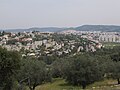 Beit Shemesh from its southern quarter.jpg 4 000 × 3 000; 4,51 MB
-
 Beulah - the Land of Israel.jpg 1 228 × 818; 1,31 MB
-
 Carantal.jpg 757 × 510; 245 KB
-
 Carmelbeach.jpg 2 048 × 1 536; 824 KB
-
 Dover tverya17.jpg 4 251 × 2 372; 10,32 MB
-
 Ein Bild der Mamluk-Zeit in Eretz Israel.jpg 700 × 545; 57 KB
-
 Ein Kerem in the spring - photo Ron Havilio.JPG 3 648 × 2 736; 4,76 MB
-
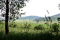
 Elah Valley below Adullam.jpg 4 000 × 3 000; 4,87 MB
-
 Elah Valley Wheat Fields.jpg 2 112 × 2 816; 2,67 MB
-
 Eretz Yisrael.jpg 3 000 × 4 000; 4,49 MB
-
 Giv'at Seled, near Tzafririm.jpg 2 816 × 2 112; 2,92 MB
-
 Hajja resrvation1.jpg 716 × 508; 133 KB
-
 Hasmoneese Kingdom.png 508 × 877; 12 KB
-
 Hubella22.jpg 400 × 600; 77 KB
-
 Judaean mountains.jpg 2 816 × 2 112; 2,87 MB
-
 Judea in early Spring.jpg 3 648 × 2 432; 3,17 MB
-
 Land of Israel.jpg 2 112 × 2 816; 2,79 MB
-
 Malka berlinski ottoman birth certificate.pdf 1 239 × 1 752; 531 KB
-
 Moshav Neve Michael, 25 December 2014.jpg 4 000 × 3 000; 4,46 MB
-
 Mountain scenery in Judean mountains.jpg 5 472 × 3 648; 9,91 MB
-
 Neve Michael, path to village.jpg 2 816 × 2 112; 2,88 MB
-
 Neve Michael.jpg 1 228 × 819; 1,03 MB
-
 PikiWiki Israel 14301 Gilboa Mountain.JPG 2 896 × 1 944; 1,47 MB
-
 PikiWiki Israel 29370 Religion in Israel.JPG 1 232 × 661; 282 KB
-
 Purple Anemone coronaria in Israel.jpg 3 648 × 5 472; 5,29 MB
-
 Quarry remains.jpg 4 608 × 3 456; 10,28 MB
-
 Rock-cut ruins.jpg 4 608 × 3 456; 9,57 MB
-
 Rosh HaAyin.jpg 800 × 533; 160 KB
-
 Tabun of Palestine - 1935.jpg 1 244 × 802; 251 KB
-
 View of Beit Shemesh from Beit Jamal.jpg 4 000 × 3 000; 4,81 MB
-
 View of Elah Valley from atop Aderet, March 2015.jpg 4 000 × 2 066; 1,94 MB
-
 View of Wadi Sur, Israel.jpg 5 472 × 3 648; 6,76 MB
-
 Village of Neve Michael ("Michael's Haven"), in Israel.jpg 4 000 × 3 000; 4,55 MB
-
 Wadi Sur (Elah Valley).jpg 5 472 × 3 648; 8,87 MB
-
 Wadi Sur.jpg 5 472 × 3 648; 11,29 MB
-
 Wheat fields in Elah Valley.jpg 2 816 × 2 112; 2,84 MB
-
 Yekutiel Ravayev.jpg 150 × 190; 9 KB


.jpg)
.jpg)


,_in_Israel.jpg)
.jpg)


