Category:Evangelische Kirche (Rod an der Weil)
Jump to navigation
Jump to search
| Object location | | View all coordinates using: OpenStreetMap |
|---|
 .jpg) | |||||
| Upload media | |||||
| Instance of | |||||
|---|---|---|---|---|---|
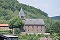
| Location | Rod an der Weil, Weilrod, Hochtaunuskreis, Darmstadt Government Region, Hesse, Germany | ||||
| Heritage designation | |||||
 | |||||
This is the category of the Hessian Kulturdenkmal (cultural monument) with the ID 100707 (Wikidata)
|
Media in category "Evangelische Kirche (Rod an der Weil)"
The following 3 files are in this category, out of 3 total.
-
 Orgel von Gustav Rassmann Rod an der Weil (1892).jpg 1,836 × 3,264; 1.55 MB
-
 Rod an der Weil, Kirche und Pfarrhaus.JPG 4,288 × 2,848; 5.58 MB
-
 Rod an der Weil, Kirche.JPG 4,288 × 2,848; 6.99 MB
