Category:Evangelische Kirche (Schwabsburg)
Jump to navigation
Jump to search
| Object location | | View all coordinates using: OpenStreetMap |
|---|
church building in Schwabsburg  | |||||
| Upload media | |||||
| Instance of | |||||
|---|---|---|---|---|---|
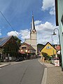
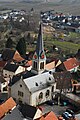
| Location | Schwabsburg, Nierstein, Verbandsgemeinde Rhein-Selz, Mainz-Bingen, Rhineland-Palatinate, Germany | ||||
| Heritage designation | |||||
 | |||||
Media in category "Evangelische Kirche (Schwabsburg)"
The following 6 files are in this category, out of 6 total.
-
 Evangelische Kirche Schwabsburg-01.jpg 3,240 × 4,320; 5.08 MB
-
 Evangelische Kirche Schwabsburg-02.jpg 4,187 × 3,140; 3.92 MB
-
 Evangelische Kirche Schwabsburg-03-Eingang Nordseite.jpg 4,320 × 3,240; 5.46 MB
-
 Kirche, 1, Schwabsburg, Nierstein, Landkreis Mainz-Bingen.jpg 3,240 × 4,320; 3.32 MB
-
 Kirche, 2, Schwabsburg, Nierstein, Landkreis Mainz-Bingen.jpg 3,240 × 4,320; 2.7 MB
-
 Nierstein Schwabsburg Evangelische Pfarrkirche.JPG 1,432 × 2,148; 1.88 MB


