Category:Evangelische Kirche Gröditz
Jump to navigation
Jump to search
| Object location | | View all coordinates using: OpenStreetMap |
|---|
| Upload media | |||||
| Instance of | |||||
|---|---|---|---|---|---|
| Made from material | |||||
| Location |
| ||||
| Heritage designation | |||||
 | |||||
Media in category "Evangelische Kirche Gröditz"
The following 13 files are in this category, out of 13 total.
-
-
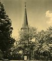
 28890-Gröditz-1955-evangelische Kirche-Brück & Sohn Kunstverlag.jpg 1,000 × 1,498; 407 KB
-
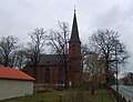
 Ev Kirche Gröditz P1100652.jpg 3,497 × 3,094; 2.76 MB
-
 Friedhof Kirche Gröditz IMG 7372.jpg 5,184 × 3,456; 3.78 MB
-
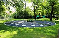 Gemeinschaftsgrabanlage Ev Kirche Gröditz IMG 7370.jpg 5,079 × 3,305; 3.29 MB
-
 Gröditz 2009 si.jpg 2,297 × 1,758; 781 KB
-
 Gröditz 2009 sj.jpg 1,920 × 2,560; 999 KB
-
 Gröditz 2009 sl.jpg 1,773 × 2,375; 858 KB
-
 Kirche Gröditz 2.jpg 1,559 × 2,254; 2.11 MB
-
 Kirche Gröditz IMG 7360.jpg 3,359 × 4,597; 2.89 MB
-
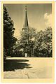
 Kirche Gröditz.jpg 1,237 × 1,833; 1.11 MB
-
 Turm Kirche Gröditz IMG 7377.jpg 3,456 × 5,184; 2.97 MB
-
 Wasserbrunnen Friedhof Kirche IMG 7375.jpg 3,249 × 2,890; 1.46 MB
.jpg)


