Category:Evangelische Pfarrkirche Brandoberndorf
Jump to navigation
Jump to search
| Object location | | View all coordinates using: OpenStreetMap |
|---|
church  | |||||
| Upload media | |||||
| Instance of | |||||
|---|---|---|---|---|---|
| Location | Brandoberndorf, Waldsolms, Lahn-Dill-Kreis, Giessen Government Region, Hesse, Germany | ||||
| Heritage designation | |||||
 | |||||
This is the category of the Hessian Kulturdenkmal (cultural monument) with the ID 45144 (Wikidata)
|
Subcategories
This category has the following 2 subcategories, out of 2 total.
E
- Epitaphs in Brandoberndorf (12 F)
K
Media in category "Evangelische Pfarrkirche Brandoberndorf"
The following 19 files are in this category, out of 19 total.
-
 Brandoberndorf Ev. Kirche (01).jpg 5,184 × 3,456; 3.57 MB
-
 Brandoberndorf Ev. Kirche (02).jpg 3,456 × 5,184; 2.14 MB
-
 Brandoberndorf Ev. Kirche (03).jpg 4,965 × 3,310; 2.66 MB
-
 Brandoberndorf Ev. Kirche (04).jpg 3,456 × 5,184; 2.02 MB
-
 Brandoberndorf Ev. Kirche (07).jpg 5,184 × 3,456; 7.59 MB
-
 Brandoberndorf Ev. Kirche (08).jpg 5,184 × 3,456; 6.29 MB
-
 Brandoberndorf Ev. Kirche (09).jpg 3,456 × 5,184; 8.66 MB
-
 Brandoberndorf Ev. Kirche (10).jpg 5,184 × 3,456; 5.8 MB
-
 Brandoberndorf Ev. Kirche (11).jpg 3,456 × 5,184; 5.51 MB
-
 Brandoberndorf Kirche-1.JPG 850 × 567; 623 KB
-
 Brandoberndorf, Pfarrgasse 1, Evangelische Pfarrkirche (1).jpg 5,040 × 6,752; 21.26 MB
-
 Brandoberndorf, Pfarrgasse 1, Evangelische Pfarrkirche (2).jpg 3,600 × 2,804; 4.77 MB
-
 Brandoberndorf, Pfarrgasse 1, Evangelische Pfarrkirche (3).jpg 8,064 × 5,912; 23.79 MB
-
 Brandoberndorf, Pfarrgasse 1, Evangelische Pfarrkirche.jpg 5,187 × 4,708; 13.22 MB
-
 Evangelische Kirche Brandoberndorf Glocke 1.jpg 2,736 × 3,648; 3.98 MB
-
 Evangelische Kirche Brandoberndorf Glocke 2.jpg 2,736 × 3,648; 3.77 MB
-
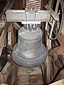 Evangelische Kirche Brandoberndorf Glocke 3.jpg 2,736 × 3,648; 3.39 MB
-
 Evangelische Pfarrkirche Brandoberndorf Turm.jpg 3,000 × 4,000; 4.16 MB
-
 Evangelische Pfarrkirche Brandoberndorf Turmuhr.jpg 4,000 × 3,000; 4.84 MB
.jpg)
.jpg)
.jpg)
.jpg)
.jpg)
.jpg)
.jpg)
.jpg)
.jpg)
.jpg)
.jpg)
.jpg)


