Category:Evangelische Friedenskirche (Ratheim)
Jump to navigation
Jump to search
| Object location | | View all coordinates using: OpenStreetMap |
|---|
 | |||||
| Upload media | |||||
| Instance of | |||||
|---|---|---|---|---|---|
| Location | Hückelhoven, Heinsberg, Cologne Government Region, North Rhine-Westphalia, Germany | ||||
 | |||||
Media in category "Evangelische Friedenskirche (Ratheim)"
The following 4 files are in this category, out of 4 total.
-
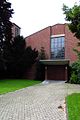
 Ratheim Evang. Kirche Anbau.jpg 1,200 × 800; 211 KB
-
 Ratheim Evang. Kirche Ansicht.jpg 1,200 × 800; 205 KB
-
 Ratheim Evang. Kirche Eingang.jpg 800 × 1,200; 195 KB
-
 Ratheim Evang. Kirche Turmansicht.jpg 800 × 1,200; 194 KB


