Category:Everton, Nottinghamshire
Jump to navigation
Jump to search
English: Everton is a village and civil parish in Nottinghamshire, England. Located on the A631 between Gainsborough and Bawtry, it is part of Bassetlaw district.
village and civil parish in Nottinghamshire, England  | |||||
| Upload media | |||||
| Instance of | |||||
|---|---|---|---|---|---|
| Location | Bassetlaw, Nottinghamshire, East Midlands, England | ||||
| Different from | |||||
 | |||||
Subcategories
This category has the following 3 subcategories, out of 3 total.
Media in category "Everton, Nottinghamshire"
The following 200 files are in this category, out of 211 total.
(previous page) (next page)-
 "The Sun Inn", Everton - geograph.org.uk - 4784042.jpg 4,953 × 3,735; 4.66 MB
-
 A bend in the Chesterfield Canal - geograph.org.uk - 5134266.jpg 654 × 800; 238 KB
-
 A623 at Chapel Street, Everton - geograph.org.uk - 5677227.jpg 640 × 481; 45 KB
-
 A631 Gainsborough Road Bridge No 73 - geograph.org.uk - 5133901.jpg 800 × 674; 236 KB
-
 A631 heading west - geograph.org.uk - 4047565.jpg 640 × 480; 52 KB
-
 A631 through Everton - geograph.org.uk - 2508542.jpg 640 × 422; 61 KB
-
 Another little used bridleway - geograph.org.uk - 3070808.jpg 1,024 × 768; 211 KB
-
 Approaching Carr Hill Farm - geograph.org.uk - 4495396.jpg 1,600 × 1,200; 794 KB
-
 Approaching Drakeholes - geograph.org.uk - 4021470.jpg 1,024 × 768; 222 KB
-
 Approaching Mattersey on old road-path from north - geograph.org.uk - 4616792.jpg 3,020 × 1,628; 3.33 MB
-
 Autumn colour on Barrow Hills - geograph.org.uk - 2136629.jpg 1,024 × 768; 229 KB
-
 Barn across the field - geograph.org.uk - 2136571.jpg 1,024 × 768; 119 KB
-
 Barrier Bank - geograph.org.uk - 3061783.jpg 1,024 × 768; 181 KB
-
 Barriers on Everton Sluice Lane - geograph.org.uk - 3061703.jpg 1,024 × 768; 207 KB
-
 Barrow hills - geograph.org.uk - 1761983.jpg 640 × 480; 86 KB
-
 Bawtry Road (A631) - geograph.org.uk - 4047573.jpg 640 × 480; 67 KB
-
 Bawtry Road (A631) - geograph.org.uk - 4047579.jpg 640 × 480; 61 KB
-
 Bawtry Road (A631) - geograph.org.uk - 4047588.jpg 640 × 480; 69 KB
-
 Bawtry Road, Everton - geograph.org.uk - 6213951.jpg 1,024 × 683; 252 KB
-
 Black Bank - geograph.org.uk - 3061636.jpg 1,024 × 768; 136 KB
-
 Black Bank near Everton - geograph.org.uk - 3061622.jpg 1,024 × 768; 144 KB
-
 Bridge 73a and Drakeholes Tunnel - geograph.org.uk - 2661233.jpg 1,024 × 768; 192 KB
-
 Bridleway along Polly Well Bank - geograph.org.uk - 3070809.jpg 1,024 × 768; 250 KB
-

-

-
 Broomhill Lane - geograph.org.uk - 2136665.jpg 1,024 × 768; 164 KB
-
 Buildings at Drakeholes Farm - geograph.org.uk - 5133895.jpg 800 × 557; 134 KB
-
 Bus shelter on Mattersey Road, Everton - geograph.org.uk - 4784054.jpg 5,184 × 3,888; 5.36 MB
-
 Buzzard watching over his patch - geograph.org.uk - 3070810.jpg 1,024 × 808; 300 KB
-
 Byway to Everton - geograph.org.uk - 2136537.jpg 1,024 × 768; 351 KB
-
 Carr Hill Farm - geograph.org.uk - 4616642.jpg 800 × 533; 102 KB
-
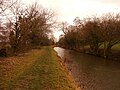
 Chesterfield Canal - geograph.org.uk - 4496082.jpg 1,600 × 1,200; 969 KB
-
 Chesterfield Canal - geograph.org.uk - 66175.jpg 640 × 480; 162 KB
-
 Chesterfield Canal - Tunnel at Drakeholes - panoramio.jpg 3,072 × 2,304; 1.55 MB
-

-
 Chesterfield Canal at sunset - geograph.org.uk - 4260684.jpg 1,280 × 895; 353 KB
-
 Chesterfield Canal near Gringley - geograph.org.uk - 3153365.jpg 435 × 640; 281 KB
-
 Chesterfield Canal north of Drakeholes - geograph.org.uk - 4495431.jpg 1,600 × 1,200; 700 KB
-
 Chesterfield Canal south of Park Farm - geograph.org.uk - 4496085.jpg 1,600 × 1,200; 610 KB
-
 Chesterfield canal. - geograph.org.uk - 1738342.jpg 480 × 640; 117 KB
-
 Claybank Lane - geograph.org.uk - 3061715.jpg 1,024 × 897; 138 KB
-
 Clipping the corner - geograph.org.uk - 4021395.jpg 1,024 × 768; 279 KB
-
 Corner farm, Everton (1) - geograph.org.uk - 2136518.jpg 1,024 × 768; 125 KB
-
 Corner farm, Everton (2) - geograph.org.uk - 2136522.jpg 1,024 × 768; 151 KB
-
 Cottage on Harwell Sluice Lane - geograph.org.uk - 4614633.jpg 2,952 × 1,728; 1.76 MB
-
 Cottage on Harwell Sluice Lane - geograph.org.uk - 4616640.jpg 800 × 533; 156 KB
-
 Crop field north of Bawtry Road - geograph.org.uk - 4047577.jpg 640 × 480; 58 KB
-
 Crop field off Stone Hill Lane - geograph.org.uk - 4047581.jpg 640 × 480; 60 KB
-

-
 Cuckoo Way and the Chesterfield Canal - geograph.org.uk - 5134280.jpg 800 × 587; 169 KB
-
 Distant view of Mill farm near Everton - geograph.org.uk - 4424347.jpg 1,600 × 1,200; 485 KB
-
 Disused windmill near Everton - geograph.org.uk - 1214964.jpg 480 × 640; 68 KB
-
 Drakeholes - geograph.org.uk - 693082.jpg 640 × 427; 70 KB
-
 Drakeholes House - geograph.org.uk - 4260672.jpg 1,280 × 960; 238 KB
-
 Drakeholes tunnel - geograph.org.uk - 3153337.jpg 640 × 427; 159 KB
-
 Drakeholes tunnel - geograph.org.uk - 3153340.jpg 640 × 427; 157 KB
-
 Drakeholes tunnel - geograph.org.uk - 3153343.jpg 640 × 427; 221 KB
-
 Drakeholes Tunnel - geograph.org.uk - 3834736.jpg 1,500 × 1,125; 2.14 MB
-
 Drakeholes Tunnel - geograph.org.uk - 4260677.jpg 1,280 × 960; 388 KB
-
 Drakeholes Tunnel, Chesterfield Canal - geograph.org.uk - 4260681.jpg 1,280 × 913; 364 KB
-
 Everton Cemetery - geograph.org.uk - 2136683.jpg 1,024 × 768; 125 KB
-
 Everton Mill - geograph.org.uk - 4614230.jpg 800 × 533; 68 KB
-
 Everton Sluice Lane - geograph.org.uk - 3061709.jpg 1,024 × 768; 140 KB
-
 Everton Sluice Lane - geograph.org.uk - 4495402.jpg 1,600 × 1,200; 427 KB
-
 Everton Sluice Lane - geograph.org.uk - 4616646.jpg 800 × 533; 152 KB
-
 Everton Village Hall - geograph.org.uk - 2136502.jpg 1,024 × 768; 126 KB
-
 Everton village hall - geograph.org.uk - 4243541.jpg 1,280 × 888; 274 KB
-
 Farmland near Scaftworth - geograph.org.uk - 4803591.jpg 4,608 × 3,456; 3.62 MB
-
 Farmland north of the Chesterfield Canal - geograph.org.uk - 5134282.jpg 800 × 540; 138 KB
-
 Fence at the edge of woodland - geograph.org.uk - 2661206.jpg 1,024 × 768; 251 KB
-
 Field beside Byway. - geograph.org.uk - 1761977.jpg 480 × 640; 55 KB
-
 Field beside Everton Sluice Lane - geograph.org.uk - 4614615.jpg 3,072 × 1,728; 1.51 MB
-
 Field west of Everton - geograph.org.uk - 6213954.jpg 1,024 × 683; 200 KB
-

-
 Footbridge over the River Idle at Mattersey - geograph.org.uk - 4424359.jpg 1,600 × 1,200; 859 KB
-
 Footpath and Field near Drakeholes - geograph.org.uk - 4818291.jpg 4,608 × 3,456; 4.24 MB
-
 Footpath to Barrier Bank - geograph.org.uk - 3061687.jpg 1,024 × 768; 159 KB
-
 Footpath to Carr Hill Farm - geograph.org.uk - 3061735.jpg 1,024 × 768; 203 KB
-
 Gainsborough Road (A631) - geograph.org.uk - 4047561.jpg 640 × 480; 59 KB
-
 Glebe Farmhouse and Cottage - geograph.org.uk - 4243488.jpg 1,280 × 960; 333 KB
-
 Grazing, Willow Tree Farm - geograph.org.uk - 4047585.jpg 640 × 480; 66 KB
-
 Green Lane - geograph.org.uk - 3061789.jpg 1,024 × 768; 239 KB
-
 Hall Farmhouse, Everton - geograph.org.uk - 4243540.jpg 1,280 × 863; 258 KB
-
 Harlington House, Everton - geograph.org.uk - 4243494.jpg 1,280 × 960; 364 KB
-
 Harwell Sluice Lane - geograph.org.uk - 3061757.jpg 1,024 × 768; 155 KB
-

-
 Hedge on the hillside, near Haven Croft - geograph.org.uk - 2661217.jpg 1,024 × 768; 149 KB
-
 Hidden by trees - geograph.org.uk - 4021479.jpg 1,024 × 768; 314 KB
-
 High Street, Everton - geograph.org.uk - 4047566.jpg 640 × 480; 63 KB
-
 House in Everton with Holy Trinity Church beyond - geograph.org.uk - 3253478.jpg 4,383 × 2,922; 2.62 MB
-
 Houses seen across Bawtry Road, Everton - geograph.org.uk - 6213964.jpg 1,024 × 683; 179 KB
-
 In Pusto Hill Wood - geograph.org.uk - 4616795.jpg 3,072 × 1,728; 4.13 MB
-

-
 Junction of Pusto Hill Lane and Mill Lane, near Everton - geograph.org.uk - 4616803.jpg 3,072 × 1,728; 4.48 MB
-
 K6 telephone kiosk, Everton - geograph.org.uk - 4243515.jpg 1,280 × 960; 430 KB
-
 Lane past Drakeholes House - geograph.org.uk - 4260675.jpg 1,280 × 960; 272 KB
-

-
 Lines in fields. - geograph.org.uk - 1738346.jpg 480 × 640; 64 KB
-
 Longbottom's Mill-geograph.org-1889339.jpg 1,024 × 768; 210 KB
-
 Looking towards Pasture Farm - geograph.org.uk - 2136545.jpg 1,024 × 768; 161 KB
-
 Mattersey is just around the corner - geograph.org.uk - 1408105.jpg 640 × 427; 62 KB
-
 Meandering River Idle. - geograph.org.uk - 526983.jpg 640 × 480; 109 KB
-
 Metcalfe House, High Street - geograph.org.uk - 4243513.jpg 1,280 × 960; 259 KB
-
 Middle Cross Lane - geograph.org.uk - 3061731.jpg 1,024 × 768; 240 KB
-
 Mind the Cameras - geograph.org.uk - 2208010.jpg 640 × 427; 72 KB
-
 Mind the ice - geograph.org.uk - 2208001.jpg 640 × 427; 73 KB
-
 Moorings At Drakeholes - geograph.org.uk - 451012.jpg 640 × 480; 113 KB
-
 Mother Drain, Everton Carrs - geograph.org.uk - 3061660.jpg 1,024 × 768; 201 KB
-
 Newall Drive, Mattersey Thorpe - geograph.org.uk - 4616724.jpg 3,072 × 1,728; 3.14 MB
-
 Northern portal of the Drakeholes Tunnel - geograph.org.uk - 5134264.jpg 600 × 800; 169 KB
-
 Northern portal, Drakeholes Tunnel - geograph.org.uk - 2661282.jpg 1,024 × 768; 113 KB
-
 Nutcroft Way, Harwell - geograph.org.uk - 4784033.jpg 5,184 × 3,720; 5.04 MB
-
 Old Mattersey Road - geograph.org.uk - 2451754.jpg 640 × 427; 145 KB
-
 Old Post Office Street - geograph.org.uk - 4243507.jpg 1,280 × 960; 246 KB
-
 Overgrown bridleway - geograph.org.uk - 3072045.jpg 1,024 × 768; 205 KB
-
 Pasture Lane - geograph.org.uk - 2136542.jpg 1,024 × 768; 315 KB
-
 Path junction. - geograph.org.uk - 1761987.jpg 640 × 480; 91 KB
-
 Path through the woodland at Barrow Hills - geograph.org.uk - 4495379.jpg 1,600 × 1,200; 895 KB
-
 Pear Tree Farmhouse - geograph.org.uk - 4243525.jpg 1,280 × 849; 347 KB
-
 Pinfold Lane, Harwell - geograph.org.uk - 4495385.jpg 1,600 × 1,200; 784 KB
-
 Pond at Mattersey - geograph.org.uk - 2447174.jpg 640 × 427; 107 KB
-
 Preparing to sow the seed - geograph.org.uk - 3409111.jpg 4,000 × 2,248; 2.26 MB
-
 Private land, no shooting or fishing - geograph.org.uk - 1214936.jpg 640 × 480; 80 KB
-
 Pusto Hill Lane - geograph.org.uk - 4424341.jpg 1,600 × 1,200; 1 MB
-
 Pusto hill woodland. - geograph.org.uk - 1761989.jpg 480 × 640; 139 KB
-
 Quiet lane in Everton - geograph.org.uk - 2136513.jpg 1,024 × 768; 218 KB
-
 Rabbit warrens on Barrow Hills - geograph.org.uk - 4614651.jpg 3,072 × 1,728; 1.89 MB
-
 Ragwort and waltzing poles - geograph.org.uk - 3061671.jpg 1,024 × 768; 167 KB
-
 Ragwort infested field by the River Idle - geograph.org.uk - 3061678.jpg 1,024 × 768; 195 KB
-
 Ready for action - geograph.org.uk - 3409115.jpg 4,000 × 2,248; 3.06 MB
-
 Repairing Clay Bank Lane - geograph.org.uk - 1214954.jpg 640 × 407; 70 KB
-
 River Idle - geograph.org.uk - 2447171.jpg 640 × 427; 127 KB
-
 River Idle at Mattersey looking West - geograph.org.uk - 1889315.jpg 1,024 × 768; 253 KB
-
 Rivet bench mark, Eel Pool Road, Mattersey - geograph.org.uk - 4260657.jpg 960 × 1,280; 642 KB
-
 Road Junction for Drakeholes - geograph.org.uk - 1408120.jpg 640 × 427; 62 KB
-
 Rock Cottage at Carr Hill - geograph.org.uk - 4495389.jpg 1,600 × 1,200; 718 KB
-
 Rounding the bend - geograph.org.uk - 4021283.jpg 1,024 × 768; 342 KB
-
 Ruin in the trees - geograph.org.uk - 4021341.jpg 1,024 × 768; 374 KB
-
 Ruin next to the Chesterfield Canal - geograph.org.uk - 4818299.jpg 4,608 × 3,456; 3.74 MB
-
 Sandy byway to Stone Hill Lane - geograph.org.uk - 1214969.jpg 640 × 501; 99 KB
-
 Sandy soil - geograph.org.uk - 1214933.jpg 640 × 417; 110 KB
-
 Shooter's Lodge for sale - geograph.org.uk - 1214930.jpg 640 × 480; 93 KB
-

-
 Stone Hill Farm - geograph.org.uk - 1214970.jpg 640 × 439; 79 KB
-
 Stone Hill Lane (track) - geograph.org.uk - 4047583.jpg 640 × 480; 70 KB
-
 Stone Hill Lane - geograph.org.uk - 2136649.jpg 1,024 × 768; 151 KB
-
 Stone Hill Lane - geograph.org.uk - 6059063.jpg 1,024 × 683; 159 KB
-
 Straight on for Mattersey - geograph.org.uk - 2208071.jpg 640 × 427; 62 KB
-
 Sun Inn, Everton - geograph.org.uk - 4614597.jpg 3,072 × 1,728; 1.18 MB
-
 Tethering Lane - geograph.org.uk - 4495424.jpg 1,600 × 1,200; 638 KB
-
 The Blacksmith's Arms, Everton - geograph.org.uk - 4614529.jpg 3,072 × 1,728; 1.12 MB
-
 The Blacksmiths Arms - geograph.org.uk - 4243499.jpg 1,280 × 960; 199 KB
-
 The Blacksmiths Arms - geograph.org.uk - 4614222.jpg 800 × 533; 96 KB
-
 The Blacksmiths Arms, Everton - geograph.org.uk - 4495415.jpg 1,600 × 1,200; 462 KB
-
 The bridleway from Stone Hill - geograph.org.uk - 1214974.jpg 640 × 449; 81 KB
-
 The canal is down there - geograph.org.uk - 4021546.jpg 1,024 × 768; 380 KB
-
 The Chesterfield Canal - geograph.org.uk - 3406521.jpg 800 × 533; 146 KB
-
 The Chesterfield Canal - geograph.org.uk - 3406529.jpg 533 × 800; 185 KB
-
 The Chesterfield Canal - geograph.org.uk - 4021561.jpg 1,024 × 768; 247 KB
-
 The Chesterfield Canal and Cuckoo Way - geograph.org.uk - 4818295.jpg 4,608 × 3,456; 3.73 MB
-
 The Chesterfield Canal and the A631 overbridge - geograph.org.uk - 4021278.jpg 1,024 × 768; 308 KB
-
 The Cottage, Drakeholes - geograph.org.uk - 4260671.jpg 1,280 × 960; 383 KB
-
 The end of Broomhill Lane near Everton - geograph.org.uk - 1214967.jpg 640 × 480; 111 KB
-
 The old Malthouse - geograph.org.uk - 4243510.jpg 1,280 × 960; 209 KB
-
 The Old School House - geograph.org.uk - 4614228.jpg 800 × 533; 100 KB
-
 The River Idle at Eel Pool - geograph.org.uk - 4260661.jpg 979 × 1,280; 465 KB
-
 The River Idle at Misson - geograph.org.uk - 4864153.jpg 4,949 × 3,568; 4.86 MB
-
 The River Idle looking East towards Mattersey - geograph.org.uk - 1889329.jpg 1,024 × 768; 185 KB
-
 The River Idle near Mattersey - geograph.org.uk - 4803563.jpg 4,608 × 3,456; 3.7 MB
-
 The Sun Inn - geograph.org.uk - 4614226.jpg 800 × 533; 115 KB
-
 The Sun Inn at Everton - geograph.org.uk - 4818282.jpg 4,608 × 3,456; 3.37 MB
-
 The Sun Inn, Everton - geograph.org.uk - 1214961.jpg 640 × 480; 49 KB
-
 The Sun Inn, Everton - geograph.org.uk - 4047571.jpg 640 × 480; 60 KB
-
 The Sun Inn, Everton - geograph.org.uk - 4243520.jpg 1,280 × 960; 217 KB
-
 The Sun Inn, Everton - geograph.org.uk - 6213966.jpg 1,024 × 683; 156 KB
-
 The tarmac ends and the bridleway starts - geograph.org.uk - 1214931.jpg 640 × 480; 112 KB
-
 The White Lodge, Everton - geograph.org.uk - 4243503.jpg 1,280 × 960; 435 KB
-

-
 Toft Hill Lane - geograph.org.uk - 3061695.jpg 1,024 × 768; 193 KB
-
 Toft Hill Lane - geograph.org.uk - 3061762.jpg 1,024 × 768; 203 KB
-
 Track across Barrow Hills - geograph.org.uk - 2136624.jpg 1,024 × 768; 248 KB
-
 Track Junction near Stone Hill Farm - geograph.org.uk - 4803584.jpg 4,608 × 3,456; 3.57 MB
-
 Track through Barrow hills woodland. - geograph.org.uk - 1761981.jpg 480 × 640; 96 KB
-
 Track to Pasture farm. - geograph.org.uk - 1761972.jpg 640 × 480; 48 KB
-
 Trees along the Chesterfield Canal - geograph.org.uk - 2661275.jpg 1,024 × 768; 181 KB
-
 Twelfth century chancel arch in Everton parish church - geograph.org.uk - 3253502.jpg 4,144 × 2,960; 2.61 MB
-
 View to Carr Hill - geograph.org.uk - 2136638.jpg 1,024 × 768; 126 KB
-
 View towards Barrow Hills - geograph.org.uk - 2136550.jpg 1,024 × 768; 119 KB
-
 View towards Pusto Hill Wood - geograph.org.uk - 2751240.jpg 1,024 × 768; 137 KB
-

-
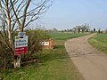
 Village entrance sign at Everton - geograph.org.uk - 4237148.jpg 1,280 × 877; 325 KB
-
 Village Scene in Everton - geograph.org.uk - 4818276.jpg 4,575 × 3,372; 3.4 MB
-
 Walking the dog in Pusto Hill Wood - geograph.org.uk - 4614233.jpg 800 × 533; 199 KB
-
 Waste ground on Mattersey Road, Everton - geograph.org.uk - 2136674.jpg 1,024 × 768; 205 KB
-
 Wheat and poppies - geograph.org.uk - 3061653.jpg 1,024 × 768; 164 KB
-

-
 Wildflowers and Barrow Hills (2) - geograph.org.uk - 3061752.jpg 1,024 × 768; 178 KB
-
 Wildflowers and Barrow Hills - geograph.org.uk - 3061746.jpg 1,024 × 768; 218 KB
-
 Windmill from Mill lane. - geograph.org.uk - 1761991.jpg 480 × 640; 55 KB
-
 Wisteria Cottage, Everton - geograph.org.uk - 4243506.jpg 1,280 × 960; 260 KB


_-_geograph.org.uk_-_4047573.jpg)
_-_geograph.org.uk_-_4047579.jpg)
_-_geograph.org.uk_-_4047588.jpg)


_-_geograph.org.uk_-_2136518.jpg)
_-_geograph.org.uk_-_2136522.jpg)


_-_geograph.org.uk_-_4047561.jpg)


_-_geograph.org.uk_-_1214958.jpg)


_-_geograph.org.uk_-_4047583.jpg)


_-_geograph.org.uk_-_3061752.jpg)


