Category:Ewell Minnis
Aller à la navigation
Aller à la recherche
village britannique | |||||
| Téléverser des médias | |||||
| Nature de l’élément | |||||
|---|---|---|---|---|---|
| Lieu | Alkham, Dover, Kent, Angleterre du Sud-Est, Angleterre | ||||
 | |||||
Média dans la catégorie « Ewell Minnis »
Cette catégorie comprend 26 fichiers, dont les 26 ci-dessous.
-
 Bridleway along Green Lane - geograph.org.uk - 871155.jpg 480 × 640 ; 251 kio
-
 Entrance to Wolverton Farm - geograph.org.uk - 870582.jpg 640 × 480 ; 224 kio
-
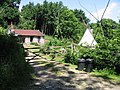 House and teepee - geograph.org.uk - 870595.jpg 640 × 480 ; 260 kio
-
 Lane towards Minnis Farm - geograph.org.uk - 871179.jpg 640 × 480 ; 224 kio
-
 Lane towards Sunnyhill Farm and The Minnis - geograph.org.uk - 871168.jpg 640 × 480 ; 226 kio
-
 Looking N towards Lord's Wood - geograph.org.uk - 871206.jpg 640 × 480 ; 209 kio
-
 Looking NE along lane at Ewell Minnis - geograph.org.uk - 871163.jpg 640 × 480 ; 167 kio
-
 Looking NW along road through Neck Wood - geograph.org.uk - 870579.jpg 640 × 480 ; 220 kio
-
 Looking SE along footpath from Swanton Lane - geograph.org.uk - 816646.jpg 640 × 480 ; 198 kio
-
 Looking W along lane at Ewell Minnis - geograph.org.uk - 871148.jpg 640 × 438 ; 240 kio
-
 Looking W towards Minnis Farm - geograph.org.uk - 871199.jpg 640 × 480 ; 211 kio
-
 Phonebox and letterbox in Ewell Minnis - geograph.org.uk - 871161.jpg 640 × 480 ; 174 kio
-
 Road junction from Green Lane - geograph.org.uk - 871144.jpg 640 × 480 ; 234 kio
-
 The Alkham Valley in early summer - geograph.org.uk - 870577.jpg 640 × 480 ; 260 kio
-
 The former Newcastle Inn, Ewell Minnis - geograph.org.uk - 871193.jpg 640 × 480 ; 166 kio
-
 The road to Ewell Minnis through Neck Wood - geograph.org.uk - 870589.jpg 640 × 480 ; 289 kio
-
 Trees in the Alkham Valley - geograph.org.uk - 870598.jpg 640 × 480 ; 214 kio
-
 Unmetalled road towards The Minnis - geograph.org.uk - 871204.jpg 640 × 480 ; 181 kio
-
 View of the Alkham Valley - geograph.org.uk - 577567.jpg 640 × 480 ; 48 kio
-
 View towards Ewell Minnis - geograph.org.uk - 870586.jpg 640 × 480 ; 253 kio
-
 Wolverton Hill - Steep Hill 16^ - geograph.org.uk - 1429960.jpg 640 × 400 ; 84 kio
-
 Ferne Lane from Chalksole Green Lane - geograph.org.uk - 363707.jpg 640 × 480 ; 80 kio
-
 Lane with well maintained hedge - geograph.org.uk - 423191.jpg 640 × 480 ; 93 kio
-
 Triangular lane junction at Ewell Minnis - geograph.org.uk - 423247.jpg 640 × 480 ; 84 kio
-
 Valley view - geograph.org.uk - 423249.jpg 640 × 480 ; 109 kio
-
 View across grassland to Brown's Wood - geograph.org.uk - 363189.jpg 640 × 480 ; 51 kio


