Category:Eyton upon the Weald Moors
Aller à la navigation
Aller à la recherche
village britannique  | |||||
| Téléverser des médias | |||||
| Nature de l’élément | |||||
|---|---|---|---|---|---|
| Lieu | Telford et Wrekin, Shropshire, Midlands de l'Ouest, Angleterre | ||||
 | |||||
Sous-catégories
Cette catégorie comprend seulement la sous-catégorie ci-dessous.
Média dans la catégorie « Eyton upon the Weald Moors »
Cette catégorie comprend 47 fichiers, dont les 47 ci-dessous.
-
 'The Duke's Drive' - a little overgrown. - geograph.org.uk - 2055502.jpg 640 × 426 ; 131 kio
-
 A short stretch of the Old Road at Long Lane - geograph.org.uk - 5014746.jpg 1 102 × 1 469 ; 877 kio
-
 A stretch of the Strine Brook - geograph.org.uk - 5031760.jpg 1 306 × 979 ; 667 kio
-
 A442 south towards Telford - geograph.org.uk - 5014689.jpg 1 306 × 979 ; 570 kio
-
 Across Wappenhall Moor - geograph.org.uk - 5033004.jpg 1 306 × 979 ; 613 kio
-
 Arable land near Long Lane - geograph.org.uk - 5014702.jpg 1 469 × 1 102 ; 637 kio
-
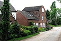
 Barn at Eyton House Farm - geograph.org.uk - 5035765.jpg 1 306 × 979 ; 576 kio
-
 By Long Lane Farm - geograph.org.uk - 5014740.jpg 1 469 × 1 102 ; 687 kio
-
 Canal cottage at Eyton Moors - geograph.org.uk - 999419.jpg 640 × 480 ; 62 kio
-
 Canal Cottage, Eyton - geograph.org.uk - 5035758.jpg 1 306 × 979 ; 533 kio
-
 Cottages at Wappenshall Farm - geograph.org.uk - 2974770.jpg 1 142 × 857 ; 313 kio
-
 Eyton upon the Weald Moors - geograph.org.uk - 810072.jpg 640 × 480 ; 75 kio
-
 Eyton upon the Weald Moors, Eyton House - geograph.org.uk - 1627288.jpg 640 × 480 ; 84 kio
-

-
 Eyton upon the Weald Moors, the cemetery - geograph.org.uk - 1627653.jpg 640 × 480 ; 120 kio
-

-

-
 Farmland at Wappenshall - geograph.org.uk - 2974775.jpg 1 142 × 857 ; 304 kio
-
 Field drain near Long Lane - geograph.org.uk - 5014737.jpg 1 469 × 1 102 ; 619 kio
-
 Heading for Eyton upon the Weald Moors - geograph.org.uk - 5031748.jpg 1 306 × 979 ; 664 kio
-
 House and a field of Oilseed Rape - geograph.org.uk - 810083.jpg 640 × 480 ; 131 kio
-
 Hurley Brook, Eyton upon the Weald Moors - geograph.org.uk - 1319104.jpg 640 × 480 ; 503 kio
-
 Irrigation pool by Mantle Covert - geograph.org.uk - 5033003.jpg 1 306 × 979 ; 675 kio
-
 Lane into Eyton upon the Weald Moors - geograph.org.uk - 5014145.jpg 1 469 × 1 102 ; 699 kio
-
 Lane through Wappenhall - geograph.org.uk - 821121.jpg 640 × 480 ; 79 kio
-
 Large barn at Wappenshall Farm - geograph.org.uk - 2974773.jpg 1 142 × 857 ; 325 kio
-
 Long Lane Cafe - geograph.org.uk - 5168605.jpg 1 600 × 1 200 ; 689 kio
-
 Massive barn and old machinery. - geograph.org.uk - 57159.jpg 640 × 480 ; 102 kio
-
 Narrow lane into Eyton on the Weald Moors - geograph.org.uk - 5014683.jpg 1 469 × 1 102 ; 782 kio
-
 Old Lock Chamber - geograph.org.uk - 1319095.jpg 640 × 480 ; 374 kio
-
 Old Mill, Eyton upon the Weald Moors - geograph.org.uk - 1319086.jpg 640 × 431 ; 286 kio
-
 Original warehouse, Wappenshall Junction.jpg 640 × 480 ; 254 kio
-
 OS benchmark - Long Lane, bridge over a field drain - geograph.org.uk - 5014694.jpg 1 469 × 1 102 ; 901 kio
-
 Out for a drive, in our little tanks - geograph.org.uk - 5014736.jpg 1 632 × 1 224 ; 718 kio
-
 Pig sheds (^) in a field near Wappenshall - geograph.org.uk - 2974769.jpg 1 306 × 979 ; 359 kio
-
 Potato crop - geograph.org.uk - 5032998.jpg 1 306 × 979 ; 571 kio
-
 South of Long Lane - geograph.org.uk - 5014705.jpg 1 469 × 1 102 ; 607 kio
-
 Strine Brook north of Eyton upon the Weald Moors - geograph.org.uk - 5031762.jpg 1 306 × 979 ; 828 kio
-
 The A442 leading to Long Lane - geograph.org.uk - 5014710.jpg 1 469 × 1 102 ; 605 kio
-
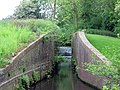
 The remains of Eyton Lock - geograph.org.uk - 5035726.jpg 979 × 1 306 ; 454 kio
-
 Track alongside New Rookery - geograph.org.uk - 5033010.jpg 1 306 × 979 ; 502 kio
-
 Track towards Mantle Covert - geograph.org.uk - 5033000.jpg 979 × 1 306 ; 493 kio
-
 Transhipment Warehouse, Wappenshall Junction.jpg 640 × 480 ; 254 kio
-
 Water in the canal - geograph.org.uk - 5014751.jpg 979 × 1 306 ; 796 kio
-
 Welcome to Long Lane - geograph.org.uk - 5168599.jpg 1 600 × 1 200 ; 732 kio
-
 Wheat in a field on Eyton Moor - geograph.org.uk - 5033012.jpg 1 306 × 979 ; 489 kio
-
 Wheat in a field west of Eyton - geograph.org.uk - 5014684.jpg 1 469 × 1 102 ; 565 kio


_in_a_field_near_Wappenshall_-_geograph.org.uk_-_2974769.jpg)


