Category:Farne Islands
Salti al navigilo
Salti al serĉilo
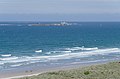
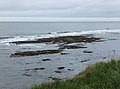
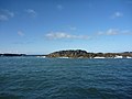
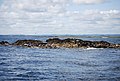
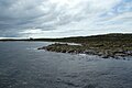
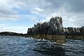
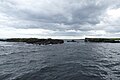
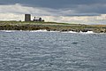
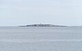
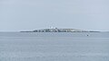
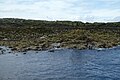
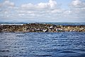
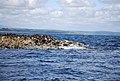
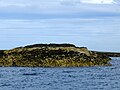
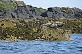
| The main islands in Farne Islands are in two groups: the Inner Group are Inner Farne, Knoxes Reef and the East and West Wideopens (all joined together on very low tides) and (somewhat separated) the Megstone; in the Outer Group are Staple Island, the Brownsman, North and South Wamses, Big Harcar and the Longstone. The two groups are separated by Staple Sound. The highest point, on Inner Farne, is 19 metres (62 feet) above mean sea level. |
 |
island group  | |||||
| Alŝuti plurmedion | |||||
| Estas |
| ||||
|---|---|---|---|---|---|
| Parto de | |||||
| Loko | North Sunderland, Northumberland, Nordorienta Anglio, Anglio | ||||
| Ĉe akvokorpo | |||||
| Mastrumata de | |||||
| Areo |
| ||||
| Supermara alteco |
| ||||
 | |||||
Subkategorioj
Ĉi tiu kategorio havas la 6 jenajn subkategoriojn, el 6 entute.
B
I
L
M
S
Dosieroj en kategorio “Farne Islands”
La jenaj 199 dosieroj estas en ĉi tiu kategorio, el 199 entute.
-
 2009 07 02 - Young grey seal and cormorants on Farne Islands.JPG 1 697 × 1 262; 1,7 MB
-
 A Seal on the Bush, Farne Islands - geograph.org.uk - 1059923.jpg 640 × 480; 92 KB
-
 An outcrop, Farne Islands - geograph.org.uk - 2688314.jpg 640 × 430; 40 KB
-
 Bamburgh MMB 25 Farne Islands.jpg 4 557 × 2 359; 2,77 MB
-
 Bamburgh MMB 27.jpg 4 218 × 2 775; 5,7 MB
-
 Bamburgh MMB 29 Bamburgh Castle.jpg 4 641 × 2 616; 3,14 MB
-
 Bamburgh MMB 32 Bamburgh Castle.jpg 4 431 × 2 559; 2,34 MB
-
 Basking Grey Seals - geograph.org.uk - 2967928.jpg 2 272 × 1 275; 1,56 MB
-
 Beach, West Wideopen - geograph.org.uk - 2691426.jpg 640 × 430; 51 KB
-
 Beach, West Wideopen - geograph.org.uk - 2691494.jpg 640 × 430; 35 KB
-
 Between Staple Island and Brownsman - geograph.org.uk - 2686860.jpg 640 × 390; 53 KB
-
 Big Harcar - geograph.org.uk - 5067573.jpg 640 × 427; 100 KB
-
 Big Harcar, Farne Islands - geograph.org.uk - 1298997.jpg 640 × 480; 55 KB
-
 Big Scarcar - geograph.org.uk - 2678031.jpg 640 × 346; 29 KB
-
 Big Scarcar - geograph.org.uk - 5067552.jpg 640 × 427; 108 KB
-
 Birds on Big Scarcar - geograph.org.uk - 5067553.jpg 640 × 427; 105 KB
-
 Birds, Big Harcar - geograph.org.uk - 3955815.jpg 640 × 480; 102 KB
-
 Blissful Existence.jpg 4 128 × 2 886; 6,85 MB
-
 Boat anchored off Staple Island - geograph.org.uk - 2678297.jpg 640 × 430; 48 KB
-
 Boat near North Wamses - geograph.org.uk - 6235400.jpg 1 024 × 683; 443 KB
-
 Boat passing - geograph.org.uk - 3600526.jpg 640 × 428; 79 KB
-
 Braidcarr Rocks - geograph.org.uk - 3470500.jpg 4 544 × 3 370; 4,57 MB
-
 Breeding birds, East Wideopen - geograph.org.uk - 2678022.jpg 640 × 430; 54 KB
-
 Brownsman and Staple Island - geograph.org.uk - 3473010.jpg 3 945 × 2 764; 2,72 MB
-
 Buildings on Brownsman, Farne Islands - geograph.org.uk - 3230372.jpg 3 008 × 2 000; 502 KB
-
 Burton MMB 01.jpg 4 708 × 3 030; 4,75 MB
-
 Clove Car - geograph.org.uk - 2688255.jpg 640 × 430; 43 KB
-
 Clove Car - geograph.org.uk - 2960361.jpg 2 520 × 1 680; 318 KB
-
 Clove Car - geograph.org.uk - 810581.jpg 640 × 480; 52 KB
-
 Clover Car - geograph.org.uk - 2688267.jpg 640 × 430; 38 KB
-
-
 Cormorant on his nest.jpg 6 303 × 4 400; 11,07 MB
-
 Crumstone - geograph.org.uk - 2680050.jpg 640 × 430; 47 KB
-
 Dive boat at Solan Rock - geograph.org.uk - 6235408.jpg 1 024 × 683; 432 KB
-
 Divers - geograph.org.uk - 2967954.jpg 623 × 640; 96 KB
-
 Divers - geograph.org.uk - 2967970.jpg 1 433 × 1 500; 1,24 MB
-
 East Wide Open - geograph.org.uk - 6235351.jpg 1 024 × 683; 398 KB
-
 East Wideopen - geograph.org.uk - 179932.jpg 640 × 480; 118 KB
-
 East Wideopen - geograph.org.uk - 2677995.jpg 640 × 430; 58 KB
-
 East Wideopen - geograph.org.uk - 2678013.jpg 640 × 306; 37 KB
-
 East Wideopen - geograph.org.uk - 2678025.jpg 640 × 430; 51 KB
-
 East Wideopen - geograph.org.uk - 5067551.jpg 640 × 427; 107 KB
-
 Edge of Skeney Scar - geograph.org.uk - 6235361.jpg 1 024 × 683; 440 KB
-
 Farne Grey seal (cropped).jpg 1 922 × 1 221; 1,67 MB
-
 Farne Grey seal.jpg 2 235 × 1 772; 2,19 MB
-
 Farne Island, sea stacks - geograph.org.uk - 1096879.jpg 640 × 500; 108 KB
-
 Farne island.jpg 6 000 × 4 000; 13,15 MB
-
 Farne Islands (1241170695).jpg 3 456 × 2 304; 4,28 MB
-
 Farne Islands - geograph.org.uk - 946317.jpg 640 × 426; 56 KB
-
 Farne Islands - geograph.org.uk - 946319.jpg 640 × 426; 61 KB
-
 Farne Islands - geograph.org.uk - 946320.jpg 640 × 423; 43 KB
-
 Farne Islands - geograph.org.uk - 946368.jpg 640 × 426; 95 KB
-
 Farne Islands - geograph.org.uk - 946371.jpg 640 × 428; 48 KB
-
 Farne Islands - geograph.org.uk - 946603.jpg 640 × 426; 65 KB
-
 Farne Islands banner from Bamburgh Castle.jpg 6 300 × 900; 2,36 MB
-
 Farne Islands from Bamburgh Castle.jpg 6 884 × 2 363; 5,7 MB
-
 Farne Islands from Seahouses (48380980272).jpg 5 341 × 2 586; 1,55 MB
-
 Farne Islands, boats - geograph.org.uk - 1096875.jpg 640 × 500; 81 KB
-
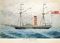 SS Forfarshire c1835.jpg 600 × 433; 87 KB
-
 Glad Tidings VII - geograph.org.uk - 5067569.jpg 640 × 427; 105 KB
-
 Grey Seal - Farne Is - FJ0A3328 (35498725744).jpg 1 280 × 640; 271 KB
-
 Grey Seal - Farne Is - FJ0A3345 (35498726044).jpg 1 280 × 640; 254 KB
-
 Grey Seal - Farne Is - FJ0A3410 (35498725854).jpg 1 280 × 853; 298 KB
-
 Grey Seal - Farne Is - FJ0A3780 (35526017473).jpg 1 280 × 640; 270 KB
-
 Grey Seal - Farne Is - FJ0A3834 (35526017713).jpg 1 280 × 640; 288 KB
-
 Grey Seal - Farne Is - FJ0A6640 (35938100180).jpg 1 280 × 640; 286 KB
-
 Grey Seal - Farne Is - FJ0A6712 (35938099900).jpg 1 280 × 853; 273 KB
-
 Grey Seal - Farne Is - FJ0A6734 (35938100940).jpg 1 280 × 853; 270 KB
-
 Grey Seal - Farne Is - FJ0A6740 (35938100750).jpg 1 280 × 640; 283 KB
-
 Grey Seal - Farne Is - FJ0A6775 (35938100520).jpg 1 280 × 640; 259 KB
-
 Grey Seal - geograph.org.uk - 2967924.jpg 640 × 460; 108 KB
-
 Grey Seal on Big Scarcar - geograph.org.uk - 3954623.jpg 640 × 480; 116 KB
-
 Grey seal on Roddam and Green - geograph.org.uk - 4214276.jpg 640 × 480; 123 KB
-
 Grey Seals - geograph.org.uk - 2967945.jpg 2 267 × 1 058; 1,53 MB
-
 Grey Seals - geograph.org.uk - 3954618.jpg 640 × 472; 101 KB
-
 Grey Seals at Farne Islands (North Sea).JPG 4 608 × 3 456; 3,98 MB
-
 Grey seals on South Wamses - geograph.org.uk - 3473185.jpg 2 742 × 992; 1,08 MB
-
 Grey Seals, Big Scarcar - geograph.org.uk - 3954625.jpg 640 × 475; 123 KB
-
 Grey Seals, Big Scarcar - geograph.org.uk - 3954629.jpg 640 × 480; 123 KB
-
 Grey Seals, Big Scarcar - geograph.org.uk - 3954634.jpg 640 × 480; 100 KB
-
 Grey Seals, Little Scarcar - geograph.org.uk - 3954635.jpg 640 × 480; 80 KB
-
 Grey Seals, Little Scarcar - geograph.org.uk - 3954639.jpg 640 × 480; 112 KB
-
 Grey seals, South Wamses - geograph.org.uk - 3494287.jpg 1 024 × 709; 209 KB
-
 Guillemots on Inner Farne - geograph.org.uk - 3472315.jpg 4 572 × 3 408; 5,29 MB
-
 Guillemots, Big Harcar - geograph.org.uk - 3955818.jpg 640 × 480; 110 KB
-
 Gun Rock - geograph.org.uk - 2678264.jpg 640 × 430; 77 KB
-
 Ile de Farne Angleterre.jpg 800 × 600; 385 KB
-
 Inner Farne - geograph.org.uk - 2678008.jpg 640 × 430; 50 KB
-
 Inner Farne - geograph.org.uk - 2678249.jpg 640 × 347; 37 KB
-
 Inner Farne Islands - geograph.org.uk - 2960391.jpg 2 520 × 1 680; 366 KB
-
 Juvenilegreysealswimmingfarneislands.jpg 4 288 × 2 848; 5,15 MB
-
 Kittiwake on a rock - geograph.org.uk - 3954685.jpg 640 × 480; 110 KB
-
 Kittiwakes and Guillemots - geograph.org.uk - 2686873.jpg 430 × 640; 106 KB
-
 Knivestone - geograph.org.uk - 829157.jpg 640 × 471; 53 KB
-
 Knoxes Reef - geograph.org.uk - 1110484.jpg 640 × 480; 44 KB
-
 Knoxes Reef - geograph.org.uk - 2678034.jpg 640 × 285; 26 KB
-
 Knoxes Reef - geograph.org.uk - 2691354.jpg 640 × 328; 23 KB
-
 Knoxes Reef - geograph.org.uk - 2691488.jpg 640 × 430; 40 KB
-
 Knoxes Reef, Farne Islands - geograph.org.uk - 179909.jpg 640 × 480; 112 KB
-
 Leaving Inner Farne (48398018462).jpg 5 184 × 3 888; 3,07 MB
-
 Leaving the Colony.jpg 3 732 × 2 217; 4,98 MB
-
 Leaving the Farnes - geograph.org.uk - 6175536.jpg 1 600 × 1 200; 554 KB
-
 Lighthouse, Inner Farne - geograph.org.uk - 2678002.jpg 640 × 430; 52 KB
-
 Little Harcar - geograph.org.uk - 2686910.jpg 640 × 430; 45 KB
-
 Little Scarcar - geograph.org.uk - 179915.jpg 640 × 480; 106 KB
-
 Little Scarcar - geograph.org.uk - 3472904.jpg 2 979 × 1 892; 1,51 MB
-
 Little Scarcar - geograph.org.uk - 5067558.jpg 640 × 427; 112 KB
-
 Little Scarcar - geograph.org.uk - 5544859.jpg 1 024 × 768; 173 KB
-
 Little Scarcar - geograph.org.uk - 6235357.jpg 1 024 × 683; 417 KB
-
 Look the other way (48455402197).jpg 2 261 × 3 165; 339 KB
-
 Looking across Roddam and Green - geograph.org.uk - 4053908.jpg 1 600 × 1 082; 137 KB
-
 Looking across the exposed rocks of Roddam and Green - geograph.org.uk - 4053887.jpg 1 600 × 1 008; 179 KB
-
 Looking towards East Wide Open - geograph.org.uk - 6235352.jpg 1 024 × 683; 447 KB
-
 Megstone - geograph.org.uk - 2686877.jpg 640 × 278; 15 KB
-
 Megstone - geograph.org.uk - 2691334.jpg 640 × 234; 15 KB
-
 Megstone - geograph.org.uk - 2691484.jpg 640 × 335; 26 KB
-
 Megstone, Farne Islands - geograph.org.uk - 179948.jpg 640 × 480; 81 KB
-
 North Wamses - geograph.org.uk - 179898.jpg 640 × 480; 102 KB
-
 North Wamses - geograph.org.uk - 5544863.jpg 1 024 × 768; 169 KB
-
 North Wamses - geograph.org.uk - 6235398.jpg 1 024 × 683; 496 KB
-
 North Wamses and Brownsman - geograph.org.uk - 6235390.jpg 1 024 × 683; 444 KB
-
 North Wamses with Brownsman beyond - geograph.org.uk - 6235397.jpg 1 024 × 683; 513 KB
-
 Northern Hares - geograph.org.uk - 3955828.jpg 640 × 480; 68 KB
-
 Outer Farne, with seals - geograph.org.uk - 709450.jpg 640 × 426; 53 KB
-
 Oystercatcher on North Wamses - geograph.org.uk - 6235388.jpg 1 024 × 857; 779 KB
-
 Part of Longstone - geograph.org.uk - 2688294.jpg 640 × 430; 57 KB
-
 Pinnacles - geograph.org.uk - 6235365.jpg 1 024 × 683; 445 KB
-
 Pinnacles Haven - geograph.org.uk - 6235370.jpg 1 024 × 683; 425 KB
-
 Preparing for a Dive - geograph.org.uk - 2967977.jpg 2 272 × 1 704; 2,38 MB
-
 Puffin Profile.jpg 4 740 × 3 336; 11,05 MB
-
 Puffins by West Wideopen - geograph.org.uk - 3472888.jpg 3 262 × 1 284; 1,31 MB
-
 Rabbit - Farne Is - FJ0A3006 (36165832712).jpg 1 280 × 853; 243 KB
-
 RNLB Grace Darling - geograph.org.uk - 5067546.jpg 640 × 322; 79 KB
-
 Rocky Outcrop - geograph.org.uk - 2967774.jpg 2 272 × 1 704; 1,88 MB
-
 Roddam and Green - geograph.org.uk - 179903.jpg 640 × 480; 96 KB
-
 Roddam and Green - geograph.org.uk - 2688315.jpg 640 × 430; 43 KB
-
 Roddam and Green - geograph.org.uk - 2688317.jpg 640 × 308; 32 KB
-
 Roddam and Green - geograph.org.uk - 3955802.jpg 640 × 480; 69 KB
-
 Roddam and Green - geograph.org.uk - 5067578.jpg 640 × 427; 103 KB
-
 Roddam and Green island with Brownsman in the background - geograph.org.uk - 5804849.jpg 4 032 × 3 024; 1,6 MB
-

-
 Roddan and Green - geograph.org.uk - 3600521.jpg 640 × 428; 94 KB
-
 Seahouses Harbour looking toward the Farne Islands (7275437656).jpg 3 917 × 2 407; 5,29 MB
-
 Seahouses MMB 08 Farne Islands.jpg 4 548 × 2 805; 2,41 MB
-
 Seahouses MMB 09 Farne Islands.jpg 4 428 × 2 481; 2,54 MB
-
 Seahouses MMB 10 Farne Islands.jpg 4 446 × 2 514; 1,9 MB
-
 Seahouses MMB 13 "St Cuthbert II".jpg 4 374 × 2 829; 2,75 MB
-
 Seahouses MMB 21 Farne Islands.jpg 4 641 × 2 781; 3,06 MB
-
 Seahouses MMB 24 Farne Islands.jpg 4 662 × 2 414; 2,57 MB
-
 Seahouses MMB 28 Farne Islands.jpg 4 637 × 2 840; 2,94 MB
-
 Seahouses MMB 33 Farne Islands.jpg 4 708 × 1 842; 3,69 MB
-
 Seahouses MMB 35 Farne Islands.jpg 4 581 × 1 863; 2,2 MB
-
 Seal colony, Big Scarcar (Farne islands) - geograph.org.uk - 5640252.jpg 2 494 × 1 872; 2,11 MB
-
 Seal on a Bed of Fresh Kelp.jpg 4 804 × 3 547; 14,23 MB
-
 Seal on Longstone - geograph.org.uk - 2688297.jpg 640 × 430; 107 KB
-
 Seal on North Wamses - geograph.org.uk - 6235392.jpg 1 024 × 683; 557 KB
-
 Seal on South Wamses - geograph.org.uk - 6235402.jpg 1 024 × 683; 475 KB
-
 Seal on the shoreline - geograph.org.uk - 6235395.jpg 683 × 1 024; 699 KB
-
 Seals near Roddam, Farne Islands - geograph.org.uk - 1379898.jpg 640 × 414; 57 KB
-
 Seals on Farne Islands - geograph.org.uk - 5184641.jpg 1 600 × 1 067; 1,19 MB
-
 Seals on Gun Rock - geograph.org.uk - 2678256.jpg 640 × 430; 83 KB
-
 Seals on Little Scarcar - geograph.org.uk - 5067557.jpg 640 × 427; 108 KB
-
 Seals on Little Scarcar, Farne Islands - geograph.org.uk - 2215313.jpg 2 592 × 1 944; 1,03 MB
-
 Seals on South Wamses - geograph.org.uk - 6235405.jpg 1 024 × 683; 582 KB
-
 Seals on the Bush, Farne Islands - geograph.org.uk - 109803.jpg 640 × 480; 131 KB
-
 Seals, Big Scarcar - geograph.org.uk - 3954616.jpg 640 × 480; 119 KB
-
 Seals, Gun Rock - geograph.org.uk - 2678261.jpg 640 × 430; 80 KB
-
 Seals, Gun Rock - geograph.org.uk - 2678285.jpg 640 × 430; 96 KB
-
 Shag sitting on a rock - geograph.org.uk - 3955888.jpg 640 × 480; 67 KB
-

-
 Skeney Scar - geograph.org.uk - 3600433.jpg 640 × 428; 77 KB
-
 Skeney Scar - geograph.org.uk - 5067561.jpg 640 × 427; 106 KB
-
 Skeney Scar - geograph.org.uk - 6235359.jpg 1 024 × 683; 423 KB
-
 Solan Rock - geograph.org.uk - 2678253.jpg 640 × 430; 82 KB
-
 Solan Rock - geograph.org.uk - 2691382.jpg 640 × 430; 48 KB
-
 Solan Rock - geograph.org.uk - 5544846.jpg 1 024 × 768; 187 KB
-
 Some of the inhabitants of Megstone - geograph.org.uk - 828065.jpg 640 × 476; 54 KB
-
 South Wamses - geograph.org.uk - 3955803.jpg 640 × 480; 63 KB
-
 Staple Sound, Farne Islands - geograph.org.uk - 1096880.jpg 640 × 490; 59 KB
-
 Tern Taking to the Air.jpg 5 528 × 3 700; 3,34 MB
-

-
 The Outer Farne Islands - geograph.org.uk - 3954647.jpg 640 × 480; 56 KB
-
 The Sandbags - geograph.org.uk - 6235385.jpg 1 024 × 683; 468 KB
-

-
 Thoughtful Puffin.jpg 5 181 × 3 907; 7,46 MB
-
 Tip of South Wamses - geograph.org.uk - 3473337.jpg 4 396 × 2 516; 3,53 MB
-
 Towards Big Scarcar - geograph.org.uk - 5067555.jpg 640 × 427; 117 KB
-
 Tower and Chapel, Inner Farne - geograph.org.uk - 2678005.jpg 640 × 430; 48 KB
-
 Two seals on a rock - geograph.org.uk - 3600520.jpg 640 × 428; 123 KB
-
 View out to sea from Castle - geograph.org.uk - 1396587.jpg 640 × 426; 47 KB
-
 Water-proof Puffin.jpg 2 881 × 2 164; 4,64 MB
-
 Waving at Passing Ships.jpg 4 112 × 2 831; 12 MB
-
 West and East Wideopen - geograph.org.uk - 2677997.jpg 640 × 430; 62 KB
-
 West Wideopen - geograph.org.uk - 2677992.jpg 640 × 430; 55 KB
-
 West Wideopen - geograph.org.uk - 2678017.jpg 640 × 430; 57 KB
-
 West Wideopen - geograph.org.uk - 2691499.jpg 640 × 430; 46 KB
-
 West Wideopen island (Farne islands) - geograph.org.uk - 5639751.jpg 2 376 × 1 783; 1,3 MB
-
 Big Harcar, Farne Islands - geograph.org.uk - 179895.jpg 640 × 480; 115 KB
-
 Farne Isle Tour boat - geograph.org.uk - 774092.jpg 640 × 480; 73 KB


.jpg)


.jpg)


.jpg)


.jpg)
.jpg)
.jpg)
.jpg)
.jpg)
.jpg)
.jpg)
.jpg)
.jpg)
.jpg)


.JPG)


.jpg)


.jpg)


.jpg)


.jpg)


_-_geograph.org.uk_-_5640252.jpg)


_-_geograph.org.uk_-_5639751.jpg)


Kategorioj:
- Sites of Special Scientific Interest in Northumberland
- National Trust properties in Northumberland
- National Nature Reserves in England
- Islands of Northumberland
- Islands of the North Sea
- Seabird colonies in the United Kingdom
- Nature reserves in Northumberland
- North Sunderland
- Diabase formations in England
- Whin Sill