Category:Northumberland
Jump to navigation
Jump to search
Ceremonial counties of England: Bedfordshire · Berkshire · Buckinghamshire · Cambridgeshire · Cheshire · Cornwall · Cumbria · Derbyshire · Devon · Dorset · Durham · East Riding of Yorkshire · East Sussex · Essex · Gloucestershire · Greater London · Greater Manchester · Hampshire · Herefordshire · Hertfordshire · Isle of Wight · Kent · Lancashire · Leicestershire · Lincolnshire · Merseyside · Norfolk · North Yorkshire · Northamptonshire · Northumberland · Nottinghamshire · Oxfordshire · Rutland · Shropshire · Somerset · South Yorkshire · Staffordshire · Suffolk · Surrey · Tyne and Wear · Warwickshire · West Midlands · West Sussex · West Yorkshire · Wiltshire · Worcestershire
City-counties: Bristol · City of London
Former historic counties: Cumberland · Huntingdonshire · London · Middlesex · North Riding of Yorkshire · Sussex · West Riding of Yorkshire · Westmorland · Yorkshire
Other former counties: Avon · Cambridgeshire and Isle of Ely · Cleveland · East Suffolk · Hereford and Worcester · Hexhamshire · Humberside · Huntingdon and Peterborough · Isle of Ely · Parts of Holland · Parts of Kesteven · Parts of Lindsey · Soke of Peterborough · West Suffolk
English: Northumberland is a county in the North East of England
Slovenščina: Severna Umbrija, pokrajina v Združenem kraljestvu.

ceremonial county and unitary authority area in north east England, UK     | |||||
| Upload media | |||||
| Instance of |
| ||||
|---|---|---|---|---|---|
| Location |
| ||||
| Legislative body |
| ||||
| Population |
| ||||
| Area |
| ||||
| Replaces |
| ||||
| Different from | |||||
| Said to be the same as | Northumberland (historic county of England, ceremonial county of England, 1844) | ||||
| official website | |||||
 | |||||
Subcategories
This category has the following 36 subcategories, out of 36 total.
A
B
C
- Campsites in Northumberland (28 F)
E
F
G
H
I
K
- Kings Meadow Island (4 F)
M
N
- Night in Northumberland (12 F)
P
- Postcards of Northumberland (9 F)
Q
- Quality images of Northumberland (94 F)
S
T
V
Media in category "Northumberland"
The following 111 files are in this category, out of 111 total.
-
 Aaron and Taylor SHMX.jpg 4,032 × 3,024; 3.28 MB
-
 Bamburgh MMB 55 Bamburgh Castle (edited, cropped).jpg 1,262 × 622; 251 KB
-
 Barracks gate (6068925725).jpg 2,456 × 3,221; 2.58 MB
-
 Bedlington, (Bedlington South Signal Box).jpg 4,160 × 3,120; 2.13 MB
-
 Belsay Garden .jpg 4,160 × 2,940; 3.92 MB
-
 Berwick upon Tweed Barracks (6068924583).jpg 4,320 × 3,240; 4.68 MB
-
 Berwick-Upon-Tweed Barracks (6068922429).jpg 4,320 × 3,240; 4.86 MB
-
 Cateran Hole Exterior.JPG 3,648 × 2,736; 2.47 MB
-
 Cateran Hole Interior.JPG 3,648 × 2,736; 2.62 MB
-
 Coquet estuary 1.jpg 3,600 × 1,800; 1.35 MB
-
 Coquet estuary.jpg 3,600 × 1,800; 1.35 MB
-
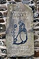
 Countess of Derwentwater photo with tent.jpg 752 × 482; 76 KB
-
 Countess of Derwentwater self portrait.jpg 718 × 983; 140 KB
-
 Craster (9815015975).jpg 5,248 × 3,068; 13.79 MB
-
 Craster (9815022296).jpg 6,016 × 4,000; 6.69 MB
-
 Distant rain (50450071592).jpg 4,032 × 3,024; 2.3 MB
-
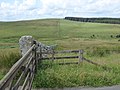 Dry stone wall (geograph 6221418).jpg 1,600 × 1,200; 375 KB
-
 East Chevington, UK - panoramio (2).jpg 6,000 × 4,000; 13.69 MB
-
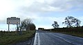 Entering Northumberland - geograph.org.uk - 3209857.jpg 1,024 × 565; 104 KB
-
 Gertrude Jekyll garden (6068909263).jpg 2,041 × 3,085; 2.26 MB
-
 Greensfield.jpg 3,264 × 2,448; 1.57 MB
-
 Hexham coat of arms.png 2,185 × 3,100; 1.65 MB
-
 Hexham Coat of Arms.svg 699 × 992; 2.23 MB
-
 Holiday at Berwick-upon-Tweed.jpg 1,333 × 2,147; 891 KB
-
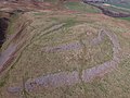 Humbleton Hill hillfort.jpg 4,000 × 3,000; 4.66 MB
-
 Hurlstone.jpg 3,456 × 4,608; 3.32 MB
-
 Hydrants And Trough At Junction With Orchard Crescent.jpg 3,396 × 1,893; 2.26 MB
-
 Igp (224682935).jpeg 2,048 × 1,024; 618 KB
-
 Industrial Northumberland (2286976466).jpg 683 × 1,024; 373 KB
-
 Jennys Lantern (geograph 3723032).jpg 1,600 × 1,200; 461 KB
-
 Kilns, Corbridge pottery.jpg 4,032 × 1,971; 2.58 MB
-
 KTM-Northumberland.jpg 1,086 × 724; 402 KB
-
 Lemmington Culvert - Flickr - johndal.jpg 939 × 900; 564 KB
-
 Lilburnes of Thickley - CoA and pedigree 1666.png 783 × 611; 381 KB
-
 Mist of Umber - Flickr - thekeithhall.jpg 2,048 × 1,536; 338 KB
-
 Monk's House.jpg 4,032 × 3,024; 6.48 MB
-
 Morning sun on the North Sea (35032966870).jpg 4,022 × 3,016; 3.51 MB
-
 Morpeth Clock Tower July 2017 (cropped, edited).jpg 725 × 1,032; 295 KB
-
 Morpeth Court.jpg 3,264 × 1,836; 1.87 MB
-
 Nastro logo.jpg 198 × 200; 22 KB
-
 NCL-2AEE8B, Roman coin, nummus of Constans (FindID 640511).jpg 1,380 × 1,184; 257 KB
-
 Newton Hall (geograph 3017199).jpg 3,072 × 2,304; 966 KB
-
 Newton Hall, Newton-by-the-Sea (geograph 3409559).jpg 640 × 415; 140 KB
-
 Northumberland coast (6069440956).jpg 4,320 × 3,240; 4.88 MB
-
 Northumberland Fusiliers Colours.jpg 1,139 × 854; 154 KB
-
 Northumberland Map.png 4,967 × 4,967; 4.18 MB
-
 Northumberland-02-Schwarze Rinder-2009-gje.jpg 2,850 × 1,792; 1.61 MB
-
 Northumberland-04-Weiden-2009-gje.jpg 3,066 × 1,842; 1.99 MB
-
 Northumberland-06-Schaffarm-2009-gje.jpg 3,063 × 1,833; 2.05 MB
-
 Northumberland-08-Schaffarm-2009-gje.jpg 3,072 × 2,048; 3.02 MB
-
 Northumberland-10-Schafweide-2009-gje.jpg 3,072 × 2,048; 1.84 MB
-
 Northumberland-12-Schaf-2009-gje.jpg 3,072 × 2,048; 2.45 MB
-
 Northumberland-14-Baum-2009-gje.jpg 3,072 × 2,048; 2.16 MB
-
 Northumberland-16-Zaun-Fahrrad-2009-gje.jpg 3,036 × 1,852; 2.3 MB
-
 Northumberland-18-Weide-2009-gje.jpg 3,072 × 2,048; 2.85 MB
-
 Northumberland-20-Zaunpfahl-2009-gje.jpg 3,072 × 2,048; 2.13 MB
-
 Northumberland-22-Getreidefeld-2009-gje.jpg 3,072 × 2,048; 2.55 MB
-
 Northumberland-24-Strassengabelung-2009-gje.jpg 3,066 × 1,672; 2.05 MB
-
 Northumberland-26-Rast-2009-gje.jpg 3,060 × 1,807; 2.17 MB
-
 Northumberland-28-Rinder-2009-gje.jpg 2,766 × 1,525; 1.69 MB
-
 Northumberland-30-Rinder-2009-gje.jpg 2,568 × 1,693; 1.45 MB
-
 Northumberland-32-Strasse-Weide-Wolke-2009-gje.jpg 3,072 × 2,048; 2.27 MB
-
 Northumberland-34-Weide-Wolke-2009-gje.jpg 3,072 × 2,048; 2.32 MB
-
 Northumberland-36-Maehdrescher-2009-gje.jpg 2,841 × 1,894; 2.14 MB
-
 Northumberland-38-Maehdrescher-2009-gje.jpg 2,568 × 1,879; 2.14 MB
-
 Northumberland-40-Objekt an Bahn-Radweg-2009-gje.jpg 3,072 × 1,869; 2.06 MB
-
 Northumberland-42-Objekt an Bahn-Radweg-2009-gje.jpg 3,072 × 2,048; 3.25 MB
-
 Northumberland-44-Kulturlandschaft-2009-gje.jpg 3,063 × 1,740; 1.66 MB
-
 Northumberland-46-Kulturlandschaft-2009-gje.jpg 3,072 × 2,048; 2.19 MB
-
 Northumberland-48-Kulturlandschaft-Zaun -2009-gje.jpg 3,072 × 2,048; 2.67 MB
-
 Northumberland-50-Kulturlandschaft-Zaun-Wolken-2009-gje.jpg 3,072 × 2,048; 2.22 MB
-
 Northumberland-52-Kulturlandschaft-Wolken-2009-gje.jpg 3,072 × 2,048; 1.87 MB
-
 Northumberland-54-Kulturlandschaft-Getreidefeld-2009-gje.jpg 2,916 × 1,369; 1.56 MB
-
 Northumberland-56-Kulturlandschaft-Rinder-2009-gje.jpg 3,072 × 2,048; 1.98 MB
-
 Northumberland-58-Radweg auf Bahntrasse-Bruecke-2009-gje.jpg 3,072 × 2,048; 2.91 MB
-
 Northumberland-60-Radweg auf Bahntrasse-Bruecke-2009-gje.jpg 3,072 × 2,048; 2.63 MB
-
 Northumberland-62-Kulturlandschaft-Wolken-2009-gje.jpg 3,072 × 2,048; 2.2 MB
-
 Northumberland-64-Kulturlandschaft-Wolken-2009-gje.jpg 3,072 × 2,048; 2.05 MB
-
 On the beach at Boulmer (9869749704).jpg 5,605 × 3,069; 3.59 MB
-
 On the beach in Northumberland (9869777296).jpg 4,932 × 3,151; 5.28 MB
-

-
 Pilgrims Passage (61073168).jpeg 2,048 × 1,356; 261 KB
-
 Reconstructed Henge - panoramio.jpg 3,888 × 2,592; 4.54 MB
-
 Reflection's in a River. - panoramio.jpg 4,320 × 3,240; 4.93 MB
-
 Remains of a series of Roman forts just south of Hadrian's Wall (22547790212).jpg 2,048 × 1,282; 3.06 MB
-
 Replica Henge House. - panoramio.jpg 3,888 × 2,592; 5.16 MB
-
 Retaining Walls.jpg 3,024 × 4,032; 6.13 MB
-
 Riponnensia splendens (male) - Flickr - S. Rae (1).jpg 2,109 × 1,752; 961 KB
-
 Riponnensia splendens (male) - Flickr - S. Rae (2).jpg 1,281 × 1,083; 404 KB
-
 River Aln bridge - panoramio.jpg 3,888 × 2,592; 3.54 MB
-
 Roadside Cross in memory of Northumberland Jacobites.jpg 3,456 × 5,184; 6.62 MB
-
 Sea Groyne (136247421).jpeg 2,048 × 1,365; 1.05 MB
-
 Snake legs (6069475354).jpg 3,857 × 2,893; 10.5 MB
-
 Snow scene to Lifeboat House in Alnmouth - panoramio.jpg 2,816 × 2,112; 2.34 MB
-
 Streams (white on black) (12599117654).jpg 4,928 × 3,264; 2.24 MB
-
 Street life Life in the north British Isles rural and coastal (5561780095).jpg 4,288 × 2,848; 3.91 MB
-
 Sunrise in Leaplish - panoramio.jpg 2,048 × 1,536; 790 KB
-
 Sunset, sky and beach.jpg 3,888 × 2,592; 6.18 MB
-
 The Breamish (34643482924).jpg 6,000 × 4,000; 7.52 MB
-
 The Coach Inn, Lesbury, Alnwick, Northumberland (9777517892).jpg 6,016 × 4,000; 5.77 MB
-
 The Old Bridge with Anchor Hotel, Haydon Bridge.jpg 3,456 × 5,184; 5.87 MB
-
 The Waterford Fountain, Ford Village.jpg 3,264 × 4,928; 10.71 MB
-
 Three - Flickr - rawdonfox.jpg 4,180 × 2,953; 3.08 MB
-
 Three bridges (6068915079).jpg 3,676 × 2,013; 2.38 MB
-
 Three Bridges (6069464418).jpg 3,656 × 2,429; 3.22 MB
-
 Under the Border Bridge (8999463291).jpg 4,150 × 2,766; 7.37 MB
-
 Unusual plant pot (6068919307).jpg 3,240 × 4,320; 4.73 MB
-
 View of Hadrian's Wall adjacent to Turret 38b.jpg 3,648 × 2,736; 5.47 MB
-
 Village Green, Wall (geograph 3195000).jpg 640 × 480; 536 KB
-
 Wall Country (49780447351).jpg 1,190 × 665; 1.07 MB
-
 Warkworth castle.jpeg 2,448 × 3,264; 2.31 MB

.jpg)
.jpg)
.jpg)

.jpg)
.jpg)


.jpg)
.jpg)
.jpg)
.jpg)
.jpg)

.jpg)


.jpeg)
.jpg)
.jpg)


.jpg)
.jpg)

.jpg)
.jpg)
.jpg)
.jpg)


.jpg)
.jpg)

.jpeg)


.jpg)


_-_Flickr_-_S._Rae_(1).jpg)
_-_Flickr_-_S._Rae_(2).jpg)


.jpeg)
.jpg)

_(12599117654).jpg)
.jpg)


.jpg)
.jpg)


.jpg)
.jpg)
.jpg)
.jpg)

.jpg)
.jpg)
